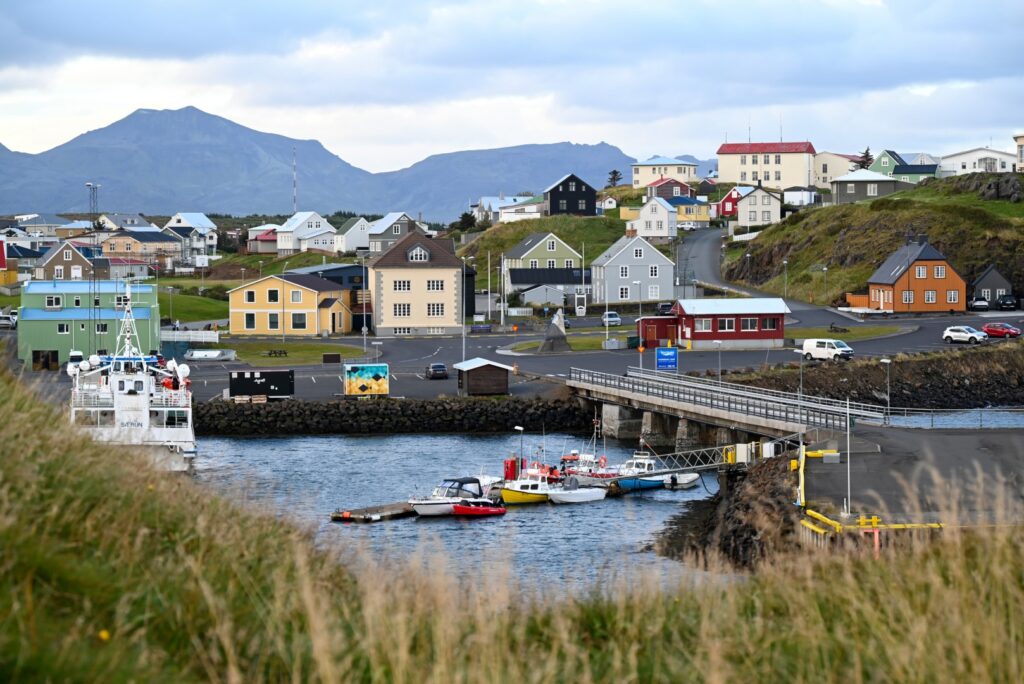
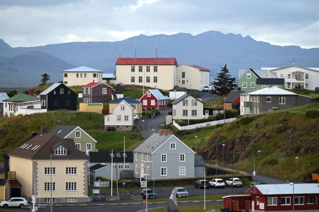
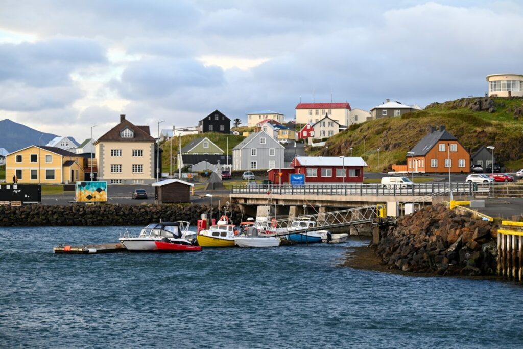
Stykkishólmur
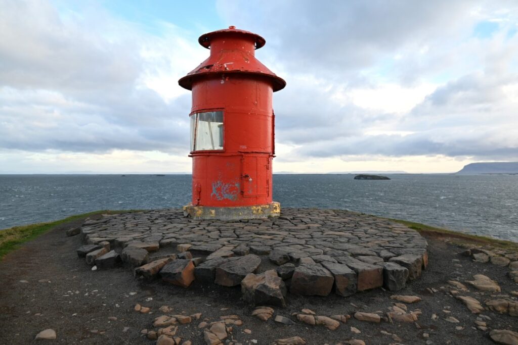
Before departing Stykkishólmur, we did a quick hike to the top of Súgandisey Island to view the Súgandisey Island Lighthouse and take advantage of the lighting conditions of the early morning sun. After eating breakfast and filling ourselves with coffee, we began what would be a long and adventurous day circling the Snæfellsnes Peninsula.
Bjarnarhöfn Shark Museum
It was not long before we turned off the main road (Highway 54) and began a short drive to Bjarnarhöfn. This remote farmstead-turned-museum is dedicated to sharing the story of fishing for sharks in Iceland and producing the traditional dish of hákarl, or fermented Greenland shark. The Bjarnarhöfn Shark Museum is run by a family that has been catching and curing shark for generations. While sharks are no longer caught on purpose in Iceland, they are often bycatch of other fisheries on the island. Instead of wasting this once-prized commodity, the museum cures and prepares the shark, helping to keep this tradition alive.
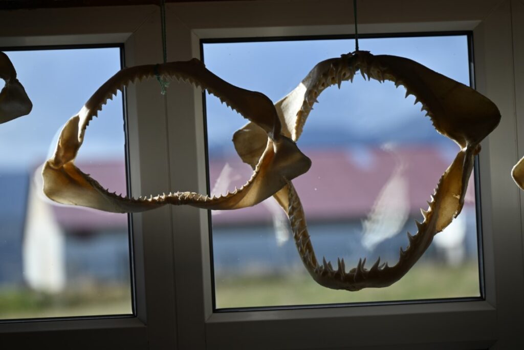
Once inside, the museum is a single room with one side boasting a collection of artifacts relating to the shark industry, with TVs and signs telling the history and culture behind eating sharks in Iceland. On the other side was a retired example of a boat that was used to catch sharks, surrounded by the jawbones of different species of sharks. A guide walked us through the process of catching, curing, and eating shark and how it originated. Sharks, particularly Greenland Sharks, have a high concentration of urea and ammonia in their bodies, which help them survive the frigid Arctic waters. This makes their meat toxic to humans, and so for centuries sharks were harvested for certain organs, their skin, and oils, while their meat was buried for the smell and the toxicity.
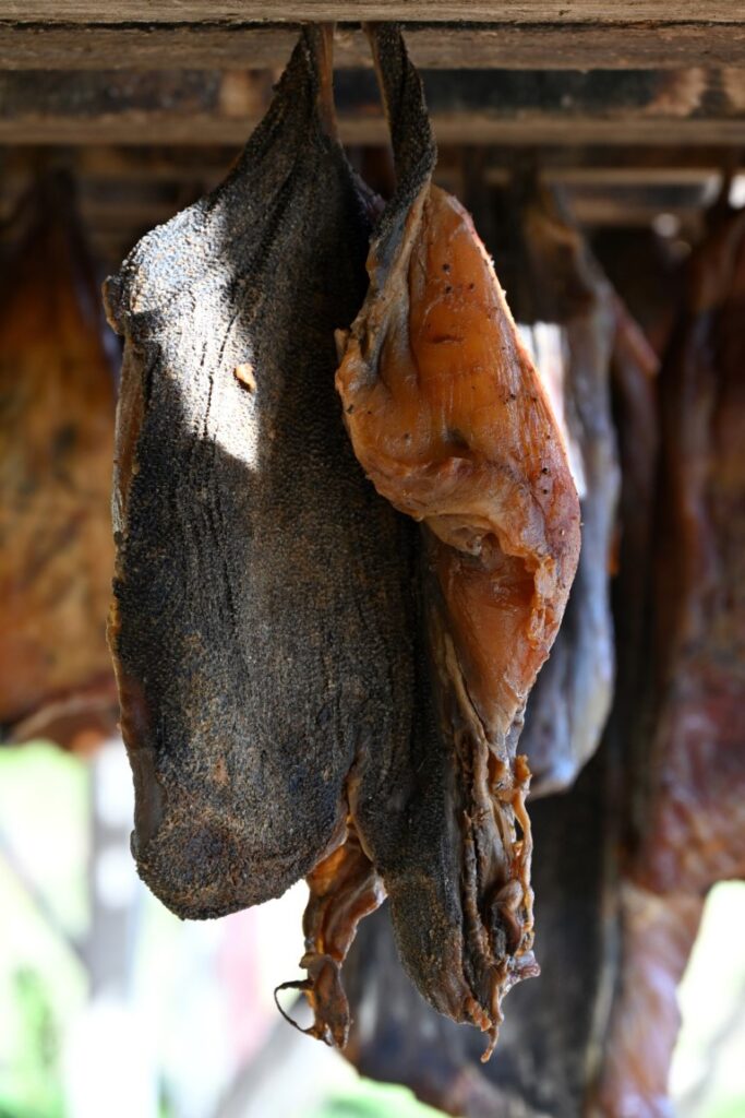
The story of how Icelanders came to eat this toxic shark meat is that there was once a man who was exiled from his community, with no food or water. Starving, the man dug up a buried shark and in desperation ate the meat. Astonishingly, he survived, as the meat had fermented while in the ground, breaking down the ammonia. This story of survival became part of Icelandic traditions, and fermented shark is still prepared in a similar fashion and enjoyed as a snack today. After telling the story, the guide offered us samples of shark with a side of sweet brown bread.
The taste, while not quite as bad as we thought, was still challenging—largely due to the extreme blast of ammonia you get in your sinuses. The guide joked that many Icelanders use it to instantly cure hangovers, which we were inclined to believe. Politely finishing our samples, we thanked the staff, did not purchase any to take home (although you can if you have brave friends—or enemies—at home), and turned our attention westward again, with our sights set on what is perhaps Iceland’s most photographed mountain.
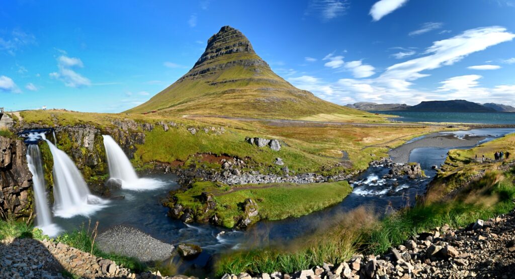
Kirkjufell & Kirkjufellsfoss
The drive from Bjarnarhöfn Shark Museum to Kirkjufell was stunning. Loosely following the coastline, we periodically rounded steep mountains before crossing inland fjords and rivers. Soon we found ourselves passing the beautiful town of Grundarfjörður before catching our first glimpse of Kirkjufell. Almost perfectly symmetrical, Kirkjufell rises from a small peninsula and resembles more of a witch’s hat than anything else. Across the road from the mountain is Kirkjufellsfoss, which, while not high, is a popular waterfall among photographers because of the ability to capture the falls and mountain in the same image. While the wind was consistent, we were greeted with sunshine on our last day, making the sights even more majestic.
After travelling the northern part of the Ring Road for several days, we had become accustomed to having fewer people around us. However, as the Snæfellsnes Peninsula is driving distance from Reykjavik, this was the first time in several days we once again found ourselves surrounded by people and bus tours. Nonetheless, we hiked the short distance to the falls before heading back to the car and continuing on.
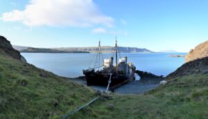
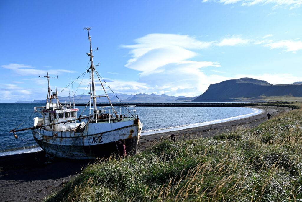
Sæljós GK-2 Shipwreck
Not far past Kirkjufell, we pulled off the road again, this time to an unmarked attraction: the remains of the Sæljós GK-2, a former fishing trawler now abandoned on a stone-covered beach. Based out of the nearby fishing harbour of Sandgerði, the 14.7-meter-long vessel was left here after it sank off the coast and was refloated to await repairs. However, the ship was determined to be irreparable and has thus been abandoned on the beach since 2017. The deteriorating wood and rusting metal now serve as both a symbol of the history of fishing in the harbour and the unforgiving conditions of the harsh sea.
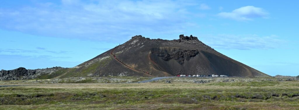
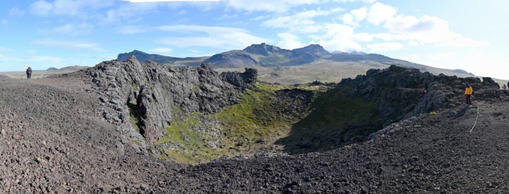
Saxhóll Crater
Rounding the westernmost edge of the Snæfellsnes Peninsula—which meant circling the backside of the glacier-capped Snæfellsjökull volcano—we pulled into the trailhead of the Saxhóll Crater hike. This black, circular cone is one of the many remnants of volcanic activity in the region. Now made accessible by a modern steel staircase that spirals up its southern flank, we began the short trek to the top, battling the wind more and more as our elevation climbed. From the rim, the view opens in all directions: to the west, the Snæfellsjökull glacier; to the north, the endless expanse of the Atlantic; and to the east, the cracked lava field plains stretching as far as the eye could see.
As our stomachs were starting to rumble, before departing we tucked ourselves into the corner of the parking lot near the black volcanic rocks and boiled a few hot dogs for lunch
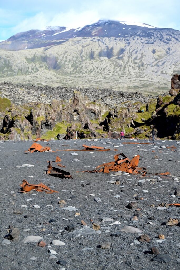
Djúpalónssandur or the Black Lava Pearl Beach
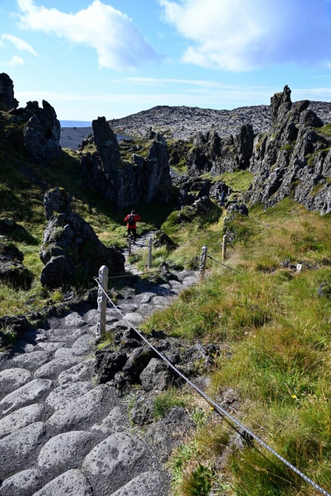
Beginning the drive along the south side of the Snæfellsnes Peninsula, we found ourselves driving over rugged terrain comprised of lava fields that had originated from the mountains on our left. Turning onto a small winding road, we were led down to the ocean, ending at Djúpalónssandur, known as the “Black Lava Pearl Beach.” Unlike Iceland’s many well-known black sand beaches, this one is composed of countless “polished” black stones that have been eroded over millennia by the pounding surf. A short trail led from the overflowing parking lot to the beach, but not before leading us through a twisted and jagged lava field consisting of small pinnacles and archways. Once on the beach, we came across the beach’s “lifting stones”—a line of different-sized rocks used to test the strength of those who attempt to lift them. We each tried—some more successfully than others—before continuing to the water’s edge.
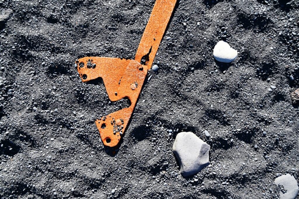
Another unique feature of this beach is that scattered among the rounded black and grey rocks were hundreds of pieces of rusting metal. These remnants are all that’s left of the British trawler Epine GY7, which was wrecked here in 1948. With a seemingly endless wave of bus tourists coming down the trails, we had our fill and photos, and headed back to the car.
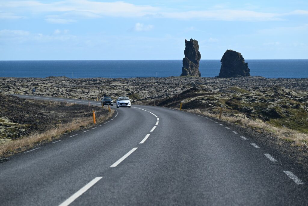
Lóndrangar or Castle Rock
As we drove along the coast, we approached Lóndrangar, where two enormous basalt plugs towered over the coastal terrace, giving the impression of a castle or fortress. While we never had time to stop here, we had no problem appreciating the scale of the 75-meter-tall pinnacles as they towered over the rest of the landscape. The two towers of rock were formed at the center of an ancient crater that had since eroded away, leaving behind just the cores.
Arnarstapi
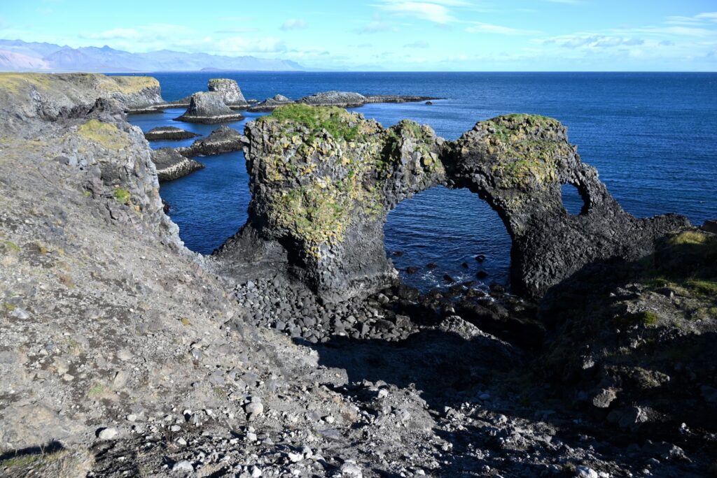
The next stop was in Arnarstapi, a tiny village nestled beneath the cliffs of the volcano Stapafell. Driving into the tourist-focused town, we parked the car before venturing along the town’s coastal trail. The trail winds along the shore, where you can get close to the dramatic basalt cliffs, sea stacks, and the famous Gatklettur stone arch. After taking in the sights and watching a local seal play in the water below, we headed back, passing the giant stone sculpture of a mythical protector of the region, Bárður Snæfellsás.
With the sun slowly starting to fall, we headed to our last destination of the day, still in awe of the spectacular scenery the Snæfellsnes Peninsula has to offer.
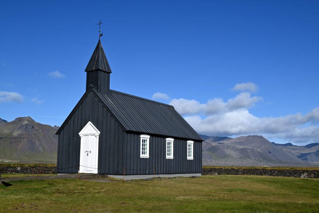
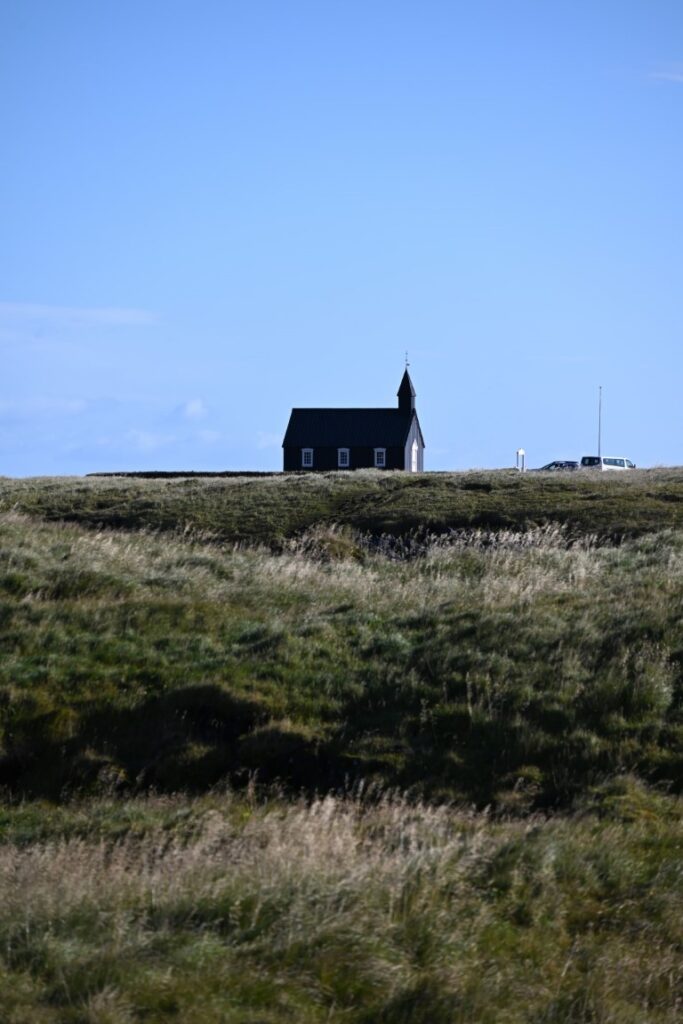
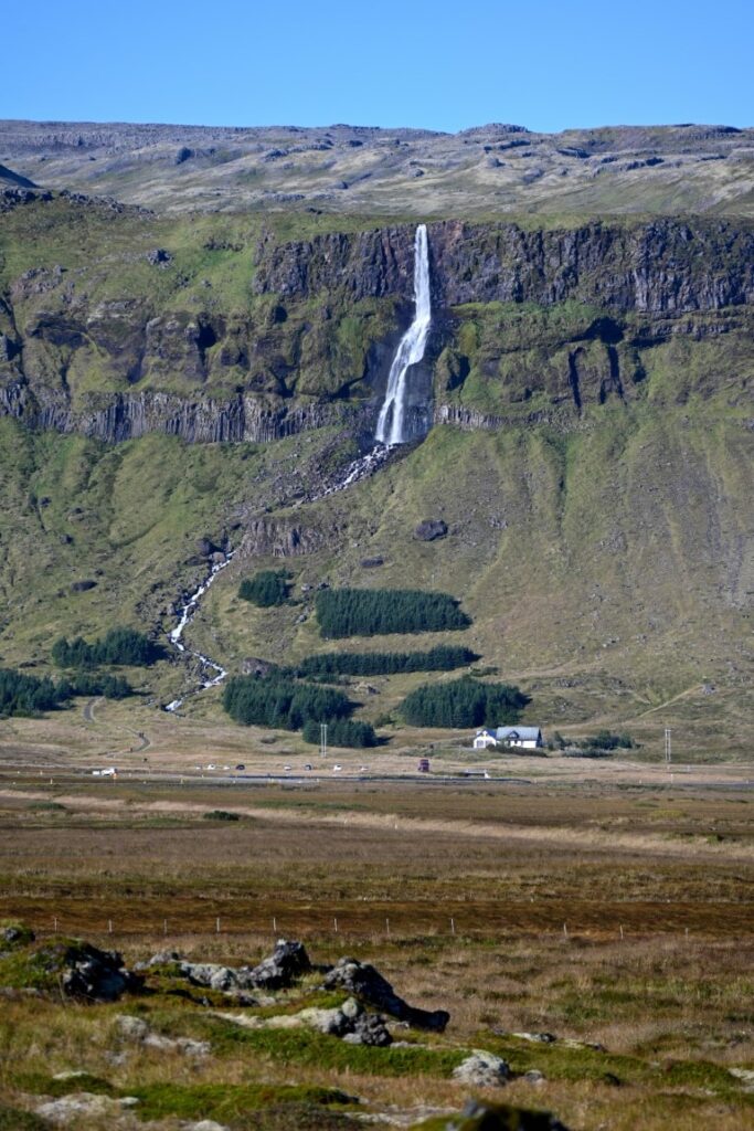
Búðakirkja (Black Church) & Bjarnarfoss
Near the sandy beach of Búðavík stands Búðakirkja—Iceland’s famous Black Church, one of the oldest churches and one of the last remaining landmarks of the community of Búðir. Painted black with white trim, the small wooden church stands alone among the region’s lava fields and grass plains. It was once a turf church that was destroyed and rebuilt, only to have the parish abolished in 1861. One of the parishioners, a woman by the name of Steinunn Sveinsdóttir, felt strongly that there should be a new church built here, but her request was rejected by the national church. Not taking no for an answer, she sought permission directly from the Danish King, which was granted, and the church was successfully built in 1848. It has since been rebuilt and reconsecrated and now stands as a functioning church and event space, as well as an icon of Iceland’s tourism industry and a favourite among photographers.
The drive to and from the church follows a jagged lava field dotted with deep crevasses and caves formed as the lava cooled. As you drive back along the road, you get spectacular views of the volcano that formed these lava flows thousands of years before, as well as the waterfall Bjarnarfoss. Originating from the glaciers high in the mountains and cascading off the surrounding cliff faces, the falls is an 80-meter drop onto the mossy terrain below.
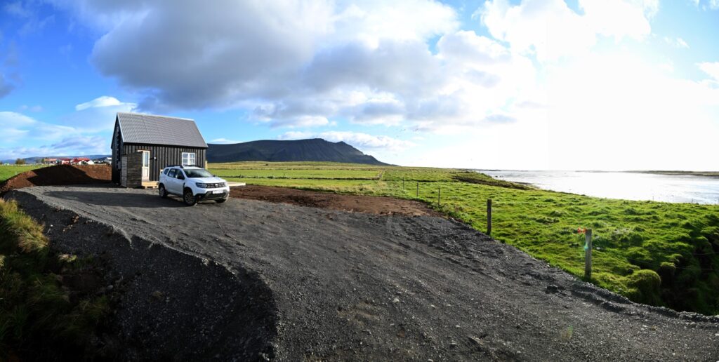
As one of our last travel days came to a close, we headed into the town of Akranes, where we grabbed some food at the Lighthouse Restaurant before continuing on to our accommodations for the night—a cottage located on a working farm, named Fjörukot. As nighttime fell, we held out hope for one last shot at seeing the northern lights, and while they unfortunately didn’t appear that night, we were treated to a dark sky of twinkling stars, with the sound of waves on one side and towering mountains on the other.
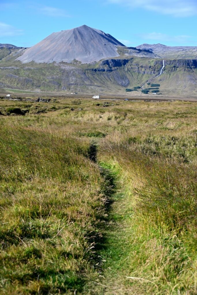
The Snæfellsnes Peninsula lived up to everything we had ever heard or seen. It represents a little bit of everything that Iceland has to offer, from incredible mountains and glaciers to volcanoes and lava flows. Along the coast, incredible cliffs and coastal formations are found adjacent to traditional Icelandic towns, rich in history and culture. While this route is a very popular tourism destination given its closeness to Reykjavik, it is a place we would not recommend skipping when visiting Iceland.