Paddling Five Fathom Hole & the Musquash Estuary Ships
We woke up to the sound of ATVs and vehicles passing by, presumably on the way to nearby Black Beach and its many hiking trails. After cooking a quick breakfast, we packed up and headed to our first paddle of the day at Five Fathom Hole.
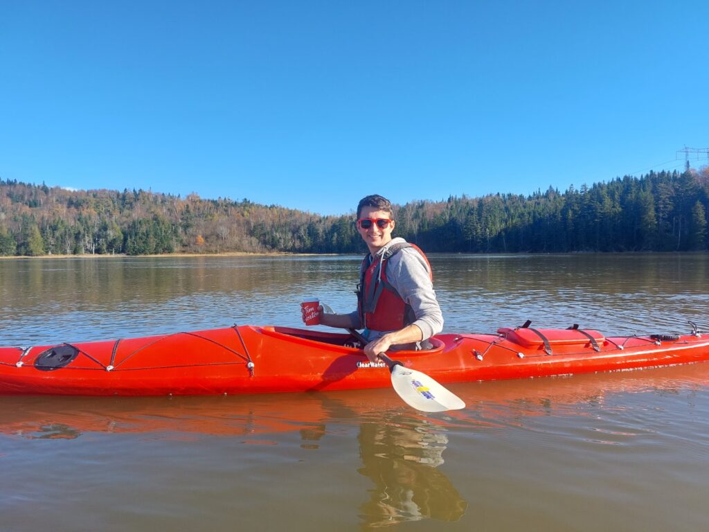
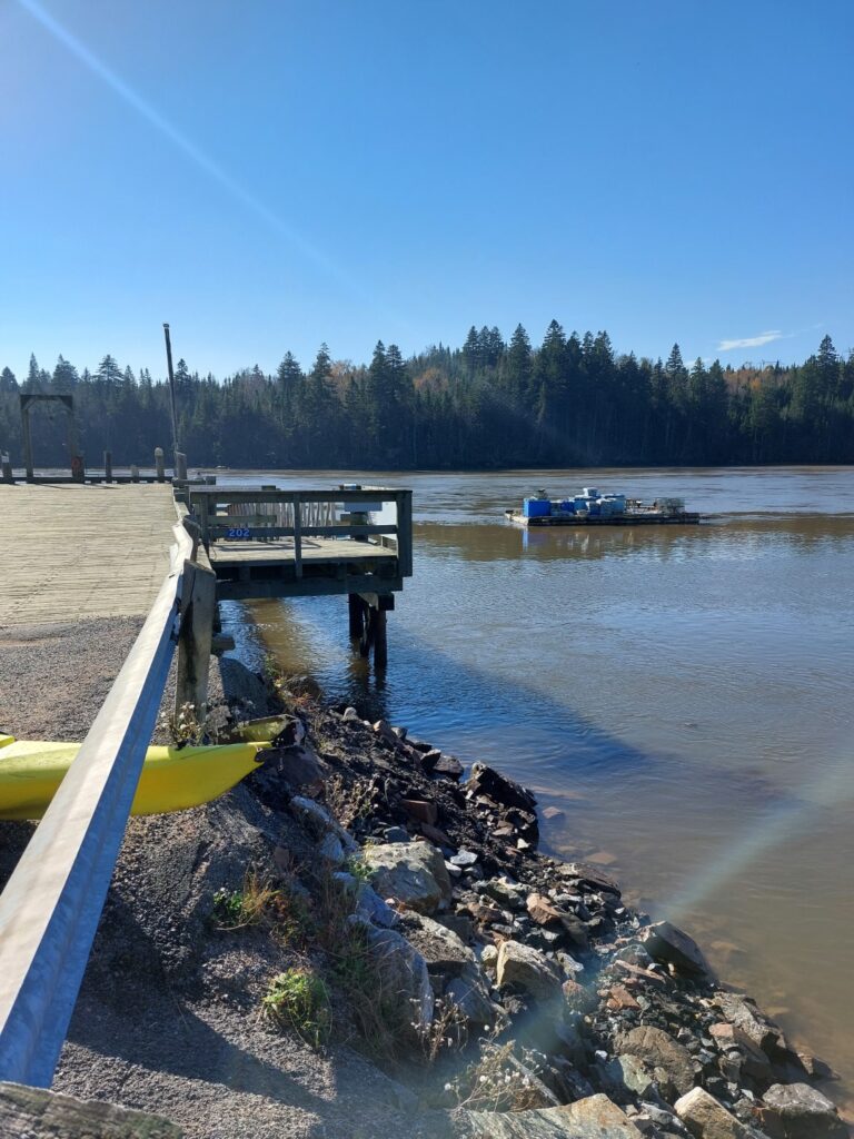
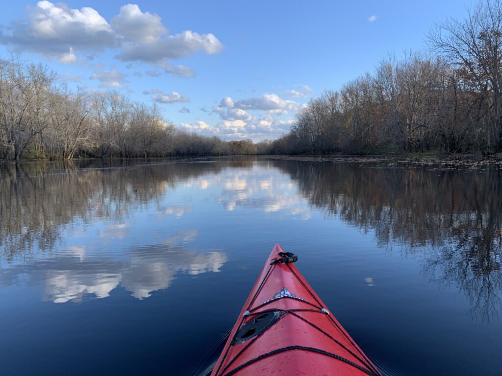
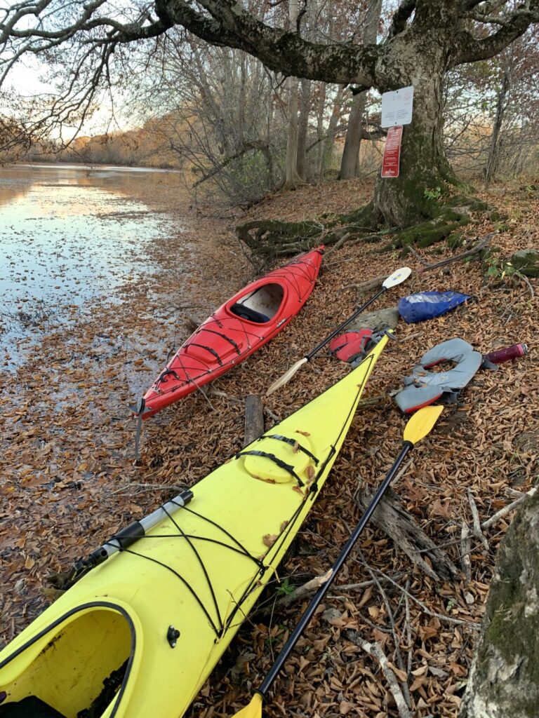
Five Fathom Hole is located at the mouth of the Musquash River before it enters Musquash Bay. And as you might expect from its location on the Bay of Fundy, it is heavily affected by the local tides. Expecting strong currents, we timed our put-in an hour before high tide to give us the best conditions for exploring at slack water. However, we instantly ran into several problems. The first was the launch site. While beautiful and worth the visit, the wharf at the end of Five Fathom Hole Road is not the “most accessible” launch site for paddlers. After offloading them, we shoved them beneath the guard rail and carefully lowered them over the steep, rock-lined embankment. From here, we had to get creative in how we entered them, but after a few close calls, were both in the river. The second issue was that by the time we were in the water, we were just 30 minutes before high tide or slack water. Despite this, the current moving around the fishing wharf and “upriver” was still very strong and once we launched, we delicately entered the fast-moving river before being pushed quickly upstream.
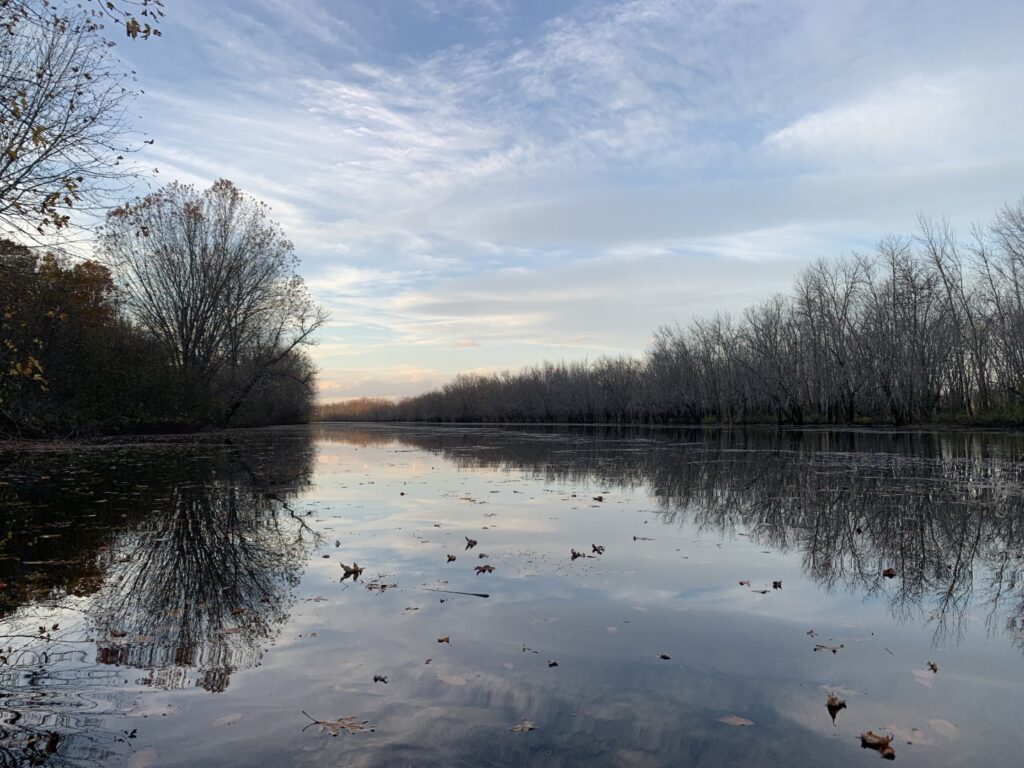
The Musquash Estuary which the river flows through is beautiful and holds a profound ecological significance. Nestled on the coast of New Brunswick, it is a sanctuary where the pristine mudflats, salt marshes, and coastal forests remain seemingly untouched by humans. The estuary is the last of its kind along the Bay of Fundy, with rich biodiversity and undisturbed habitats. Because of this, the land is now managed by the Nature Conservancy of Canada as the Musquash Estuary Nature Reserve.
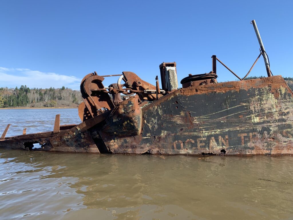
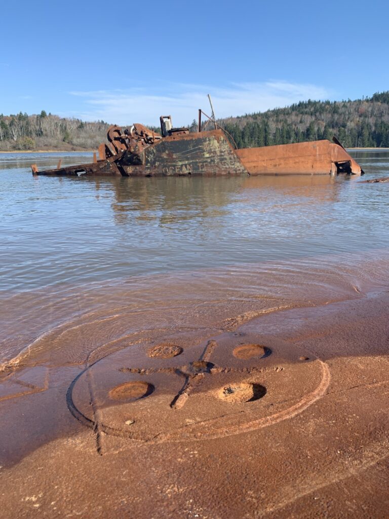
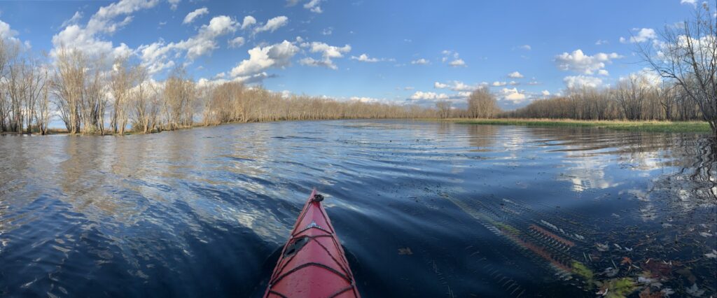
We only had about a kilometer to go before reaching our destination. Amongst the banks of the isolated estuary is one of Atlantic Canada’s only recognized ship graveyards, most of which remain visible even during high tide. While some have deteriorated to the point where only the outline of the hull can be seen, others, like two former American landing craft, have managed to stay remarkably intact.
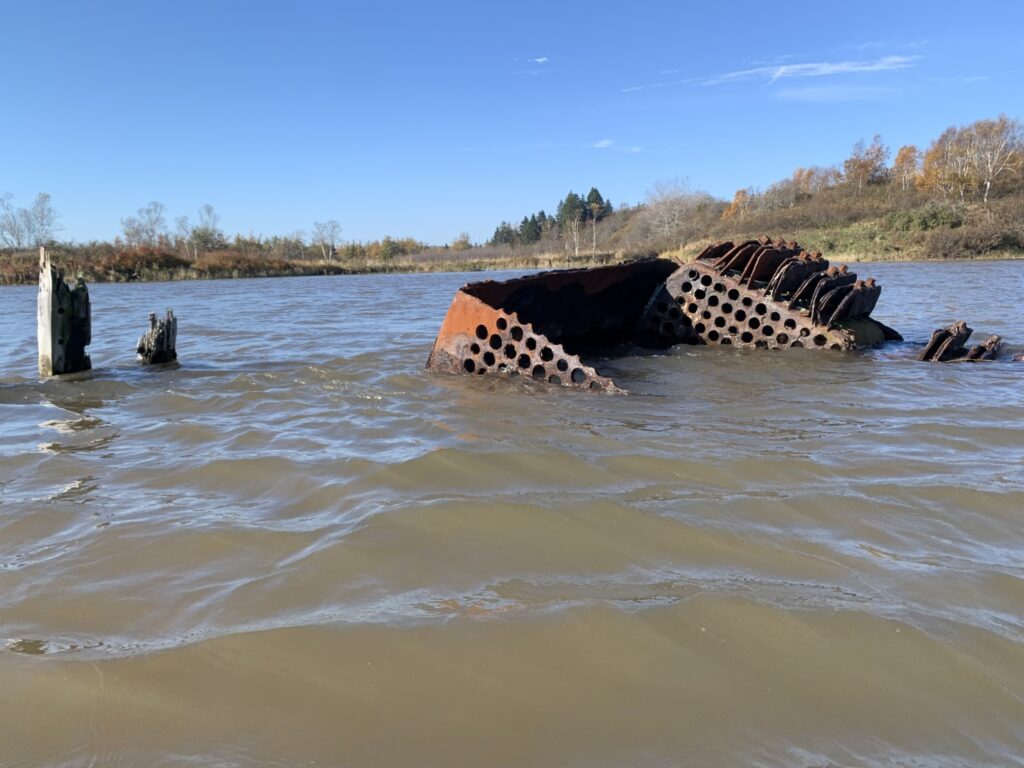
When approaching from the south, you first come across a line of ships and barges, including a steel barge, a large wood-hull ship, and a large steel boiler. Signs along the shore warn people of the vessels’ unstable conditions, however, it is hard to imagine any of the ships here would support the weight of a person. After paddling through the wooden skeleton of one ship, we continued to trace the shoreline passing by the numerous others.
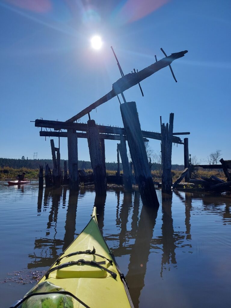
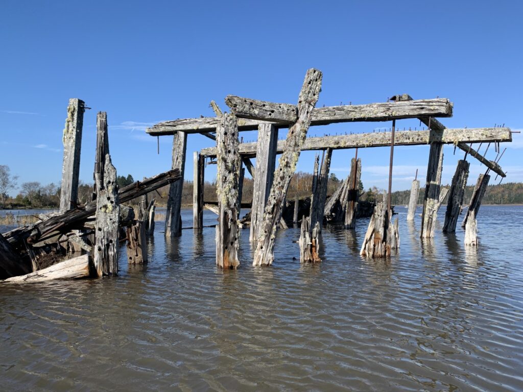
The origin of the ships is not clear however, it seems likely the ships were abandoned here periodically after they were no longer of use. It is not uncommon to find ship graveyards such as this one just outside of the harbour limits of major ports. After ships fell into disrepair, they were often towed outside the jurisdiction limits of their harbour and scuttled or abandoned to avoid the cost of scraping them.
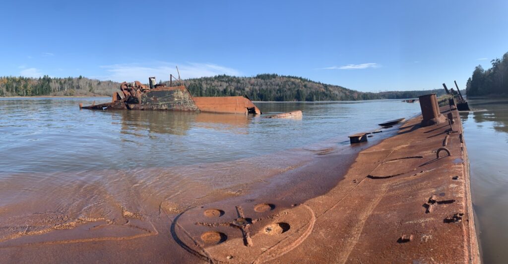
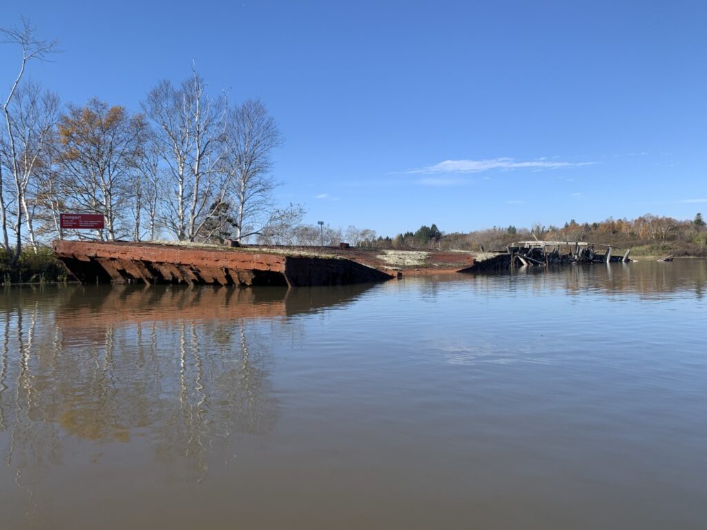
As we rounded the bend, we came across the surprisingly intact steel hull of two former American military landing crafts. It is believed that these ships were used in the Pacific War during World War II before being purchased by a resident to move logs between Saint John and Maine. Similar to the other ships nearby, they eventually met their fate when they were no longer needed and abandoned in the waters. A third ship is said to exist deeper in the river, but we stood no chance of seeing that one at high tide.
We were not around long before slack water ended and the current began to sweep back out the river once again. While we battled it for a while to continue taking pictures and exploring the neighbouring wetland, we soon gave in and let it carry us back downstream toward our launch point. The currents here should not be underestimated and as we were shot around the last bend before returning to the wharf, we came into some rapids caused by submerged rocks and obstacles found along the shore. Being careful not to be swept under the wharf, we hurriedly paddled into the small, protected cove we left from and once again began the difficult task of moving our kayaks from the water back to the road.
Saint John River Drive
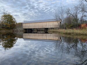
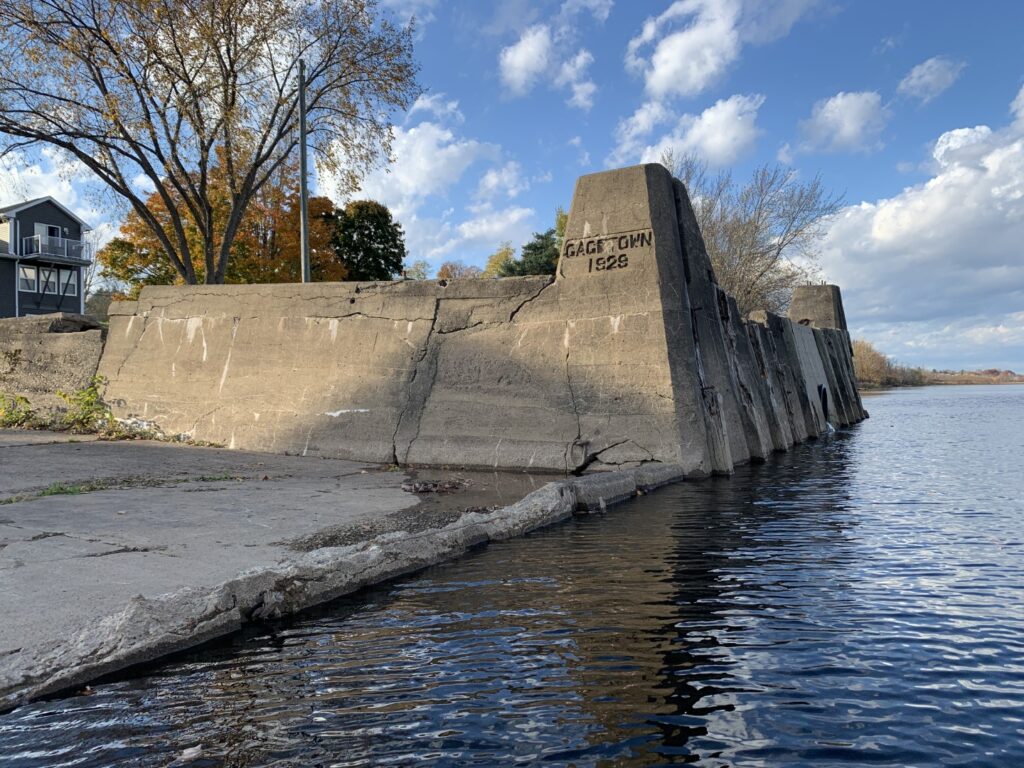
From here we loaded the kayaks on the car and with the winds picking up along the coast, we drove the riverside route along the Saint John River, headed to our next paddle near Gagetown. The drive itself is one that we would recommend. Route 102 travels from Grand Bay to Fredericton, tracing the south shore of the river through farmland and the forested interior. After stopping to take pictures of a few of the many former concrete wharves, once used by the river’s steamship service, we made it to Gagetown around 5:00 pm.
Gagetown Island Paddle
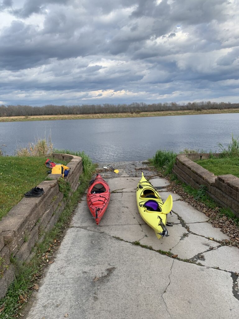
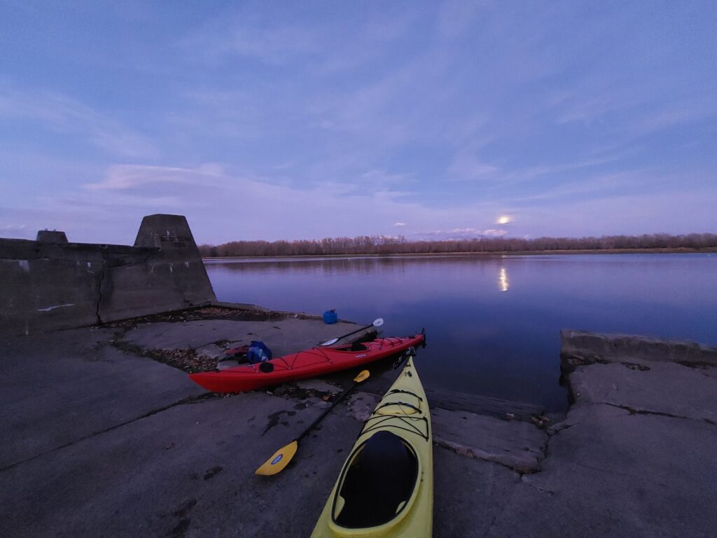
The historic village of Gagetown can be found on the banks of the Saint John River facing one of the river’s largest island Gagetown Island. We wrongfully used the GoPaddle app to choose the Gagetown Marina as our launch point. While parking was plentiful, we found ourselves for the fourth time this trip with a difficult access point. After BBQing a couple of hot dogs in the parking lot to hold us over, we placed the kayaks into some tall grass nearby and each carefully pushed out into the water. As we paddled along the waterfront we quickly saw two other launch sites that were much more accessible and would recommend for any other paddlers.
By the time we went to cross the river into one of the inlets to access Gagetown Island’s interior, the wind had begun to pick up. Luckily by the time we got into the forested channel, we left the wind behind us and found ourselves in a swamp-like setting, with tall deciduous trees towering over flat, wetlands. The water quickly became a mirror, filled with underwater vegetation making paddling through it difficult. The beauty of the creek was reflected in the nearly 23-degree late October temperatures we had experienced all day.
Once in the channel, we found a place to get out of the boats and walk around. The island is almost completely flat with the exception of a small hill at its centre. Walking around the island was easy thanks to the well-eaten vegetation and trampled paths; both of which are thanks to the population of cows that call the island home. After exploring the island and briefly watching an eagle hunt for their supper, the sun had begun to set so we set course back to the car. This time were sure to use one of the easier access points we took note of earlier.
We loaded the kayaks on the car in almost complete darkness, before heading off to Fredericton where we went to Grimross Brewing (Grimross, coincidentally, being the pre-Acadian Expulsion name for Gagetown), to book a place to stay for the night. Unlike the last few, however, this one was going to have heat, indoor plumbing, and warm, running water.
Day 4 – Fredericton to Halifax
Unlike the following night when it was 20 degrees, until around 9:00, the next morning it was just 2 degrees and it seemed like winter was finally on its way. Opting to not kayak in the freezing conditions, we drove to the historic coal mining town of Minto to explore the many hiking and mountain bike trails that have been built over the former mine site.
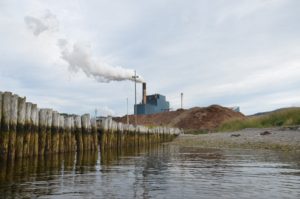
The Minto coal mines have a history that dates back to the late 19th century. While coal has been exported from the area since 1639, the first large-scale mining began around 1873. The mines played a crucial role in providing coal for local industries and heating, leading to a dramatic boom in the area’s population and industry, with the height of production occurring during the early 20th century. However, by the mid-20th century, the coal mining industry faced many economic challenges, and after the mine’s last customer, the coal-fired Grand Lake Generating Station shut down, so did the mines.
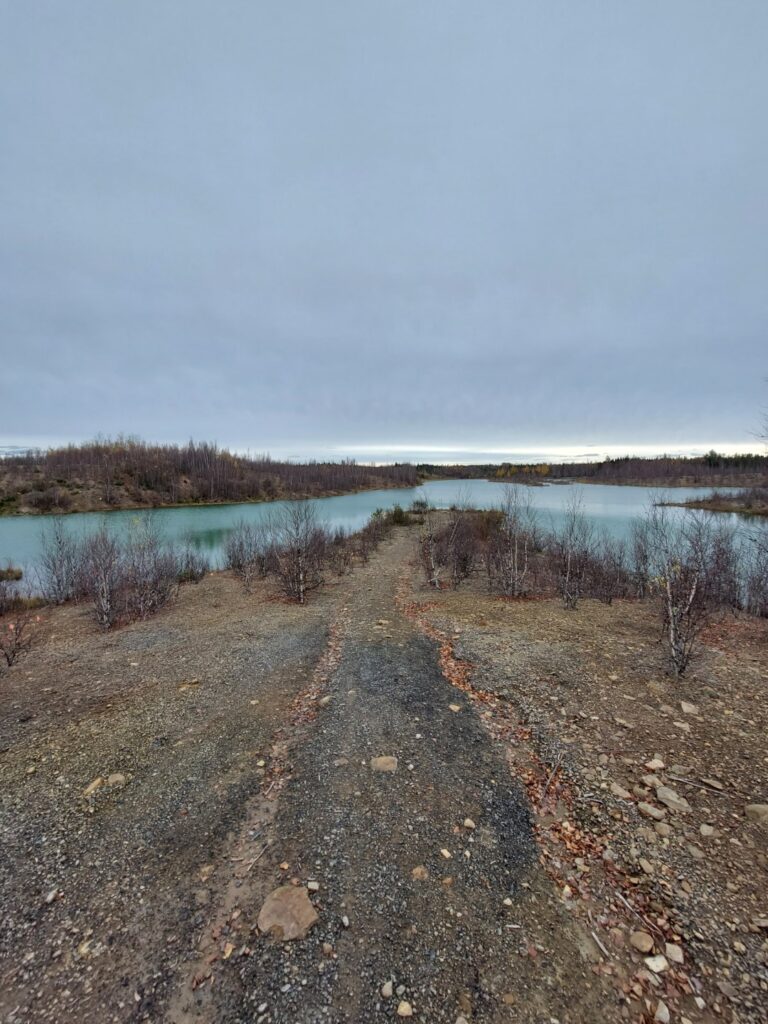
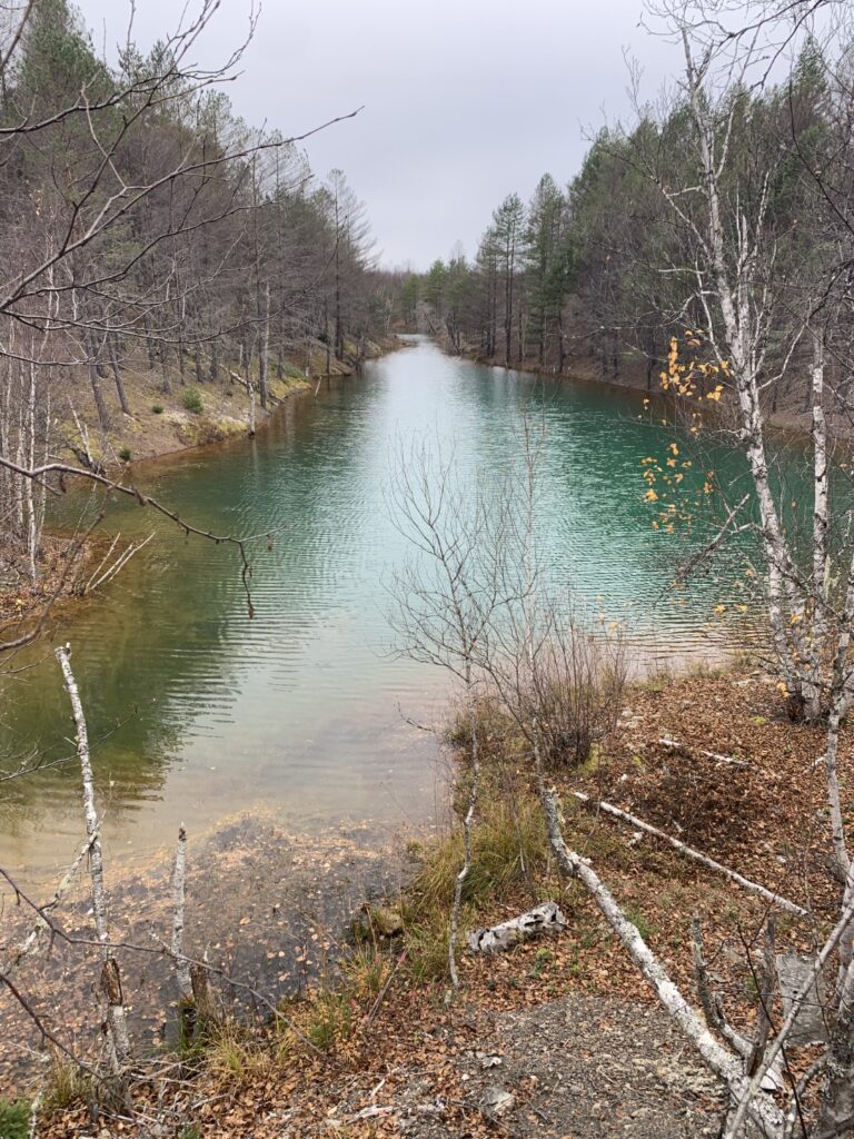
The former strip mine has left behind ridges of excavated rocks interspersed with deep pits, many of which now formed elongated ponds. After getting lost several times following the local mountain bike trails, we made our way back to the car and explored the surrounding towns while staying confined to the warm car.
Our next stop was the town of Chipman, where we stopped at the wonderfully named and delicious take-out spot, Kaboodles for lunch. After a long four days of adventuring, we decided to head on home, arriving at the remarkably early-for-us hour, of 9:30 pm.
Part 2: Partridge Island
NB Kayak Trip (Oct 2023) – Part 2: In the second installment of a three-part series, we paddle to Partridge Island to explore the remains of a WWII-era fort and the site of one of Canada’s most famous quarantine and immigration stations.

Part 1: Hammond River & Darling Lake
NB Kayak Trip (Oct 2023) – Part 1: In the first installment of a three-part series, we embark on a kayaking adventure to New Brunswick, near the town of Hampton to explore the scenic Hammond River.