Partridge Island
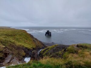
Partridge Island is a small island roughly 1 kilometer from shore, in the waters of the Bay of Fundy. Easily seen from shore, the island is a juxtaposition of lush greenery, laid on top of ragged cliffs and dark rocks. Rising above the vegetation is the distinct Partridge Island Lighthouse, several concrete structures, and a well-recognized concrete cross. Unsurprisingly, it was these unique features that drew us to the island.
The island is connected to the mainland by a large stone breakwater designed to protect the vessels coming and going from the city’s busy port. While it lacks signage, the breakwater is illegal to cross due to the dangerous and difficult trek that has resulted in many being rescued from here over the years. Additionally, the kilometer-long breakwater is now home to several birds, including a family of eagles which greeted us during our paddle.
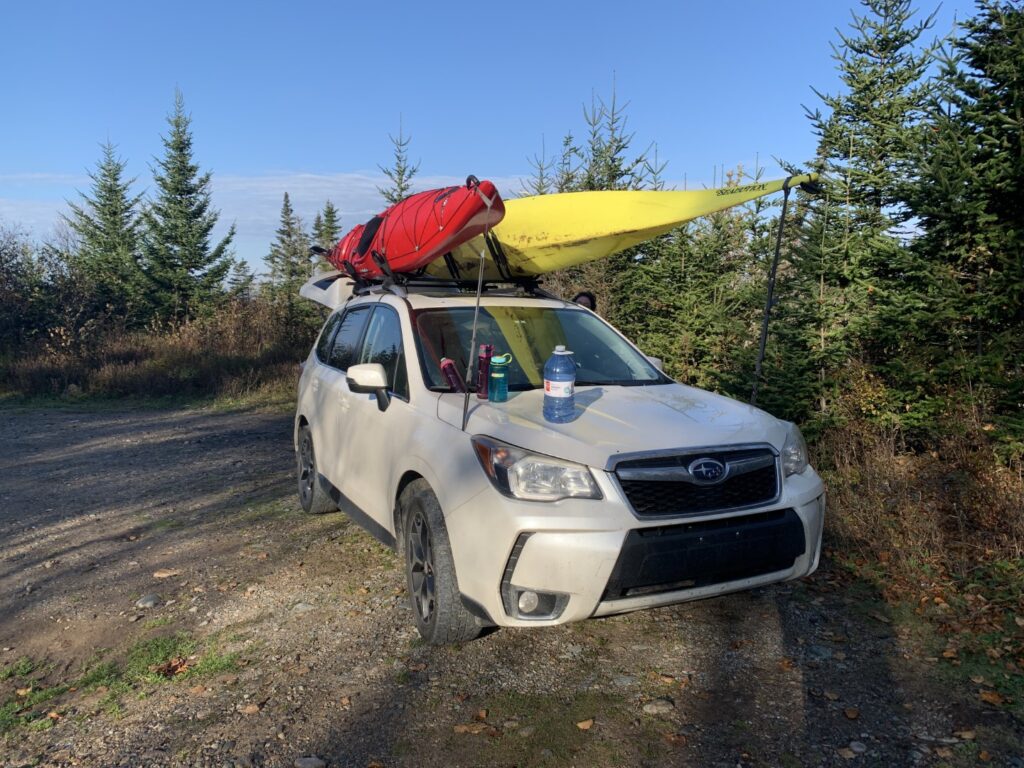
There are two potential launch points for those looking to paddle to Partridge Island. The first of these is from Bay Shore Beach which at the time we thought was the only suitable launch. However, for the same reason the breakwater to the island is needed, this beach is often plagued by wind and waves that can be extremely difficult and dangerous to launch or paddle in. In addition to this, there are very few landing places on the south and east sides of the island, meaning paddlers have to circle the island exposing themselves to even more dangerous ocean conditions. When we got to the beach, we quickly decided that the conditions were just a bit too rough for our liking. Keep in mind that here, it is not only the wind, waves, and swells that pose a danger, but paddlers are also fighting the infamous Bay of Fundy tides.
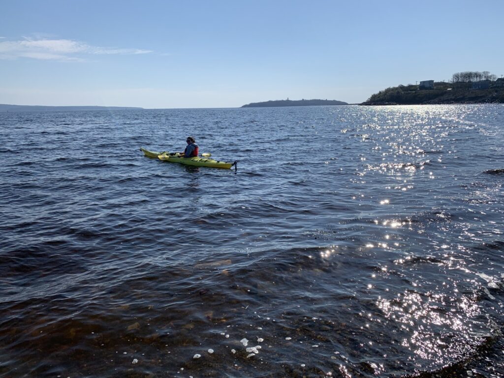
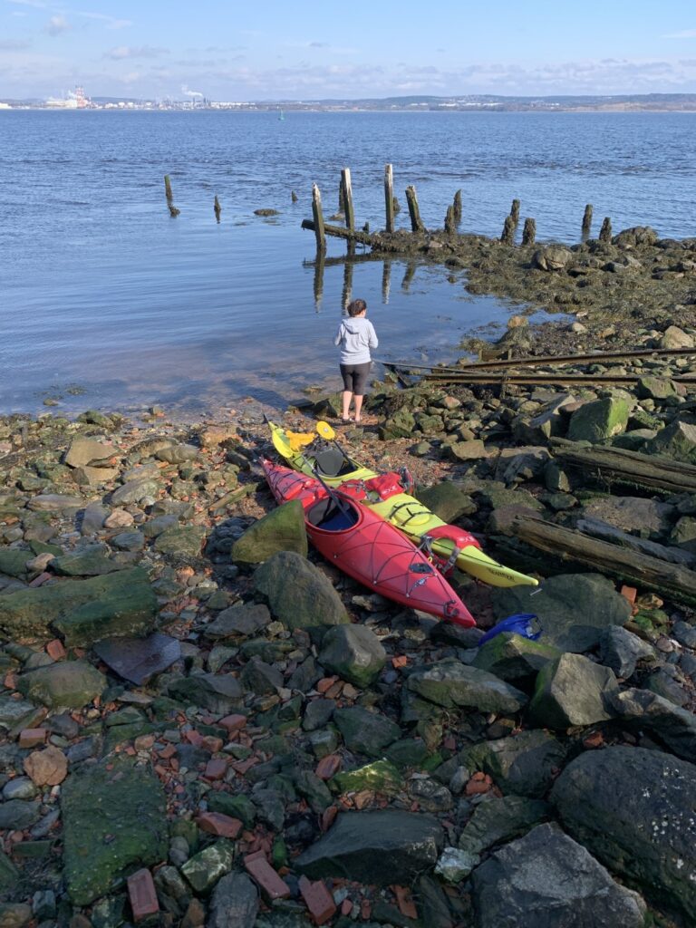
Before giving up, however, we decided to search for another launch site on the harbour side of the breakwater near the Saint John-Digby Ferry terminal. While not marked on any map we could find, we were pleasantly surprised to find parking and easy access to a beach just off from the ferry parking terminal. When the ferry is running on a regular schedule, it is possible this beach may not be accessible, but lucky for us this was not the case and proved to be a terrific launch point so long as you launch at high tide (more on this later).
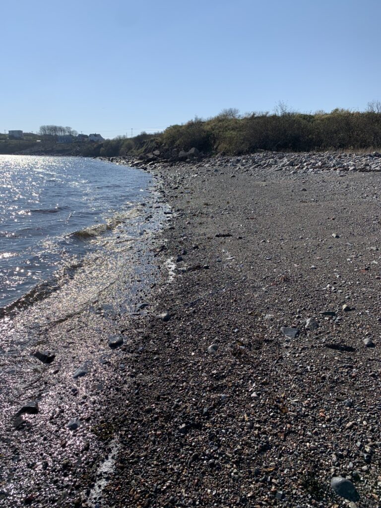
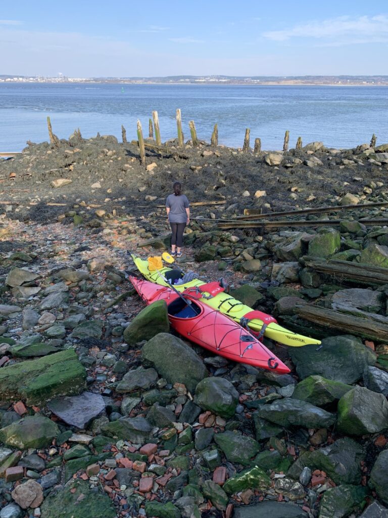
Crossing the narrow stretch of water does not take long and you are bound to be greeted by a few eagles and curious harbour seals. At high tide, this paddle looks relatively easy, however, we quickly learned that the water between Hodges Point and Partridge Island is shallow in places and therefore you must be cautious of submerged rocks and shoals along the route. Once, we reached the island, the steep jagged shore gave us few options to get on it, except for a derelict wharf on the island’s northern tip. By the time we pulled our kayaks onto the rocky shore, the tide had already started to go out.
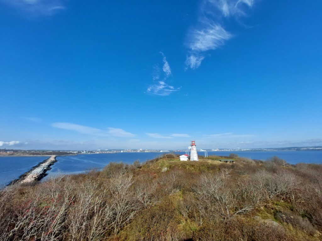
Partridge Island preserves a significant piece of Canada’s immigrant, maritime, and wartime history. While the island has a history that can be traced back a millennium, one of its most significant roles came in the 19th century when it served as a vital quarantine station providing shelter, medical care, and confinement for people immigrating to Canada, particularly during the Irish Famine migration. During this time, Saint John’s Harbour was becoming a crucial shipping port and because of that, the island’s strategic location at the mouth of harbour resulted in it quickly being fortified with coastal defense gun batteries and military structures. Today, structures from each period of the island’s history can be explored with the only active structure being the island’s distinctive lighthouse. The island is a designated National Historic Site.
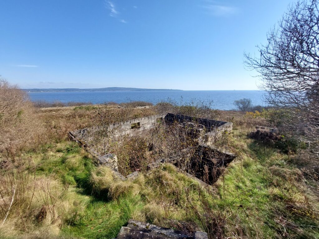
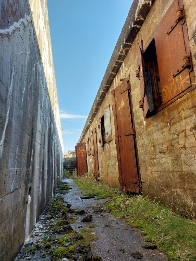
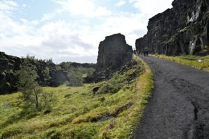
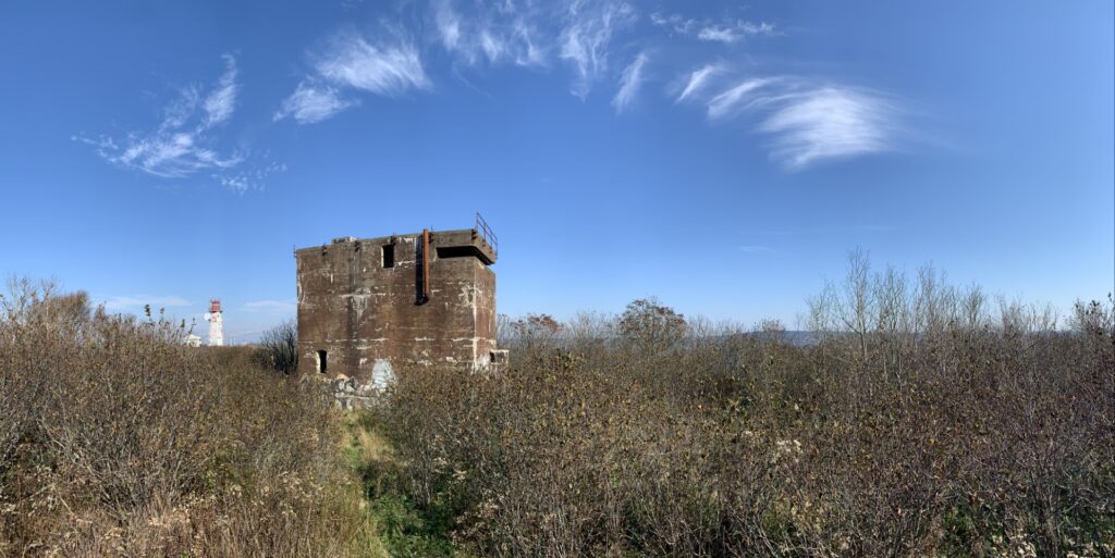
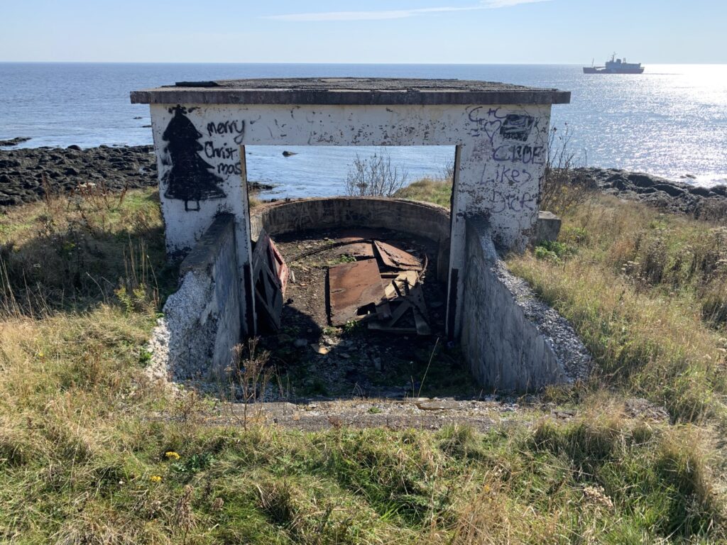
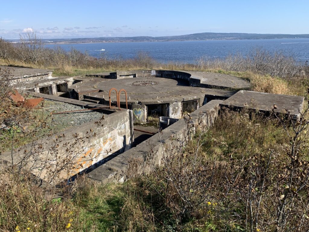
To our pleasant surprise, the island was easy to traverse thanks to a number of small pathways. As we made our way up the trail from the wharf we instantly found ourselves amongst the overgrown foundations of several former buildings and military fortifications. Continuing along the path, we reached the lighthouse, an adjacent operations building, and a helipad. From here we took in the beautiful views of Saint John Harbour, acknowledging how lucky we were that the morning wind, fog, and rain had given way to clear, calm skies. Continuing south we quickly came upon the remains of one of the largest World War Two defensive positions built in Atlantic Canada during the war. Enormous concrete observation towers, former power plants and operations buildings, and of course, the gun battery itself came into view.
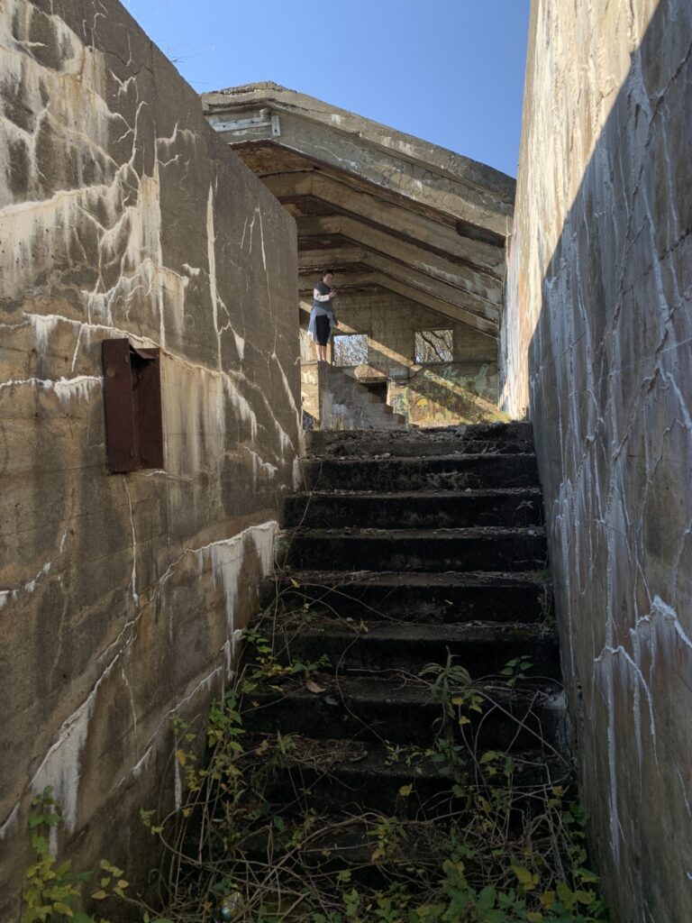
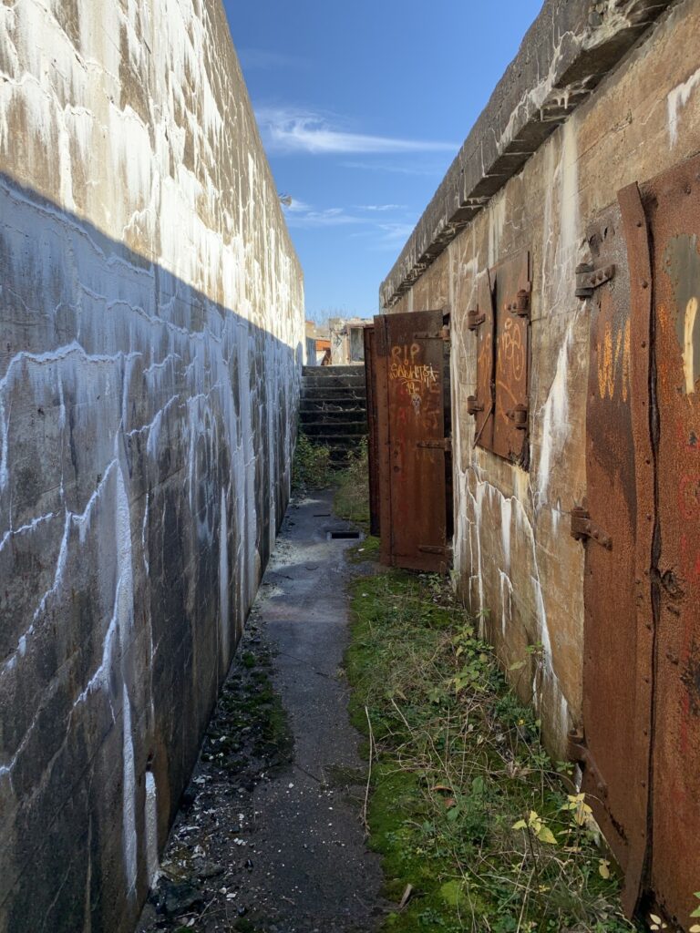
After exploring the five-story concrete observation post, we descended into the gun emplacements. Each of the three guns emplacements were built into the island’s bedrock, each one connected to one another by a series of tunnels, hallways, and underground storage rooms. We have seen, explored, and studied many Second World War structures in Atlantic Canada, but few compared to the enormity and complexity of this. Between two of the gun emplacements is a large underground network of rooms, halls, and staircases. Located several stories below the ground, the complex once housed the living quarters for those stationed there.
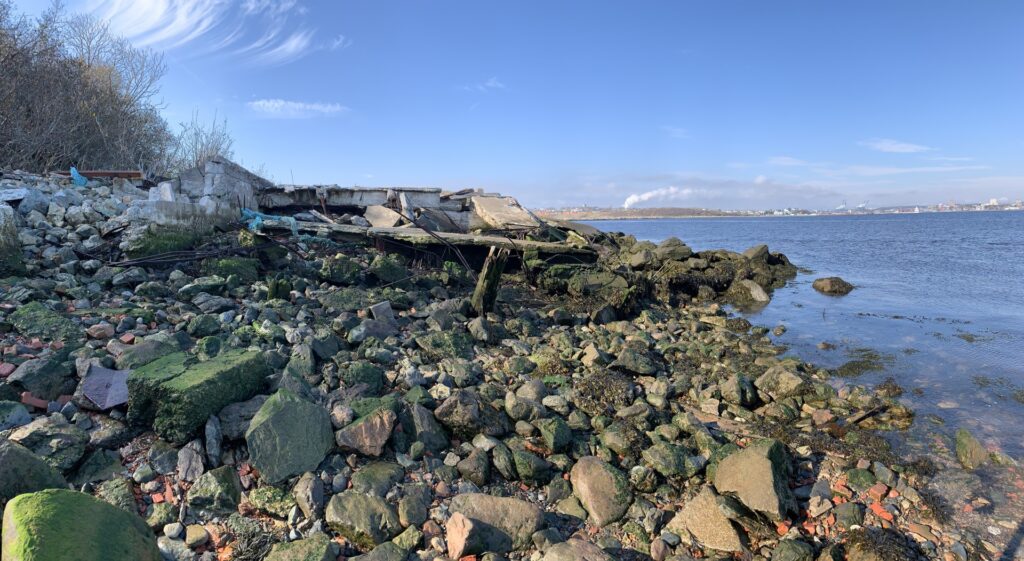
After taking our time to explore the many nooks, crannies, and surrounding structures we continued to hike along the south shore of the island, once again finding ourselves amidst abandoned concrete buildings including a former power plant for the island’s searchlights, the searchlights themselves, and a second overgrown gun emplacement that predated those we had come across thus far.
From here we ascended back to the top of the island where we passed the three-story battery observation building, before arriving at the precarious Celtic Cross which towers over the island. An inscription on the cross quickly told us why it was erected, and the realization of the island’s dark and somber history washed over us.
The inscription reads “This monument was erected in memory of more than 2,000 Irish immigrants, who died of typhus fever, contracted on shipboard during the voyage from Ireland, in the famine year 1847, and of whom 600 were buried on this Island. This Cross also commemorates the devotion and sacrifice of Dr. Patrick Collins, who, after ministering to the victims of the disease, himself contracted it and died.” The message was only further cemented by a small, flat granite headstone next to the cross. As this area was fairly overgrown, we can only imagine there were others just like it, just out of sight.
In the late eighteenth century, Saint John was incorporated by a royal charter which also stated that a pest house or quarantine station be established on the island, safely away from the city. It is believed to be the first of its kind in North America and by the time it closed in 1941, it is said that three million people had passed through the island. And while many recovered and traveled on to make new lives in North America, many did not. In 1847 alone, more than 2,000 Irish immigrants died during a typhus epidemic, with 600 believed to have been buried on the island. There are at least 6 designated cemeteries on the island. Erected in 1925, the Celtic Cross honors those who died on the island, specifically the many Irish immigrants fleeing Ireland.
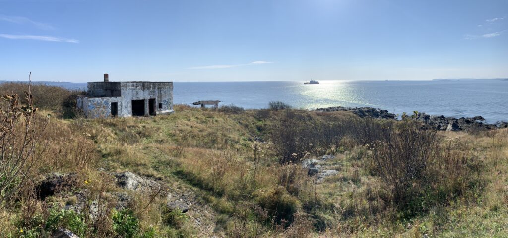
With our stomachs growling, we had just one more place to explore, an old foundation off-the-beaten-path. Heading back towards the lighthouse, we bushwacked our way through the forest towards the breakwater before arriving at a large one-story, rock-lined foundation that was likely the lighthouse keeper’s residence. Now overgrown, the large foundation is one of the best intact structures constructed before the Second World War. From here we followed the maze of paths back to the lighthouse before returning to the wharf.
The tides of the Bay of Fundy will never cease to amaze. When we left our kayaks, they were just several meters from the waterline, but now, just an hour or two later, they were more than 20-30 meters away. The island’s shoreline had more than quadrupled in size and with it, new islands and rocks were now exposed in the surrounding bay. What had once seemed like a deep harbour was now exposed as mostly shallow, rocks and mudflats. On our way back to the wharf, we had heard several strange noises that we quickly dismissed however it now became clear what it was. Among the newly exposed shoals was a colony of seals who were lounging in the warm afternoon sun.
After eating lunch, we dragged our kayaks back to the receding waterline and set course back to our departure point. This is where we learned lessons. The gravel beach was now 100 to 130 meters bigger than when we launched and was mixed with large, seaweed-covered rocks and thick mud flats. The closest we could get to the top of the beach was near the ferry terminal, but even here we ran aground 10 meters from shore and from there had to drag the kayaks across thick mud, large boulders, and finally up the inclined beach to the car. By the time we made it back to the car with the kayaks, we were covered in mud, dirt, and whatever else could be found in the industrial harbour. While the site is a great launch and end point at high tide, it is not ideal when using it at low tide.
Car Camping – Night 2
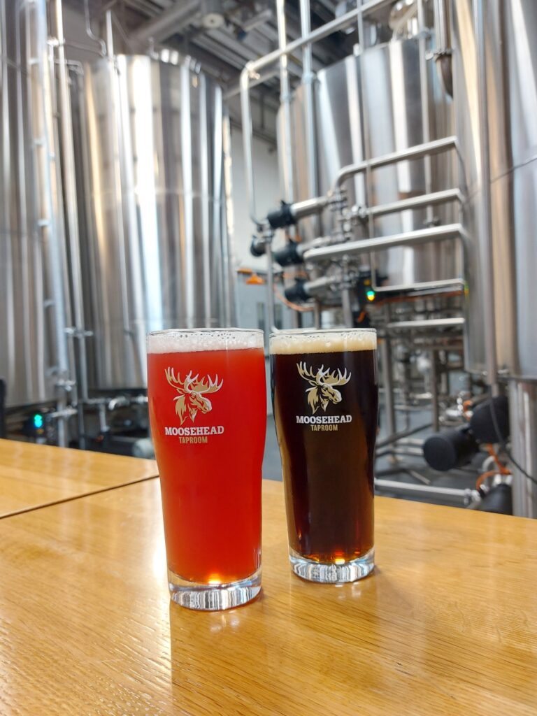
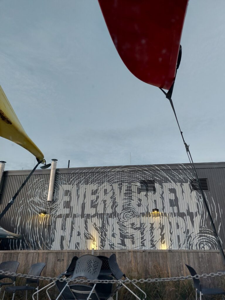
Nonetheless, the sun was dipping below the horizon and with nowhere to stay for the night and no supper plans, we did what we do best, checked out the nearest brewery. After a pint at the Moosehead Craft Brewery (which we were pleasantly surprised with given the size and reach of Moosehead beer), we opted for a traditional Newfoundland supper at Mary Browns before checking out a flagged “campsite” on a gravel road near Black Beach. Once again, we were treated to a beautiful, clear night keeping warm by a small fire before spending night 2 in the back of the car.
Part 1: Hammond River & Darling Lake
NB Kayak Trip (Oct 2023) – Part 1: In the first installment of a three-part series, we embark on a kayaking adventure to New Brunswick, near the town of Hampton to explore the scenic Hammond River.
Part 3: Five Fathom Hole & Gagetown Island
NB Kayak Trip (Oct 2023) – Part 3: In the third installment of a three-part series, we delve into the mysteries of the ghost ships at Five Fathom Hole, examine the stone foundations on an island near Gagetown, and bid farewell to summer weather with a wintry walk through the abandoned minefields of Minto.