Gullfoss
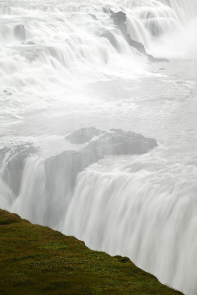
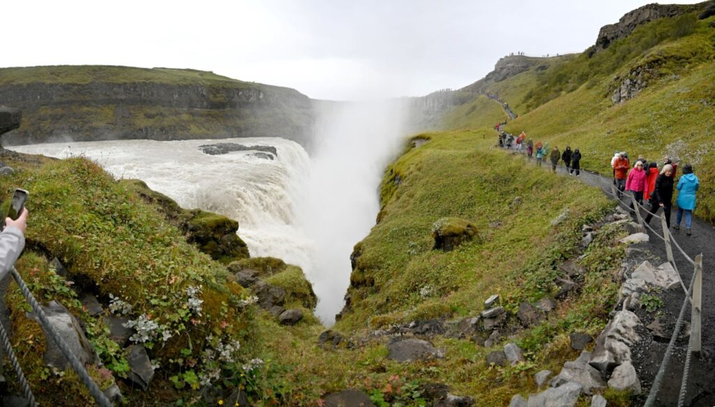
Waking up the next morning, we packed up our gear and continued driving northeast to Gullfoss. The river Hvítá drains the Langjökull ice cap, flowing through the barren, rocky interior before cascading first over an 11-meter drop, followed by a second 20-meter drop into a narrow canyon.
As we approached, views of the falls’ spray suggested its enormous size. But when we parked, we first decided to check out the jam-packed restaurant and gift shop near the trailhead, which sold both local and mass-produced Icelandic crafts and souvenirs.
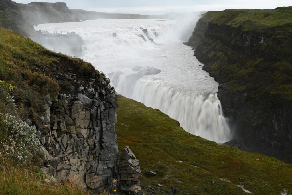
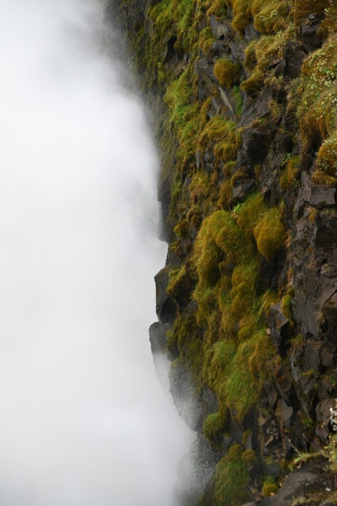
In a sort of “choose your own adventure,” several trails of varying difficulty led to different lookout spots along the falls. After taking a few pictures from a distance, we continued down the trail to the edge of the falls themselves. Thick mist from the plunging water covered the muddy, moss-lined trail, making us thankful for sturdy footwear on the slippery terrain.
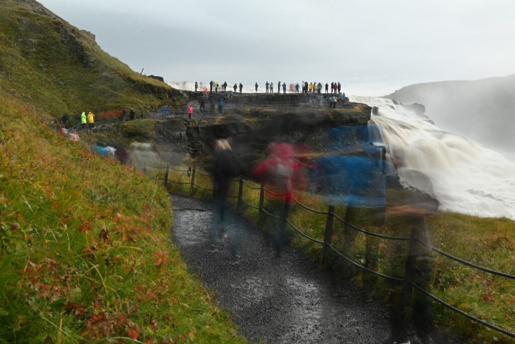
It was here that we got our first taste of what “overtourism” looks like. We’re not accustomed to being surrounded by so many people, so the line of hikers along the trail and the shoulder-to-shoulder picture-taking proved to be a bit much. Nonetheless, the crowds—of which we were, admittedly, part—could not diminish the scale and natural beauty of the falls. In hindsight, the crowds were even comforting: as we exited the parking lot, most people turned back to continue their Golden Circle adventures, whereas we turned east. Soon, the pavement disappeared, and we were entering Iceland’s Central Highlands on our first F-road adventure.
Iceland’s F-Roads
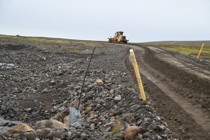
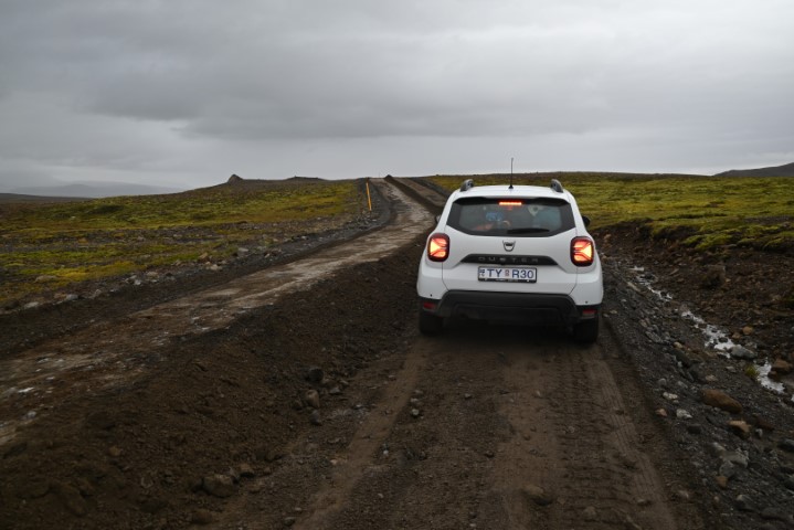
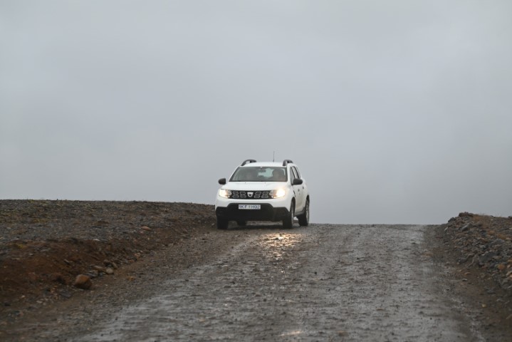
When we first started planning our trip to Iceland, we knew we would need a 4×4 rental vehicle to drive the country’s F-roads. F-roads are essentially gravel roads and trails meant more for recreation than practical travel. While most of Iceland’s population and tourism is concentrated along the coasts, the F-roads provide opportunities to explore its interior regions and harder-to-reach locations. Many are maintained by the state, but their accessibility varies with weather, road conditions, and season. Driving on these roads is permitted only in 4×4 vehicles, and it is strongly advised to check road reports before departure, as washouts and severe weather occur regularly and often with little notice. Paying for full coverage insurance from the rental company also provides extra peace of mind.
Kerlingarfjöll
The volcanically active mountain range known as Kerlingarfjöll is one of these off-the-beaten-path locations, accessible only by a 75-kilometre drive along F35—also known as Kjalvegur or the Kjölur Highland Road—which roughly follows the edge of Langjökull, Iceland’s second-largest ice cap.
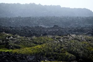
Overall, during our trip we did not feel overly affected by Iceland’s weather. There was always something to see, or a break in the rain, drizzle, and fog that allowed us to appreciate our surroundings. That was not the case, however, on our drive down F35. It has been called one of the most scenic roads in the world, but for us most of the scenery remained hidden behind a wall of low clouds and rain. Still, we caught fleeting glimpses of the nearby ice cap and its surrounding peaks, and even more so, we gained a new appreciation for the vastness of Iceland’s interior.
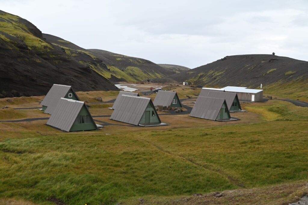
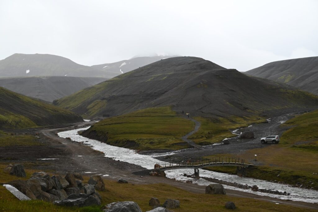
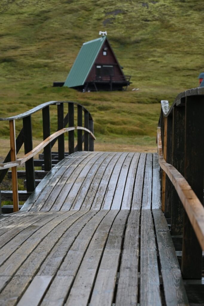
After a few stops along the road—including a questionable encounter with ongoing grading operations—we finally reached Highland Base, a modern lodge, campground, and spa seemingly built in the middle of nowhere. After a quick sandwich, we ventured inside to use the washroom, where we confirmed our suspicions that this was outside our price range. We then began a short hike along a nearby river before climbing a small ridge overlooking the valley. This area, known as Ásgarður, lies at the base of several ridges carved by glacial-fed rivers. In itself, it is a beautiful destination, but with limited daylight and bursts of cold rain, we hopped back in the car and continued along F347, the branch of F35 leading to Kerlingarfjöll.
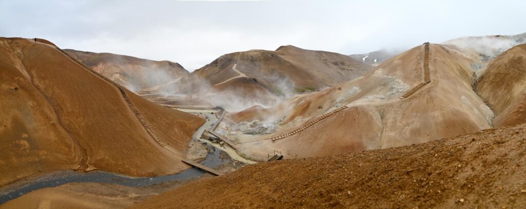
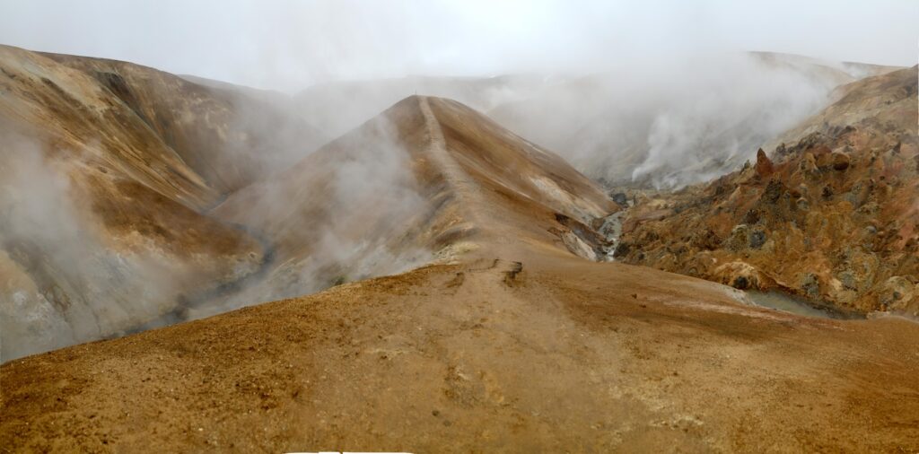
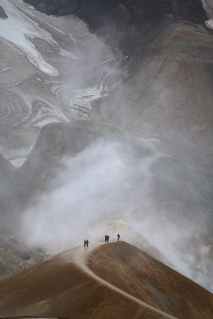
The road was questionable from the start, zigzagging its way to the top of surrounding hills and running precariously close to a vertical gorge carved by the river Ásgarðsá. Although the river lay more than 100 meters below us, we soon reached our highest elevation of just over 1,010 meters, overlooking one of the most beautiful places in the world: Neðri-Hveradalir.
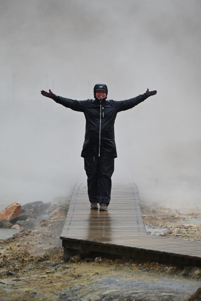
Once again, I say “overlooked,” but by this time we were high enough that we faced a constant downpour of wet snow and rain, accompanied by very strong winds. It was at this point we learned that Icelandic forecasts report wind in meters per second, not kilometers per hour—which makes a huge difference! With a deep breath and all our rain gear, we ventured out of the car. Within seconds we were soaked, which at least removed the pressure of trying to stay dry. The wind kept the fog away (along with any chance of hearing each other—or even our own breath). As we crossed a slippery, narrow ridge toward the geothermal area, we sometimes wished the fog would return to shelter us from the dizzying vertical drops on either side.
We saw only a handful of people heading back to their cars as we descended into the valley, and judging from their faces, they were either having the worst time of their lives or had embraced the weather with broad smiles. Fortunately, we channeled the latter. Soon the wind and rain faded from our minds as we caught sight of the brightly coloured ridges and hills, boiling puddles of clay and mud, and steaming vents that at times grew so thick they obscured the trail entirely. Not to sound too much like a cliché, but we had never been anywhere that felt so otherworldly.
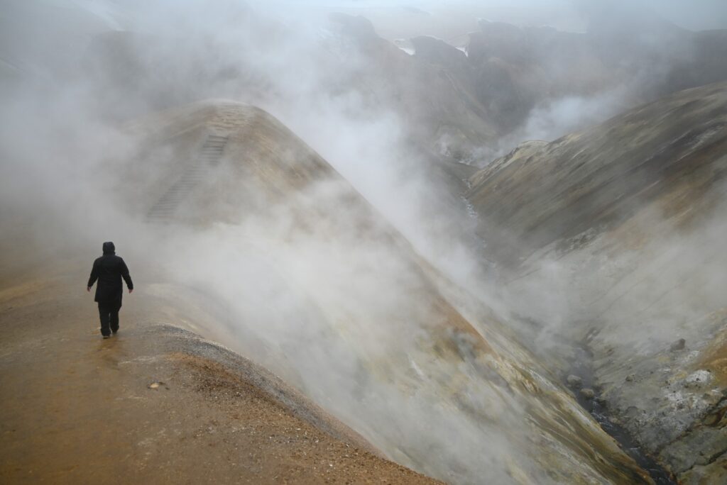
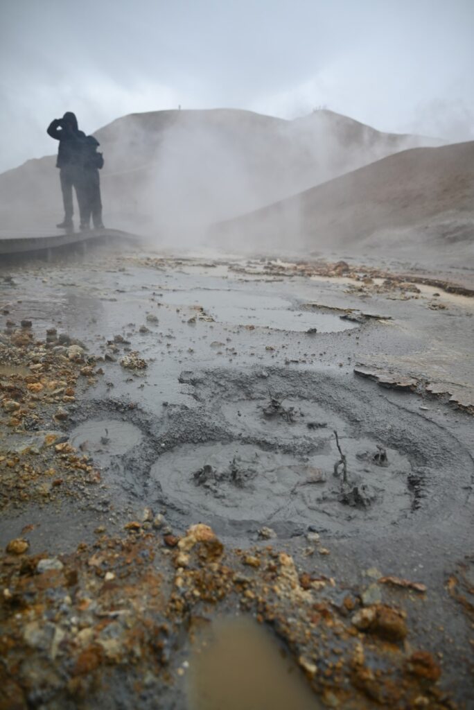
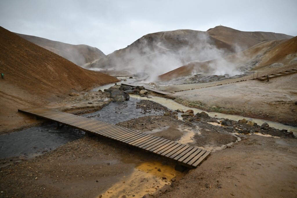
Kerlingarfjöll is one of Iceland’s active volcanic systems. Intense geothermal and volcanic activity beneath the mountains has produced a relatively shallow magma chamber. At Hveradalir, groundwater is superheated by this chamber and released through countless steam vents, boiling mud pots, and hot springs. The steam carries a strong sulfur smell, which can at times be overwhelming. Yet this same sulfur content, along with dissolved iron oxides and copper, has created the yellowish, reddish, and orange hues of the surrounding hills—earning Kerlingarfjöll the nickname “the Rainbow Mountains.”
After exploring the network of trails, staircases, and boardwalks that wind through the valley, we made our way back to the car and began the daunting descent to the lodge at Ásgarður. We had originally planned to stay at the campground, but between the plummeting temperature (now hovering around zero) and persistent winds with little shelter, we decided to head back to F35. Once within cell service, we abandoned camping altogether and booked a cabin with a geothermal hot tub at Úthlíð Cottages in Bláskógabyggð for the night. We enjoyed some Icelandic beer, cooked a hearty pasta meal, and warmed ourselves in the hot tub before turning in.