On a last-minute trip to Europe, we did a quick two-day road trip of southern Ireland. Leaving Dublin, we explored the countryside of Ireland and its many medieval ruins such as Cullahill Castle and the famous Rock of Cashel before continuing south to the Copper Coast. Entranced by the scenic coastline, we winded our way through the many villages and coves with a quick stop at several historic sites such as haunting remains of the Tankardstown Copper Mine, where stone chimneys and engine houses still stand watch over the Atlantic. Continuing south we passed through the seaside town of Dungarvan before continuing to Cork and finally onto our accommodation at The Anvil Bar in Castlemaine — the gateway to the Dingle Peninsula and the perfect starting point for the next day’s adventure.
The following day, we had an early rise, seeing the sunrise on the Dingle Peninsula and it’s small mountain passes. From here we went north stopping at Listowel Castle, taking a ferry across the River Shannon, exploring the ruins of a historic abbey and finally ending our trip at Ireland’s oldest pub in the historic center of Athlone. Our journey through Ireland took us across some of the country’s most breathtaking and historic landscapes. While short, it rekindled something deep — a sense of wonder, belonging, and adventure. Growing up in Newfoundland, with its strong Irish roots and similar rugged coastline, we had never placed Ireland high on our travel list. But exploring its incredible landscapes, meeting its kind-hearted people, and tracing its history through ruins and cultural; centers changed that entirely.
Driving the Irish Countryside
Leaving the city, the flat, city centre quickly transformed into rolling hills of farmland and forests. We started on the M7 motorway before veering off to explore the countryside. Fast, direct motorways are the most popular means of driving across the country, and the large roads were perfect for getting used to driving on the opposite side. But before long, we decided to be a little adventurous and try our luck on Ireland’s country roads — partly to avoid an upcoming toll.
- Motorways (M roads), are high-speed highways similar to a divided highway, freeway or expressway. They connect major cities and regions, pedestrians, cyclists, and slow-moving vehicles are prohibited as the speed limits are typically 120 km/h.
- National Roads (N roads) are main arteries connecting larger towns and cities. They are divided into National Primary Routes (N1–N50), which connect major urban centres, and National Secondary Routes (N51–N99), which link smaller regional areas. These roads are larger with a general speed limit of 100 km/h.
- Regional Roads (R roads), connect smaller towns, villages, and rural areas to larger National Roads or Motorways. They are typically narrower and slower than national roads, often consisting of two lanes, and speed limits between 50 km/h and 80 km/h.
- Local Roads (L roads), provide access to homes, farms, and small rural communities. These are often very narrow and winding, frequently reduced to a single-lane with passing bays. While the posted speed limit on these roads are 80 km/h, travel is usually much slower due to narrow roads and poor sightlines.
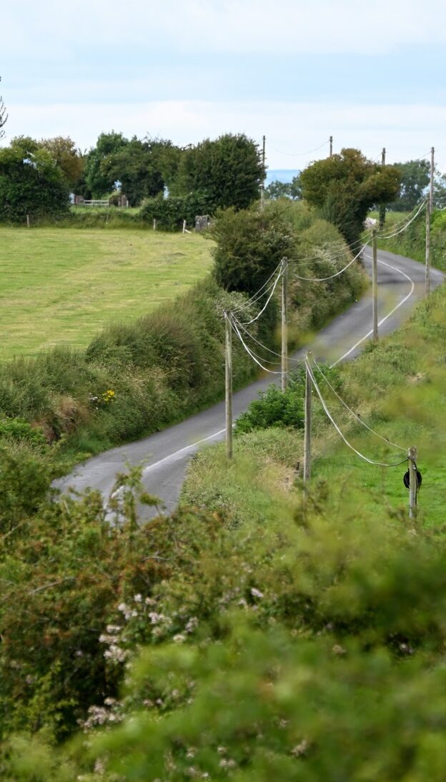
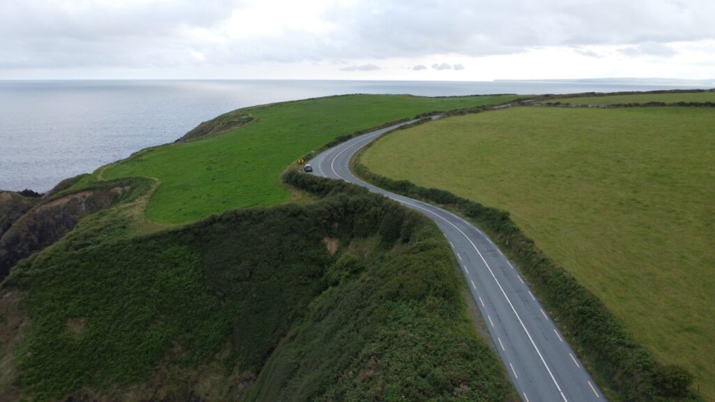
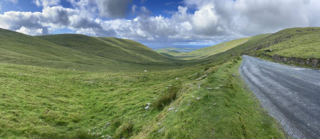
The roads of the countryside wind through varied landscapes. Many are lined by hedges and stone walls, behind which cows and sheep graze on rolling farmland. Small rivers cut through valleys, intermingled with wetlands and ponds in low-lying areas. Driving the smallest of the roads (L-roads) was unlike anything we have in North America. Roads just barely wide enough for a single car wound through the landscape, filled with blind hills and corners, constantly making us wonder when another vehicle would appear. Oddly enough, they offered a bit of fun — they flowed smoothly and contained none of the potholes or bumps we were used to. At this point, we were glad we purchased the extra insurance on the rental car, as we regularly found ourselves scraping against trees and shrubs on either side, sometimes to allow another vehicle to pass, and sometimes simply because there was not enough room on the ATV-sized road.
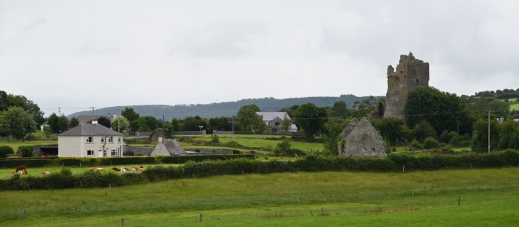
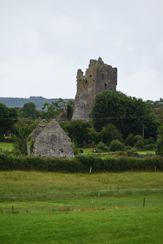
Cullahill Castle
While the countryside roads are narrow and often nerve-racking, it is here that you find the true Ireland and its many incredible places. Passing through the small village of Cullahill, the ruins of Cullahill Castle can be found. The castle was our first in Ireland and so, naturally, we pulled over and took a few photos.
The castle was built in 1425 by Finghin MacGillapatrick as an assertion of his family’s power and to defend against raids and local feuds. Fifteenth-century Ireland was an unstable period, as English royal authority over the country had shrunk dramatically, leading to a revival of native Gaelic rule. This meant that clans such as the MacGillapatricks were regularly clashing as they attempted to reclaim lands lost to them since the Norman invasion of the late 1100s.
The MacGillapatricks’ castle survived many attacks over its life, including those ordered by King Henry VI in 1441. After standing for more than 230 years, the castle was raided in 1657 during Oliver Cromwell’s conquest of Ireland, as he sought to reassert English control over the country. Cromwell’s raids have made his name synonymous with oppression, religious persecution, and colonial violence in Ireland—traits that are tangibly memorialized in the ruins of Cullahill Castle.
Today, the ruins of the former MacGillapatrick stronghold continue to rise five stories above the surrounding cow pastures. While it may never be used again, it—like so many others in Ireland—remains an indestructible landmark within the community. From the nearby road, you can also make out the hollowed ruins of what was once a chapel.
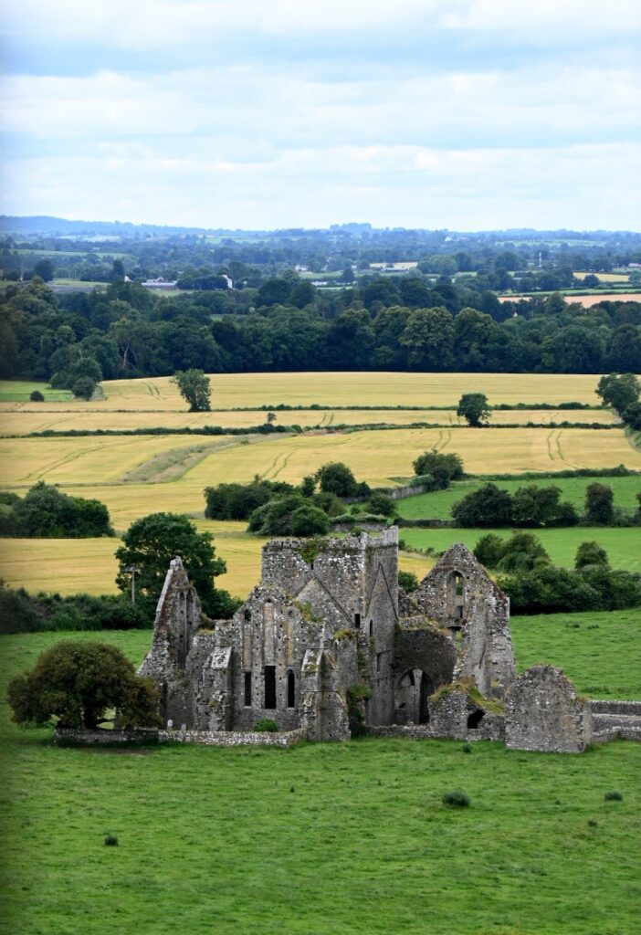
Rock of Cashel
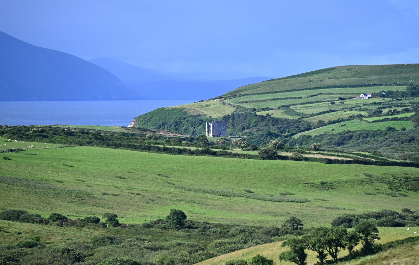
After getting lost in the Irish countryside, a rare thing we blamed entirely on Google Maps, we eventually found our way back to the motorway and continued toward the town of Cashel, home to one of Ireland’s most remarkable historic sites. Rising dramatically from the surrounding plains, the Rock of Cashel is built atop a massive limestone outcrop that towers above the Tipperary landscape. From a distance, the site appears almost otherworldly, with its cluster of medieval ruins silhouetted against the sky.
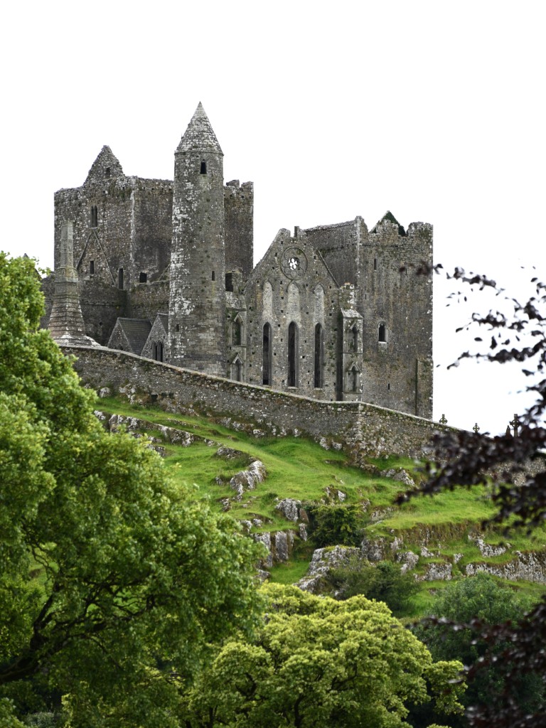
The Rock of Cashel began as the ancient seat of the Kings of Munster in the 4th century CE, serving as both a royal stronghold and a symbol of power over the surrounding lands. Between 350 and 1101 CE, a series of grand stone structures were constructed atop the hill, many for ecclesiastical and ceremonial purposes. Though its origins were royal, its destiny would become spiritual, in 1101, the site and its buildings were gifted to the Church, marking the beginning of its transformation into a center of religious significance.
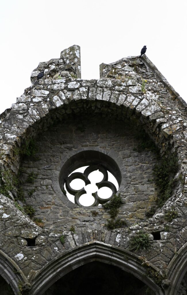
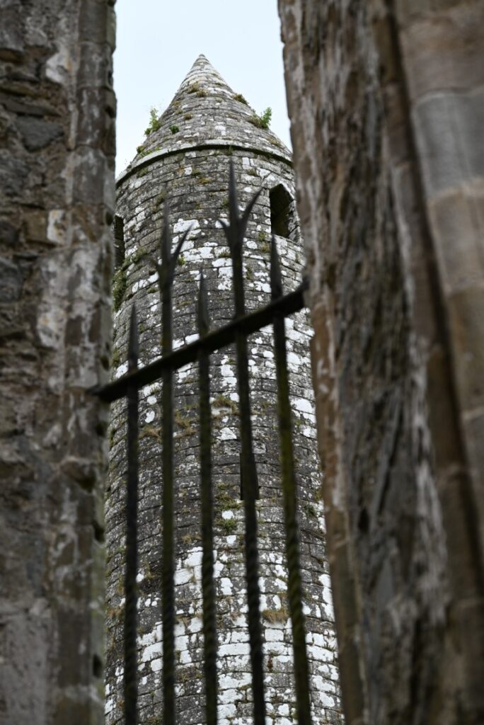
Among the ruins, the Round Tower stands as the oldest surviving structure, built around 1100 CE, just a year before the Rock was officially granted to the Church. Its slender, tapering form rises more than 28 meters above the ground and would have served as both a bell tower and a refuge in times of danger. Surrounding it are later medieval additions, including Cormac’s Chapel, an exquisite example of Romanesque architecture, and the imposing Cathedral, whose roofless walls still echo with the memory of centuries past.
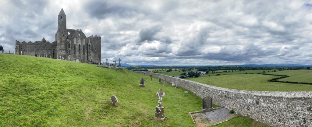
Today, the Rock of Cashel remains one of Ireland’s most iconic landmarks, a place where the island’s royal and religious histories converge. Standing atop the limestone ridge, with sweeping views of the Golden Vale stretching into the distance, it is easy to see why this site has been revered for more than sixteen hundred years. The wind that moves through the ruins seems to carry whispers of both kings and clerics, reminding visitors of the enduring layers of history that define this extraordinary place.
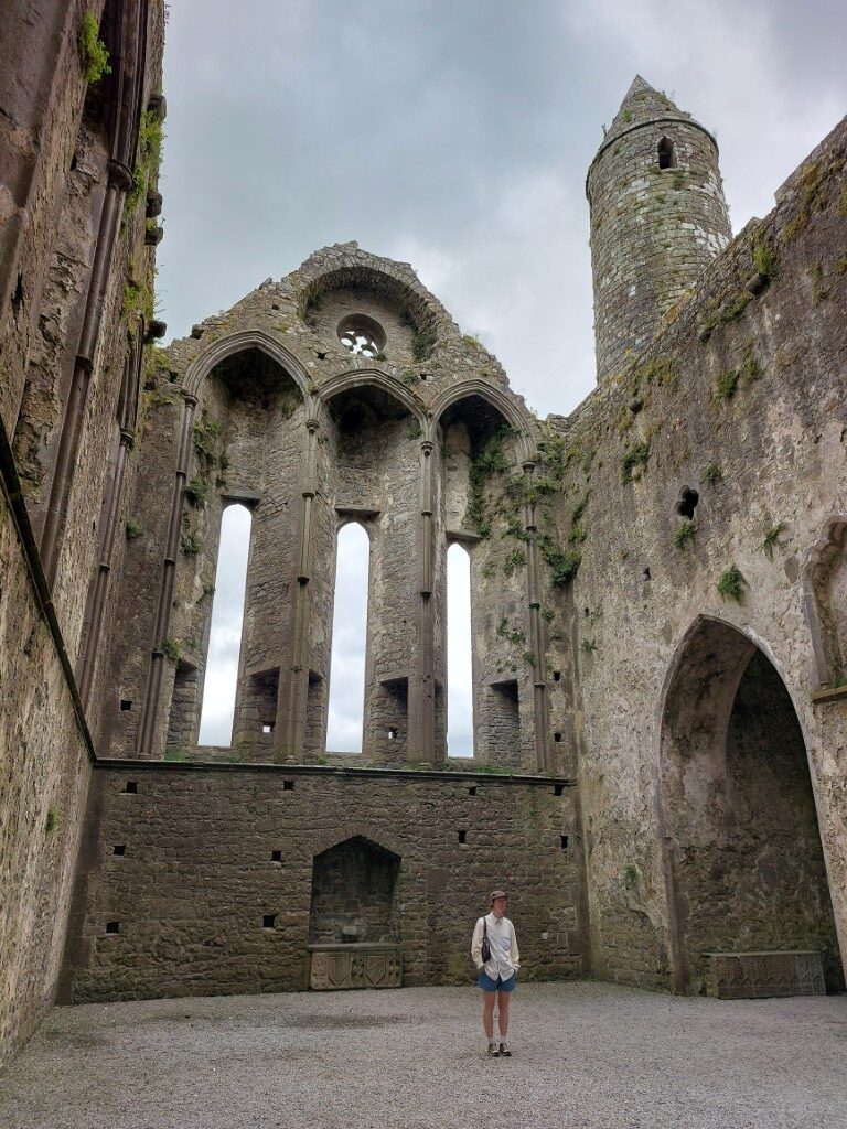
We parked at the base of the rock and wandered through the grounds. The enormity and age of the structure was incredible to say the least. Following one of the structure’s tours, we learned of the fascinating influence the area has had on all of Ireland. Eventually we were forced to say goodbye, but not before taking a detour through the town to get a few groceries for the next few days. Soon, we were back on the highway heading towards the Hook Peninsula on the country’s south coast.