Beginning at the base of the Dingle Peninsula, we started early in hopes of returning to our accommodation before breakfast ended and we had to check out. However, as soon as we left our room—with all our stuff still there—we should have known this was not the morning to rush. The sun had just come up, shining over the calm waters of Castlemaine Harbour, backdropped by the rugged mountain range known as MacGillycuddy’s Reeks. Driving down the scenic R56 highway, we had not had the chance to get coffee before we felt the pressure to stop and admire the scenery.
Inch Beach
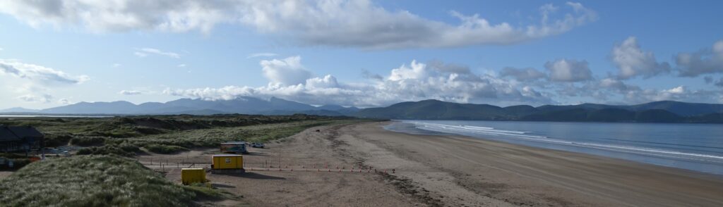
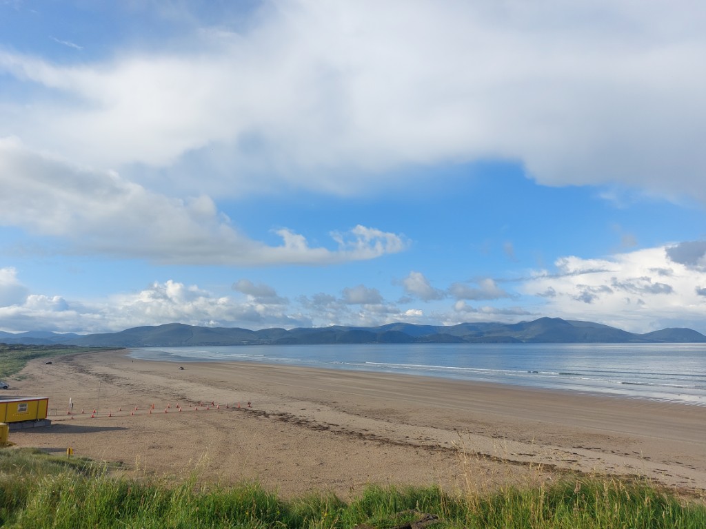
This first stop was Inch Beach, a 6.5-kilometre-long sandspit that encloses Castlemaine Harbour behind it. The beach is several hundred metres wide, ending at a wall of grassy sand dunes. A popular location on a hot day, the beach can be freely driven on, with many people driving right to the water before enjoying a dip in the frigid waters. Aside from a few swimmers and vans that had clearly overnighted there, we were mostly alone as we drove along the wet sand.
Looking across the bay, Ireland’s highest peak, Carrauntoohil, was slowly being engulfed in cloud as a squall moved off the water. Leaving the beach in search of coffee, the view kept getting better as the storm on the opposite side of the bay produced a rainbow, which we took as a sign of good luck.
Feeling much better after grabbing a coffee at Báinín Coffee in the town of Annascaul, we slowly made our way through the winding grassy farmland of the Dingle Peninsula. The peninsula was the perfect representation of Ireland: lush green fields separated by rock walls stretched from the cliff-lined coast, across the rolling hills, to the barren mountains that run along the spine of the peninsula. Tightly winding roads passed through villages and homesteads, with single-lane roads veering off in every direction.
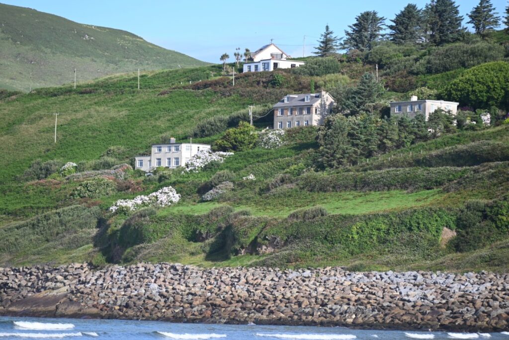
Minard Beach & Castle
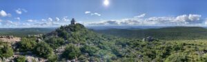
In the village of Banogue Beg, we turned onto one of these single-lane roads, which redefined how small a road can be and still be considered “drivable.” Making our way to the coastline, we arrived at Minard Beach, a place that would become one of the best hidden gems Ireland had in store for us. Parking alongside the road, we traversed a wall of large rock—presumably used to protect the road from erosion—to get to the small, crescent-shaped sandy beach. On the east side of the cove, tall cliffs rose, while on the west side the surrounding trees and grass ended abruptly on the rocky coastline. Perfectly perched among the fields, seemingly watching over the cove, was Minard Castle, a square-shaped stone structure built in the mid-1500s.
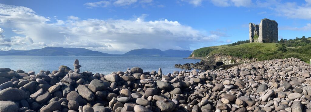
The three-storey tower (originally four) was built by the Fitzgeralds, only to be destroyed the following century when Oliver Cromwell’s forces used explosives to siege the tower, destroying the structure beyond repair. The castle is recognized today as a reminder of the Cromwellian Conquest and England’s infamous attempt to reassert control over Ireland. Having become familiar with the scale of this dark era in Irish history, we found a newfound understanding of the extent and travesty it brought upon all of Ireland.
Dingle
Leaving Minard Beach and all of its beauty behind, we continued on to the town of Dingle. Known for its vibrant shops, restaurants, and music, the picturesque community is a hub for tourism and Irish culture. The port developed as a medieval trading centre between the thirteenth and sixteenth centuries, becoming a hub for the country’s fish, wine, and textile trades with Spain and France. Short on time, we only had a chance to see the town from inside the car before turning inland to cut across the peninsula by taking one of several mountain roads.
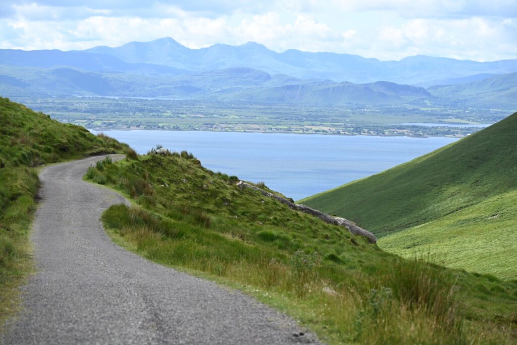
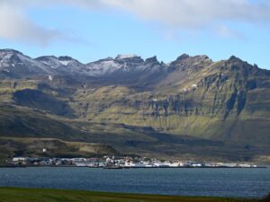
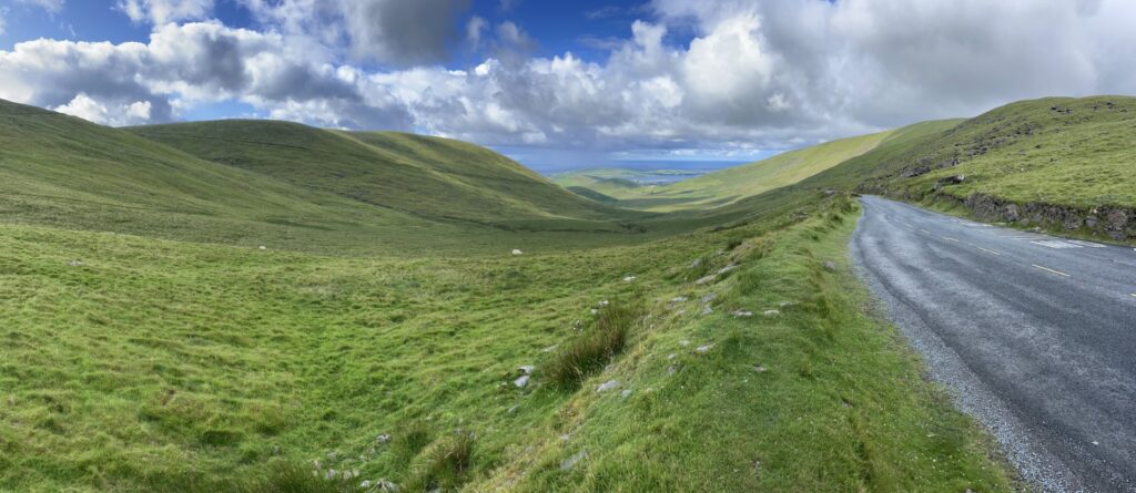
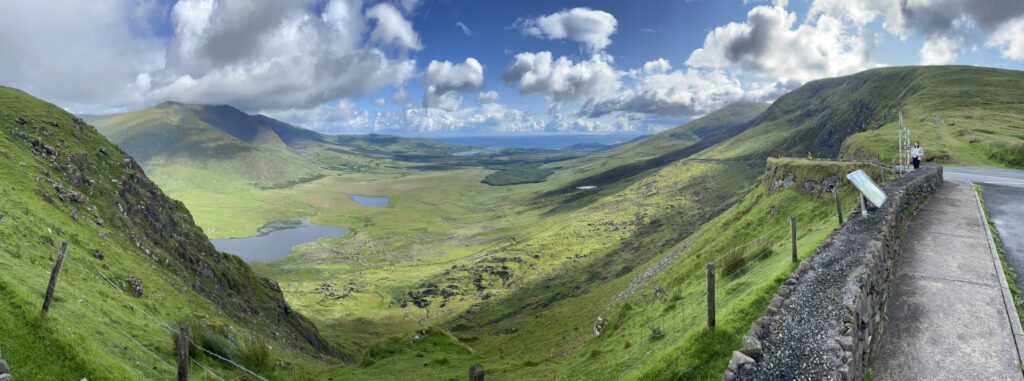
Conor Pass
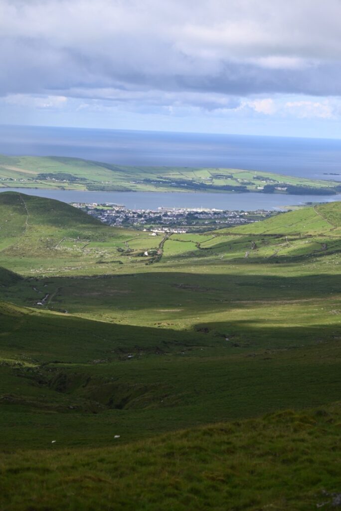
The R560 heads north from Dingle across Conor Pass to An Clochán, crossing the Slieve Mish Mountains. The road quickly winds its way up the barren, grassy hillside. The small road has poor lines of sight and, sadly, with no pull-offs until its peak, you can only admire the scenery from the car. However, at the peak of the mountains, some 456 metres high, a lookout can be found. While the parking lot is small, the abruptness of the ridge means that looking south you can overlook Dingle, Dingle Bay, and, on a very clear day, even glimpse the Skellig Islands. On the north side, a completely different view takes over as you look over Brandon Bay and the coastline stretching to Tralee Bay. The view is spectacular and gives you a sense of the sheer diversity in landscape and intricacy of the coastline found on Ireland’s west coast.
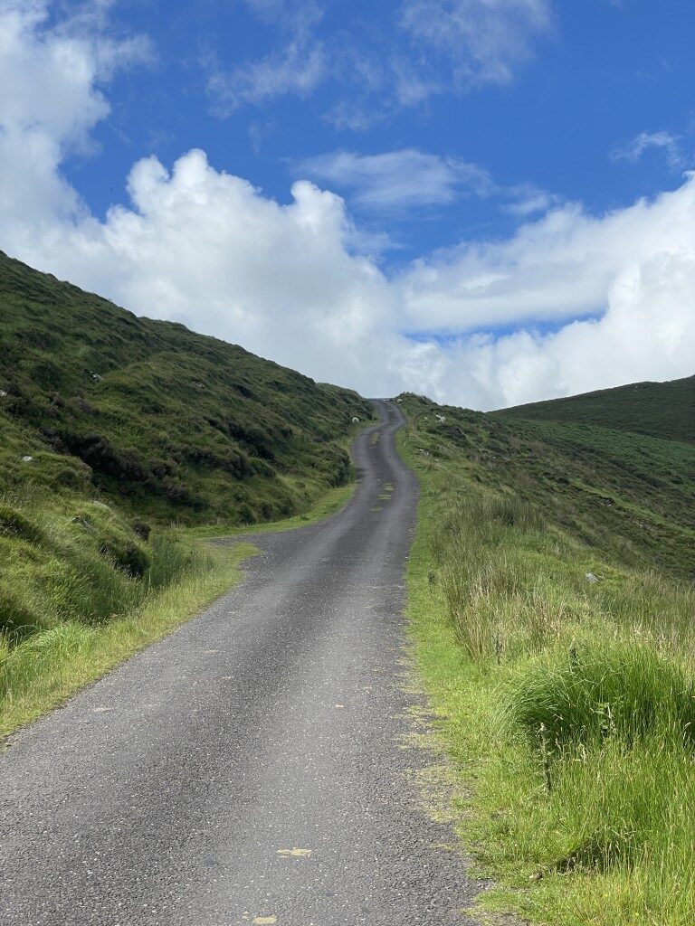
The north side of the pass is even steeper than the south, with the road following a steep, unnerving drop as it winds down the hillside. From the road you can catch a view of Conor Pass Waterfall and Lough Doon and Lough Gal, two lakes situated at the base of impressively tall mountains.
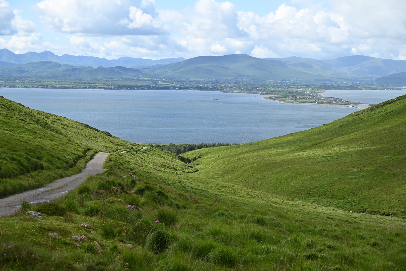
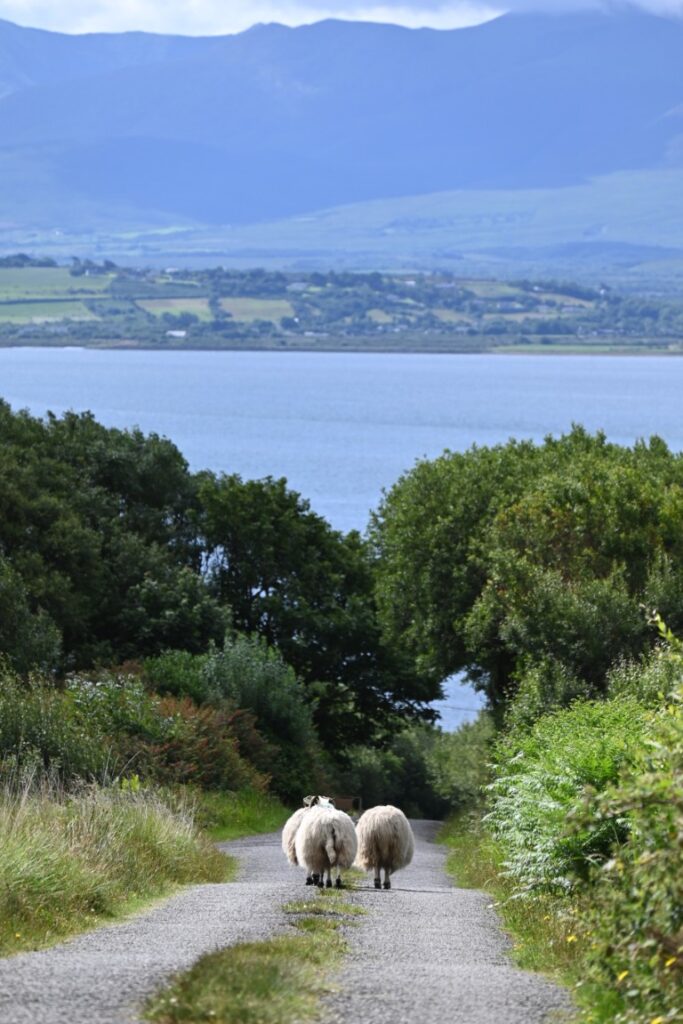
Arriving back at sea level, we did not spend much time before reaching the community of Camp and turning onto the Caherconree Scenic Route. If we thought Conor Pass—or, albeit, any other road in Ireland—was small, this proved otherwise. The road began by climbing through farmland, slowly getting smaller and smaller until we passed through Caherconree itself, where the road became a small path of paved and gravel sections. Our pace was slowed only by the breathtaking scenery and the fact that the road was so narrow we never saw a single car the entire length. After waiting in “Irish traffic”—a group of sheep who refused to veer from the roadway—we completed our loop, coming out on the highway we had started on that morning.
While we made it to the hotel just minutes before check-out, we sadly missed what would have been an amazing breakfast. Retrieving our gear from our room at the Anvil Bar, we left a thank-you note to show our appreciation for their accommodation of our hectic schedule and set forth on the road back to Dublin.