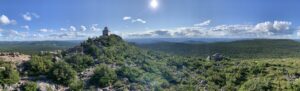
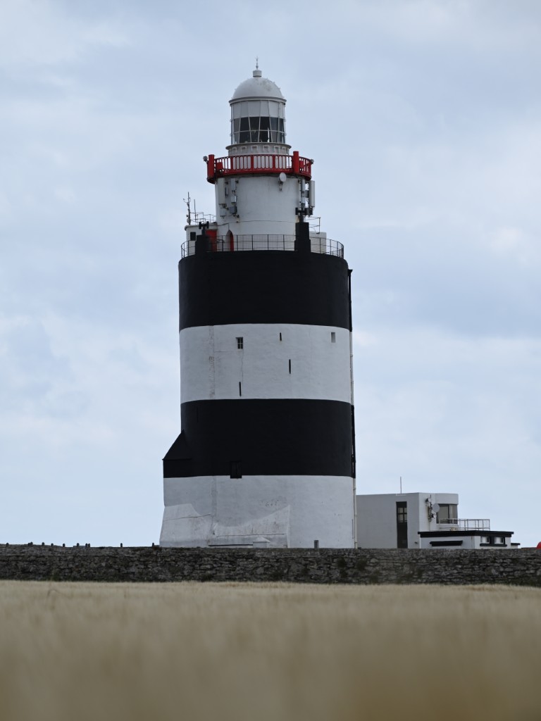
Hook Lighthouse
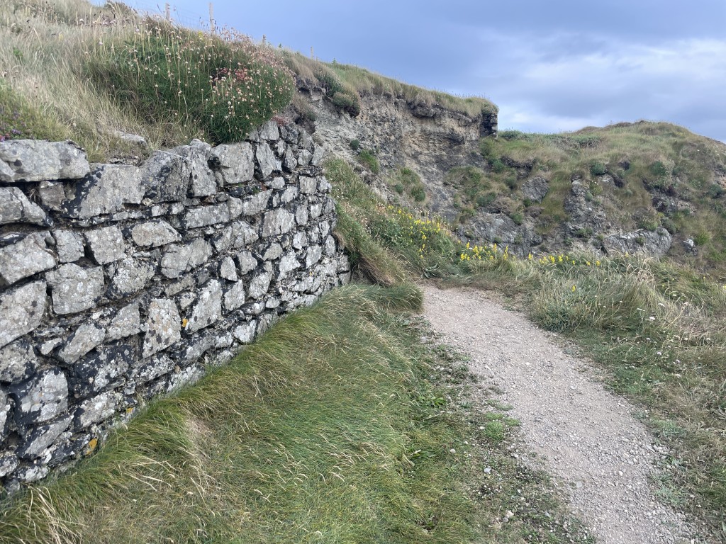
Standing for more than 800 years at the mouth of Waterford Harbour is Hook Lighthouse, the second-oldest operating lighthouse in the world. The lighthouse was built in the late 12th or early 13th century on a narrow, rocky peninsula known as the Hook, located on the east side of Waterford Harbour. Waterford Harbour is a large, shallow estuary formed where the Barrow, Nore, and Suir Rivers meet the Atlantic Ocean. The harbour has long been recognized for its potential for trade and shipping—something especially apparent to the Norman Lord of Leinster, William Marshal. Seeking to increase trade into the harbour, Marshal set about building a lighthouse at the outer harbour to help guide ships around the notorious rocky coastline.
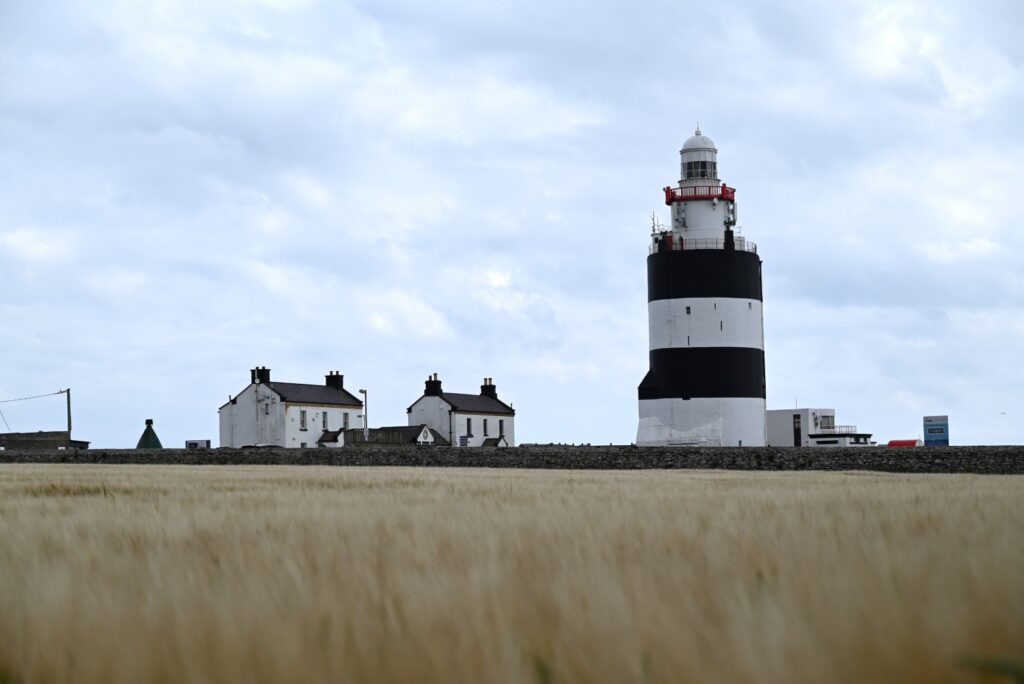
The result was the construction of a 36-metre-high circular lighthouse made of limestone. At its base, the tower’s walls are 4 metres thick, providing immense structural support. Atop the tower, the light was originally powered by a fire lit when ships were spotted nearby. To operate and maintain the lighthouse, Marshal enlisted monks from the local monastery of Rinn Dubhán. The monks operated the lighthouse until 1671, when a lighthouse keeper took over and a coal lantern was installed. In the following centuries, the lantern was periodically upgraded to burn whale oil, gas, and eventually electricity.
Since 1996, the medieval lighthouse has been fully automated and no longer requires a permanent lighthouse keeper—ending around 750 years of continuous staffing. The former keepers’ houses and surrounding lands have since been transformed into a museum and visitor centre, welcoming guests eager to experience the lighthouse’s history, dramatic coastal scenery, and even whale-watching opportunities in the surrounding waters.
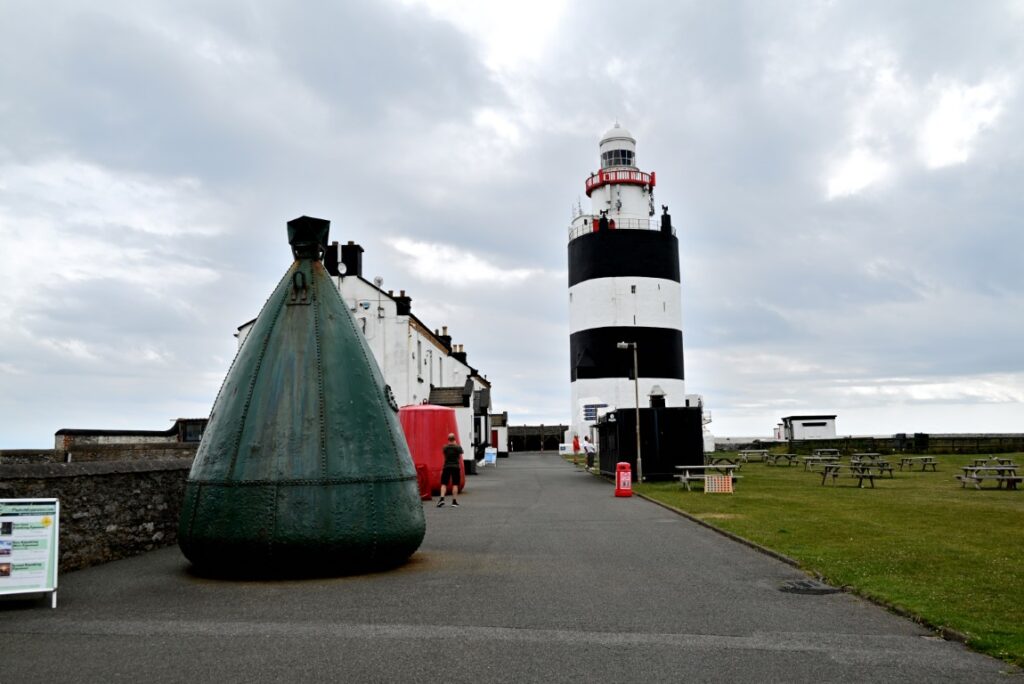
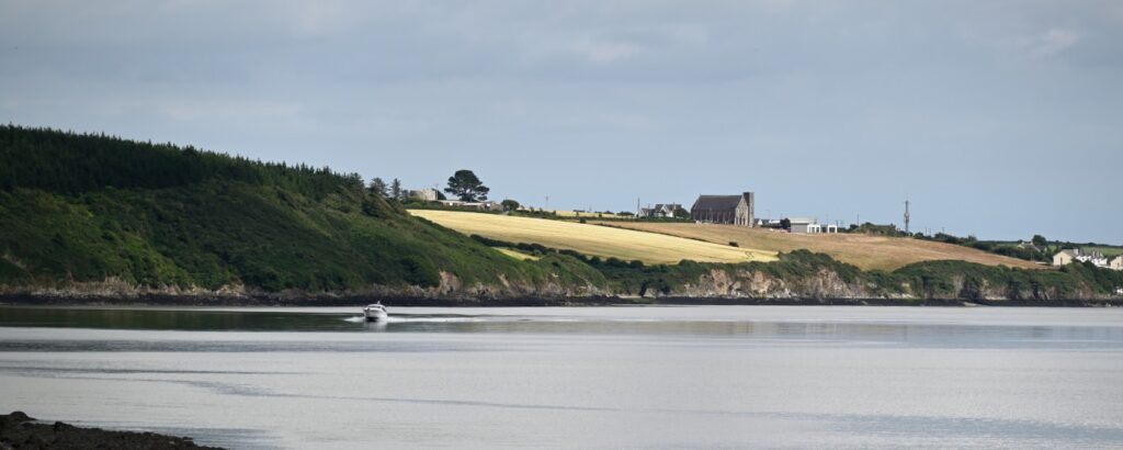
We arrived at the lighthouse just before closing—enough time to park and wander around the grounds. The massive structure, museum artefacts, and coastal vistas quickly made the detour worthwhile. Surrounded by bright fields of straw, the small peninsula offers excellent photography opportunities.
The Road to the Hook
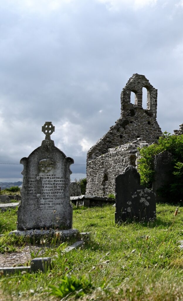
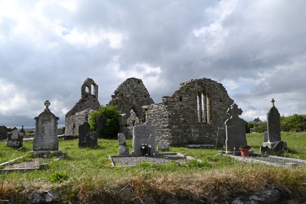
As we raced toward Hook Lighthouse, we missed many of the sites the Hook Peninsula has to offer. Despite the sun dropping lower by the minute, our next stop was nearby—the stone shell of St. Dubhán’s Church. The Norman church was built sometime between the late 11th and early 12th centuries and is considered one of the oldest surviving structures in the region. The site on which the church stands is believed to have been occupied since the 5th century, when the Welsh missionary monk Saint Dubhán established a religious settlement there. Today, the ruins of the church stand amid a manicured lawn, surrounded by gravestones and a low stone wall.
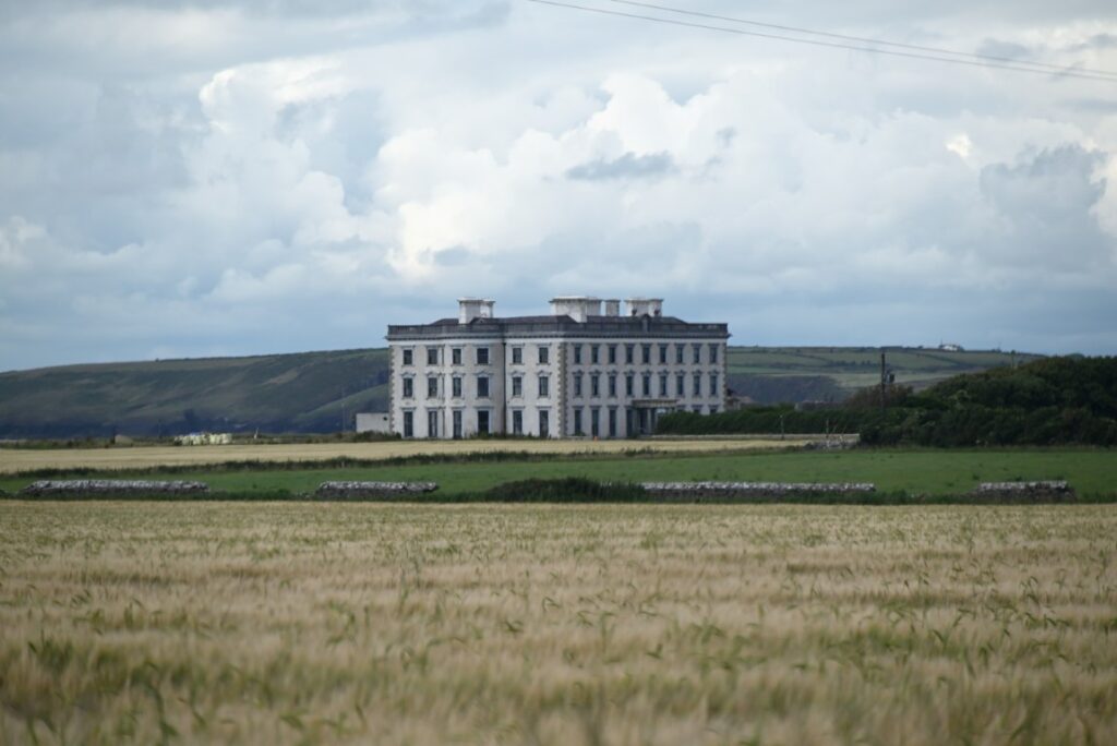
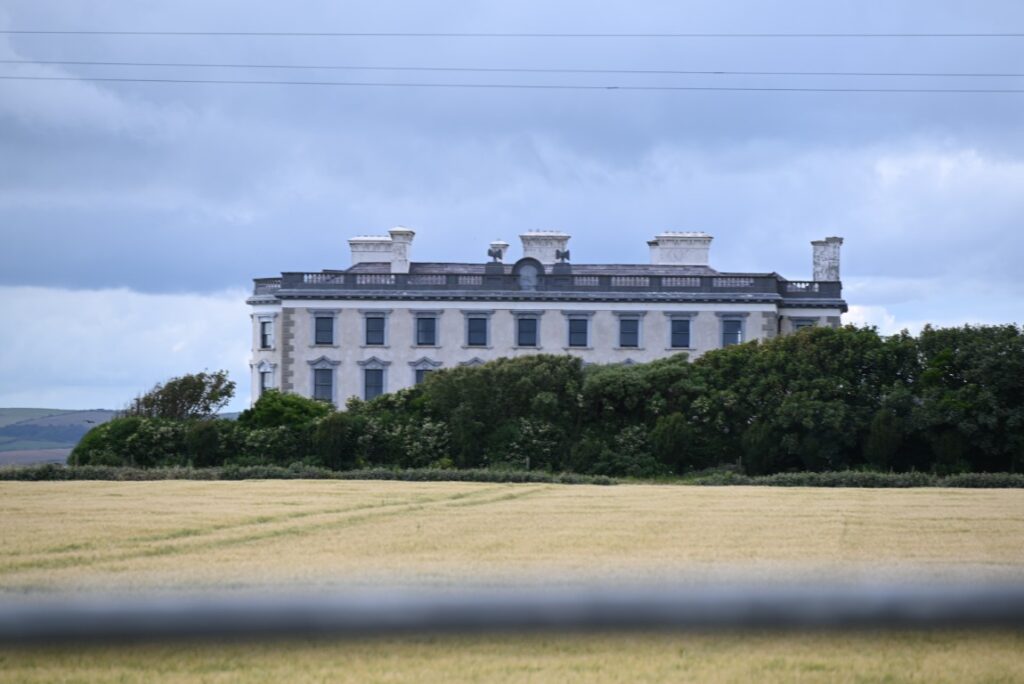
Further down the road, we pulled over again to take what photos we could of a unique—but off-limits—site known as Loftus Hall. Built in 1350 by the Redmond family, the castle was originally known as Redmond Hall. In the 1650s, during Oliver Cromwell’s conquest of Ireland, the castle fell and the family was unseated—similar to the fate of the MacGillapatricks at Cullahill Castle, which we had visited earlier that morning. The castle and country home went on to play a role in the Irish Confederate Wars before coming into the ownership of the Loftus family, who later rose to the Irish peerage—a system of noble titles including duke, marquess, and earl.
While the family’s prominence in society continued to grow through the 18th and 19th centuries, so too did its debts. After the death of John Henry Wellington Graham Loftus in 1884, the estate was sold and passed to the Sisters of Providence, who transformed it into a convent and school. In 1983, the building was sold again, this time to be converted into a hotel. Throughout its long history, the hall has seen its share of tragedy and disaster, leading to countless ghost stories and tales of haunting. Recognizing its potential as a tourist and ghost-hunting destination, new owners purchased the property in 2011 and began offering ghost tours—cementing Loftus Hall’s reputation as one of Ireland’s most famous haunted houses. Sadly, the tours have since ceased, and the grounds are now closed to visitors, leaving us to admire this historic structure from the roadside.
Hook Peninsula & Passage East
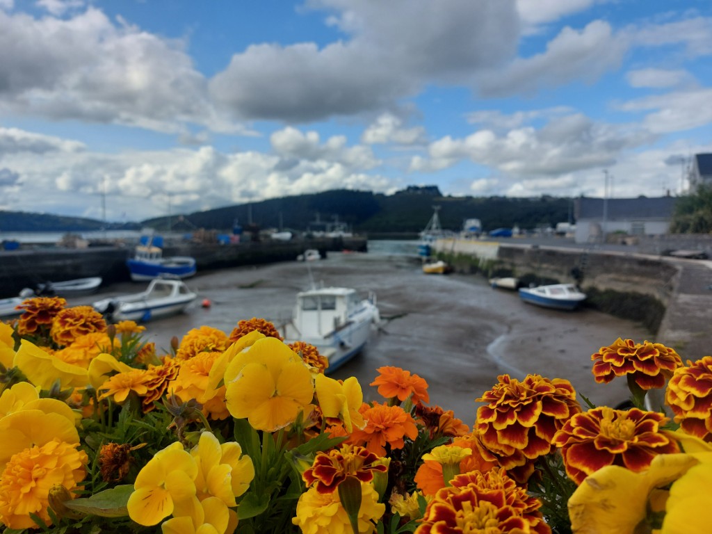
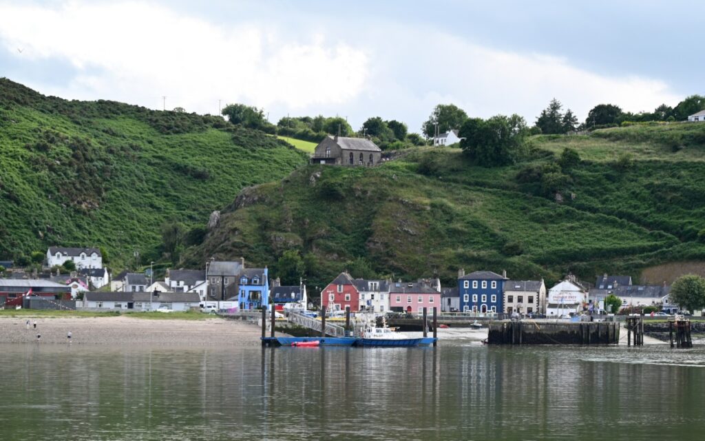
The road back along the Hook Peninsula flowed gently through farmland and small villages before dropping down to the tidal estuary of Waterford Harbour. The tree-lined hills narrow as the estuary winds its way toward the town of Waterford. To save travellers the long drive around the estuary, a short ferry service operates between Ballyhack and Passage East. Short on time—and always eager for a ferry ride—we joined the queue, paid €9 (collected onboard), and soon found ourselves crossing the narrow river.
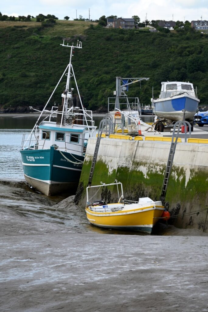
The shallow waters of the estuary, combined with tides reaching up to four metres, create a striking contrast between high and low tide. Pulling over to wander around the small town of Passage East, we quickly noticed how similar the tides were to those along Canada’s East Coast. Visiting at low tide, we found the fishing and recreational boats in the harbour completely beached, awaiting the tide’s return.
The Copper Coast
Our journey next took us to the Copper Coast—a stretch of coastline between the towns of Tramore and Dungarvan internationally recognized for its beauty, geology, and mining heritage. The Copper Coast preserves one of the most significant and complete geological records in Europe. Volcanic rocks formed around 460 million years ago (during the Ordovician Period), including andesite, rhyolite, and tuff, are interbedded with marine deposits such as slate, sandstone, and limestone.
Remarkably, these rocks formed at the same time—and in the same tectonic setting—as those found today in Newfoundland and Canada’s Maritime provinces. However, during the Ordovician, they lay on opposite sides of an ancient ocean known as the Iapetus Ocean. The Iapetus—named after the mythological Titan Iapetus, father of Atlas (for whom the Atlantic Ocean was later named)—eventually closed between 420 and 400 million years ago as continental plates collided. This immense tectonic compression created the Caledonian–Appalachian Mountain chain, a continuous range stretching from present-day Newfoundland through Ireland, Scotland, and Scandinavia.
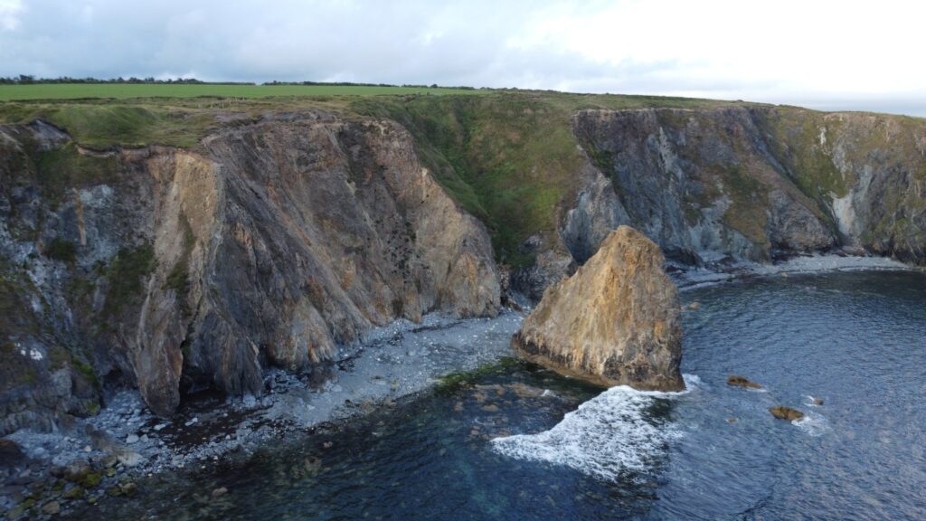
Roughly 200 million years ago, the supercontinent Pangaea began to rift apart, and the newly forming Atlantic Ocean opened along the ancient Iapetus fault system. In doing so, it split the once-continuous Appalachian–Caledonian mountains in two, leaving their remnants 3,200 kilometres apart—part in Newfoundland and eastern Canada, and part in Ireland and Scotland.
In short, the geologic story—and the resultant mining history—that shaped the landscapes we have spent our lives exploring in Newfoundland are the same forces that formed this incredible shoreline and its extensive mining heritage. These processes left behind many mineral deposits that have been exploited for centuries, the most common being, of course, copper. In 2004, the coastline was designated a UNESCO Global Geopark, recognizing both the geological significance hidden in its coves, beaches, and inlets, and the enduring impact of its mining history on 19th-century Ireland.
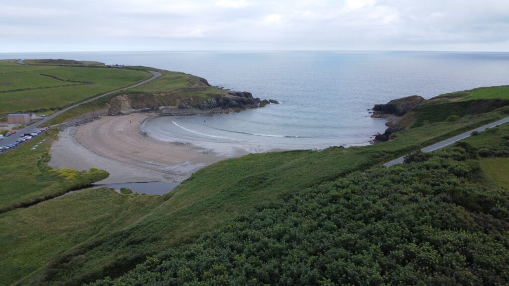
Annestown Beach
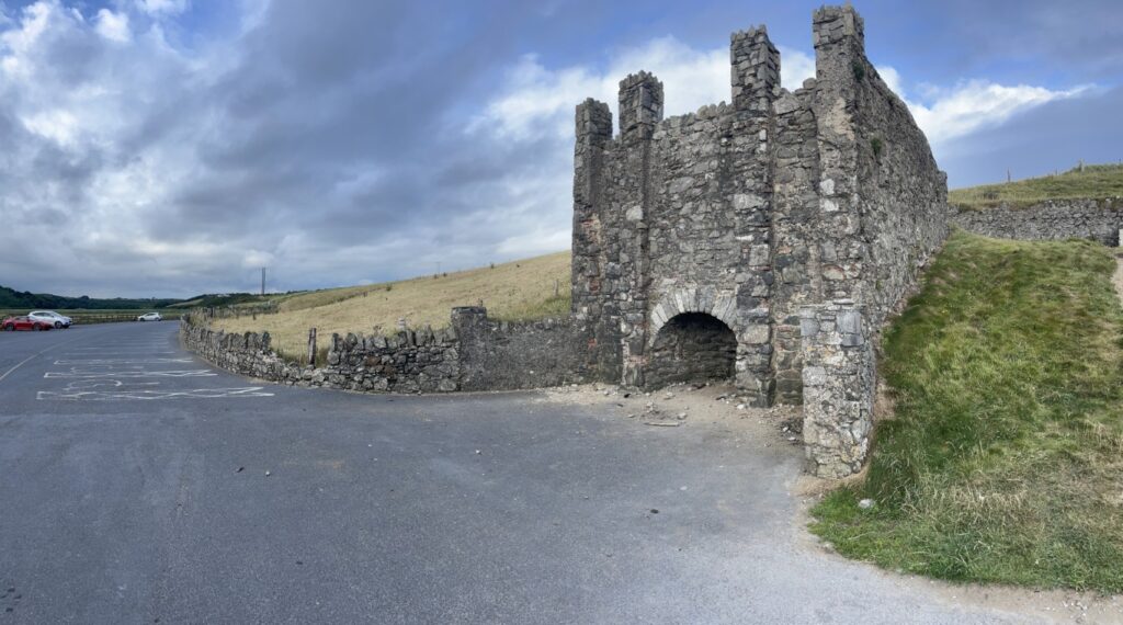
Our first stop along the Copper Coast was at Annestown, where we pulled over to walk along Annestown Beach. Sea stacks, a sandy shoreline, and steep coastal trails awaited us—but not before we explored the old lime kiln in the parking area. Resembling a small medieval tower, the structure is built of cut blocks of andesite. At its base, an arched entrance marks the kiln itself, where limestone and coal were once burned to produce lime used to reduce soil acidity in farmers’ fields.
From the kiln, we followed a small trail along the hillside overlooking the rocky beach. Despite it being a beautiful summer’s day, we were alone except for a few swimmers braving the frigid North Atlantic waters. Perhaps we’ve fallen into the habit of too often comparing new places to home in Newfoundland—but after a brief conversation with a woman walking her dog, and hearing many of the same colloquialisms and vernacular terms we hadn’t heard since leaving Newfoundland, we felt more at home than ever—despite her not knowing where Newfoundland was.
Tankardstown
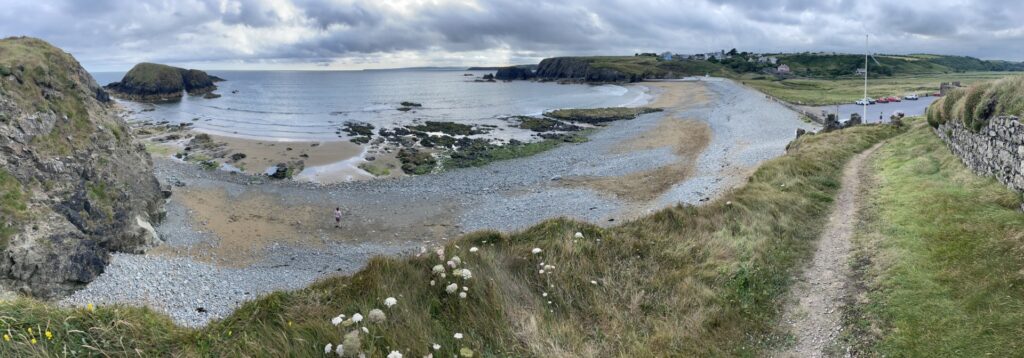
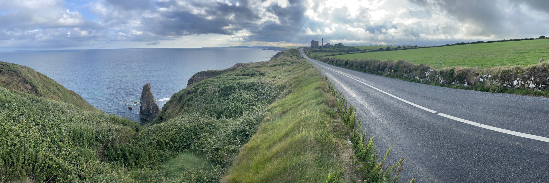
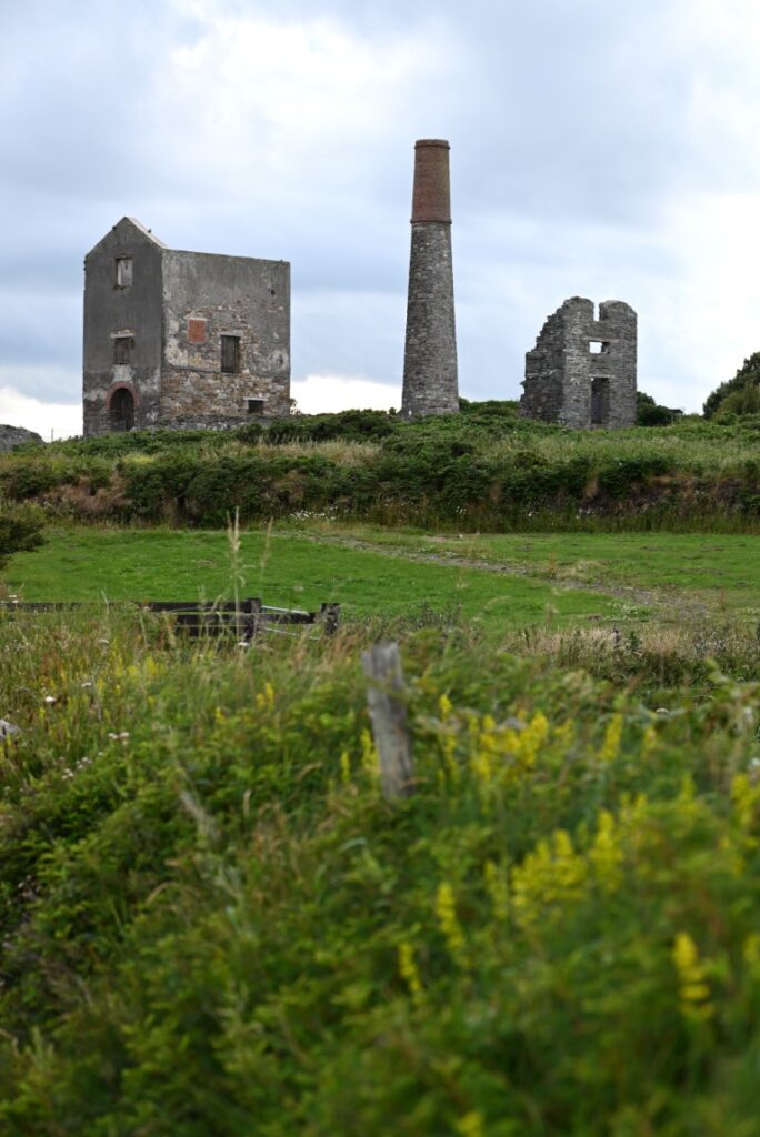
The road along the Copper Coast winds its way through meadows and small coves, rarely venturing more than a few hundred metres inland. As we passed Kilmurrin Beach, we crested a hill and were greeted with spectacular views overlooking Bunmahon Bay and our next stop—the ruins of the Tankardstown Copper Mine. Once again, the ruins appeared almost medieval, perhaps those of a castle. Positioned on the highest point of land and majestically overlooking the bay, the site would have made an excellent fortification or the home of a wealthy lord. But it was the copper and other metals found in the local geology that led to its creation.
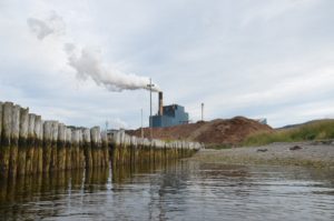
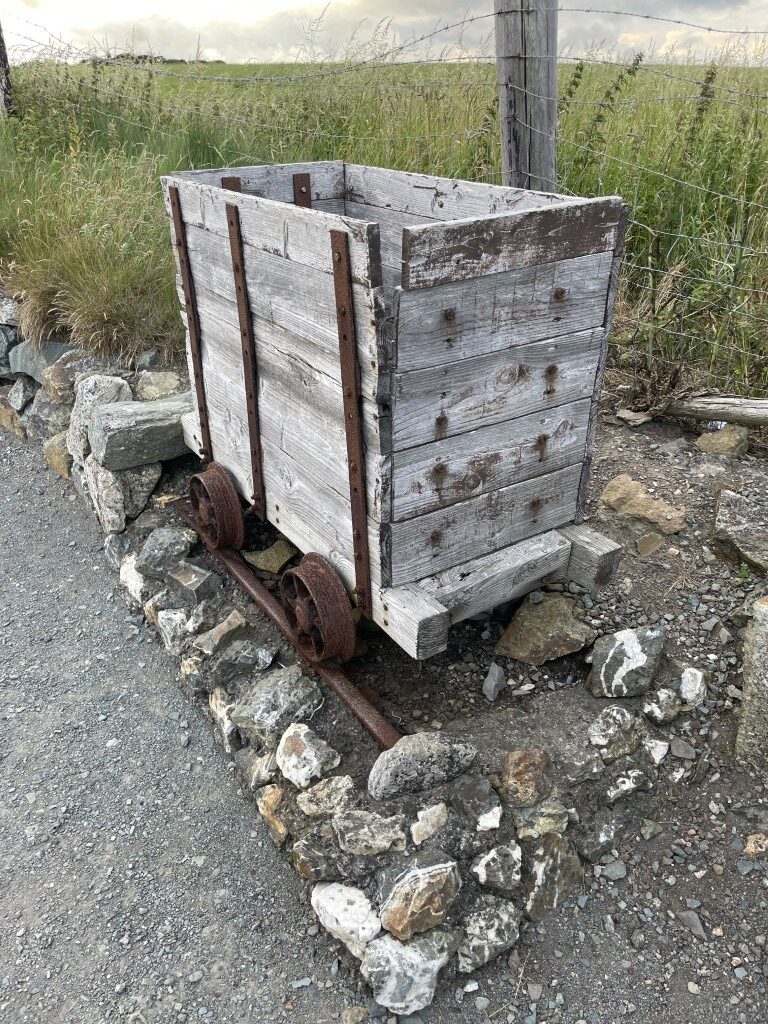
Mining on the Copper Coast likely began as early as the Bronze Age, but it was not until the nineteenth century that extensive mining took place. Underground mines were established in Stage Cove and Bunmahon, with many tunnels extending deep beneath the surrounding bay. By 1850, however, Tankardstown had become the centre of the region’s mining industry, with extensive deep mineshafts excavated throughout the surrounding hillside. Despite operations that at one time employed more than 1,200 people, by 1879 the copper reserves were no longer profitable, and the mine was shut down.
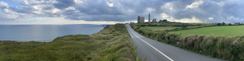
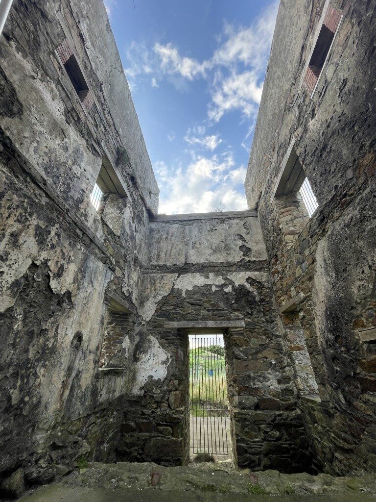
Today, the stone structures of the engine house, chimney, and several other buildings remain. Located alongside the road, the site is an easy and accessible stop, complete with interpretive signs that guide visitors through the area’s industrial past. We had the site to ourselves, save for a few small rabbits hopping through the grass. Before the sun dipped too low, we hiked back along the narrow road to view the coastline more closely. Perhaps we should not have been surprised when, after setting up a tripod on the narrow strip of grass between the road and the cliffside, we noticed the open holes of the mine’s former shafts. Vegetation had reclaimed much of the area, dangerously obscuring several of the openings with shrubs and tall grass.
Cork
Carefully navigating the roadside trails, we eventually made our way back to the car and continued through the coastal communities. We soon discovered that many towns along Ireland’s southern coast, such as Dungarvan, are popular summer destinations—complete with seaside houses, scenic cycling routes, and walking trails that attract tourists and vacationers each year. While it would have been nice to explore further if time had allowed, we pressed on toward Cork. Just before nightfall, we stopped for supper at what Reddit claimed was the best fried chicken in Ireland—Hillbilly’s Family Restaurant.
Cork to Castlemaine
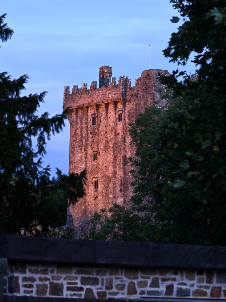
It was dark by the time we departed Cork, and despite still having a 1.5-hour drive to our accommodation, we made one final stop in the small village of Blarney, hoping to catch a glimpse of the historic Blarney Castle. The eight-storey castle was built by Dermot McCarthy, King of Munster, in 1446. After changing hands numerous times, the property is now privately owned and operated by the Colthurst family, who manage the estate as a major tourism destination. The castle is recognized as one of Ireland’s most visited heritage sites.
The grounds are well protected by fences and trees, limiting how much of the castle can be seen after closing. Nonetheless, we managed to catch a few glimpses of the tower itself and enjoyed walking through the quiet Irish village. It was well after 10:00 p.m. by the time we wound our way along the surrounding country roads and rejoined the N22 Highway, en route to Castlemaine. The roads in Ireland can be quiet and dark at night, but we were fortunate to have clear skies and a full moon, which illuminated the mountains and forests just enough to appreciate the beauty of the landscape we were travelling through. The light was especially welcome as we drove along the outskirts of Killarney National Park.
The Anvil Bar
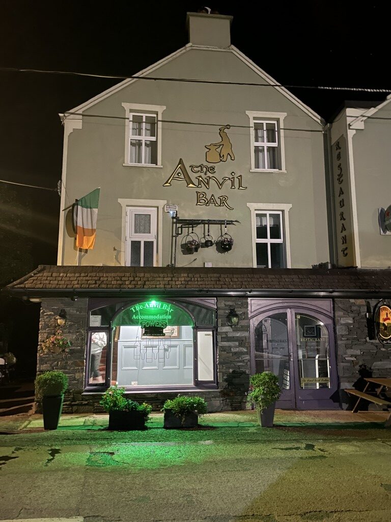
At this point, we must give a big shoutout to the owner of our accommodation that night—The Anvil Bar. This quaint bed and breakfast, perfectly situated at the start of the beautiful Dingle Peninsula, served as an ideal base for the next day’s adventure. Knowing we would arrive late, we called ahead, and the owner kindly offered to stay up to greet us. Perhaps he regretted that decision when we pulled in at a quarter past midnight—but if so, he didn’t let it show.
By the time we got to our room, showered, and chatted about plans for the morning, it was nearly 2:00 a.m.—which, in hindsight, makes us wonder why we ever agreed to an early start just to make it to Dingle and back before breakfast ended at 10:00. But at the time, that was a problem for tomorrow.