Unlike most of the island it is not hard to get a day with sunny skies, no wind, and warm temperatures on the beautiful west coast of the island, but even with that in consideration, these days should not be taken for granted, especially in September. To make the best of the day, we decided to break out the kayaks and paddle the Corner Brook waterfront.
We launched from an old boat launch turned storage/junkyard in Curling called Church Cove, not far from Barry’s Fish Plant. After unloading the kayaks, we left the car in the dirt parking lot and set out to sea. One concern we had was the whereabouts of current and past sewer outfalls. Most of the city’s sewage is now treated but the thoughts of old sewage outfalls did not sound any better. After checking with the provincial government’s Water Resources Portal, we felt fine about leaving the cove; albeit like any harbour travelling, we avoided touching the water as much as possible.
The first point of interest was the still-used oil supply dock. A small colony of cormorants have made the wharf home offering a great chance to get relatively close to the colony.
We stayed close to shore as we followed the shoreline and Griffin Drive, making the occasion paddle further out into the harbour the occasional picture. Once we began approaching the western extent of the Corner Brook Pulp and Paper Mill’s property, we moved away from shore to avoid the well known “bubble”, that once was one of the larger sewer outfalls in the bay.
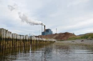
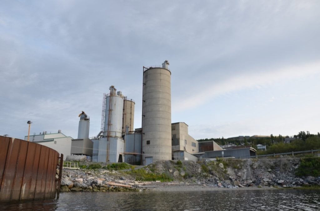
Approaching the mouth of the Corner Brook Stream that flows through the heart of Corner Brook we ventured back towards the shore in hopes of getting a closer view of the mill and look at the stream. While we had both grown up in Corner Brook and have done plenty of exploring in the area, the view of the city and mill from the water certainly provides a different perspective.
One perspective was how much the mill has changed over time. While these changes were often slow and small, cumulatively, they have left behind many signs on the landscape. The most notable was the rows of large wooden piles protruding above the waterline that are the remnants of past wharves and the railway line that travelled over them.

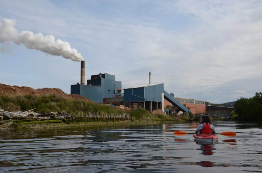
We approached the river from the west side in hopes of avoiding most of the river’s current that appeared to follow the east riverbank. This proved a good idea as we were not only able to approach the mouth of the river but also continue up it for approximately 350 meters, landing us right in the middle of the mill’s operation.
Travelling along the river opened another new perspective on the mill which was just how much effort went into to building not only the mill but the land it sits on. Prior to the start of construction in 1923 the approximately 36 hectares of land that now make up the mill’s property was part of the Humber Arm, producing a large cove that stretched almost 700 meters inland from the current shoreline. Aside from it being the only bit of land in Corner Brook that is actually flat, there are few indications that the land is artificial. But from the waterline, eroded riverbanks have exposed 100 year old layers of gravel, rock, wood, and everything else they used to fill in the land.
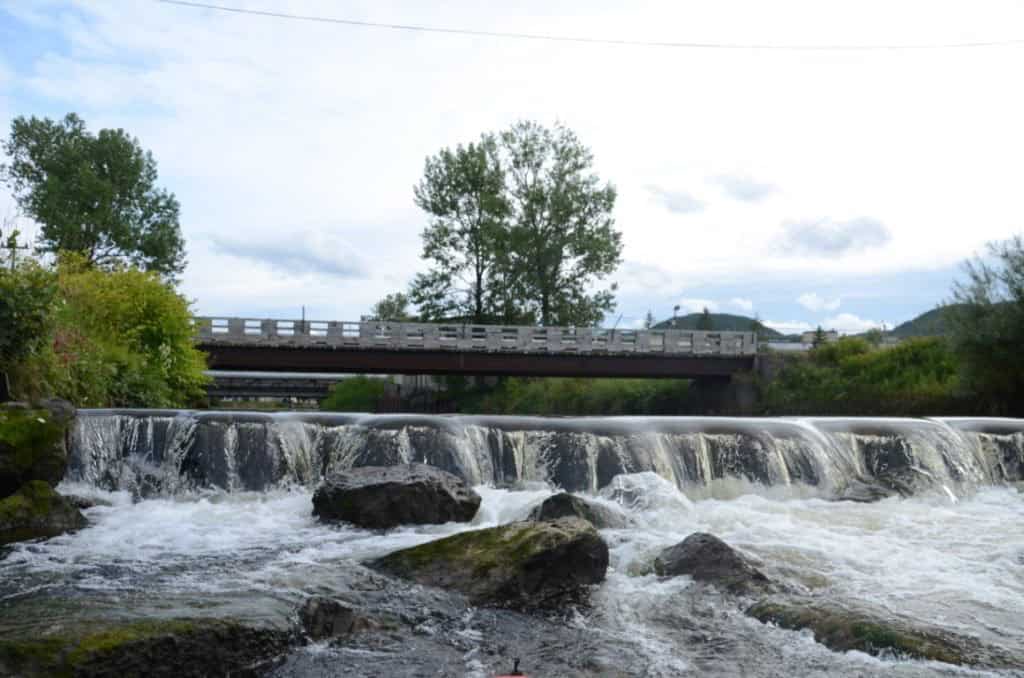
We were forced to turn back once we hit a small weir near the current Lewin Parkway Bridge. From here we let the current carry us back down the river and after stopping for a friendly conversation with a yard worker and a few photos of the old bridge piers and the log transfer building that carries wood overt the river into the mill itself, we hugged the east side the river and were shot out into the harbour.
From here, we paddled around the breakwater and found a never-seen-before (by us anyway), natural sea arch carved into the breakwater. On the opposite side of the arch, pieces of steel and parts of old machinery lined the beach offering many unique things to find and also avoid as you navigate along the shore.

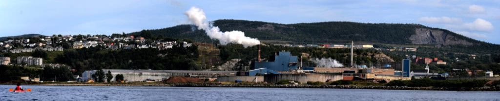
As we made our way past the mill and its three large warehouses, we could just see the outline of the original “Bowaters” sign that once greeted ships as they anchored alongside them. While we had originally planned to end our excursion here, we decided to continue on to Brakes Cove at the mouth of the Humber River.

As we followed the shore, we past by the current Corner Brook Port. Sadly, no ships were docked and instead we were greeted by the frightful sight of the hundred of large spiders that now call under-the-wharf home. While we planned to explore a little more, we quickly paddled away and never looked back.
The section between the Corner Brook Port and the old LaFarge Gypsum Plant (now a shipping port for CRH Canada) was the roughest, but still far from concerning and as it was getting late in the evening, the small chop subsided and soon we were back paddling in calm water.
The shore between here and Brakes Cove was quiet and beautiful. Here the water moves away from Riverside Drive and as you approach the Humber River, the sound of ducks and sea gulls take over.
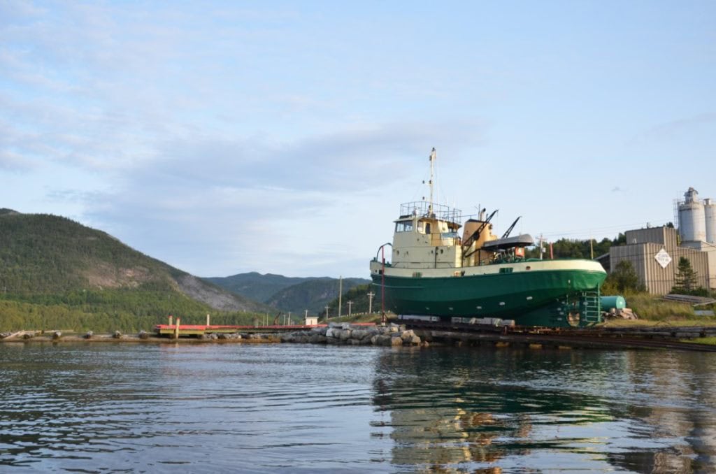
As we rounded the cove, we decided to take a few minutes to attempt to explore the series of piers and sunken barges sticking out of the river. The wooden crib piers were once used to capture logs floated down the river before being transferred to the mill wither by truck or by boat. One of the boats used to tow the logs to the mill is the “Indian Lake” which is now sitting on the riverbanks. Launched in 1962 it has spent its entire life traveling the waters of the Humber Arm and continues to be used as an occasional icebreaker for the harbour.
As we approached the piers, the current became surprisingly strong which could be seen as it flowed around the piers. While I managed to paddle through the first two piers as I began to circle around what I assumed was a sunken barge or small boat, the current became to strong and out of fear of being dragged beneath or rolling along the upstream side of the barge, I abandoned my pursuit and let the current push me back to the boat ramp where we took the kayaks out of the water and called a family member for a ride back to our vehicle.

While we waited, we met a person who had just come back from a paddle up the river. Even though his beautifully hand-crafted, wooden sea kayak was much more adapt to conquering the current than our little kayaks, we hardly believed them when they said they had paddled almost as far upstream as Shelbert Island.
After paddling just over 10 kilometers, we spent the rest pf the evening, relaxing on a deck with cold beer from local breweries, Bootleg Brewing and Boomstick Brewery.
What you need to know . . .
Distance:
Time:
Launch Point:
End Point:
Difficulty:
Words of Caution:
Overall Rating:
Approx. 10.0 kilometers
3 Hours
N 48.958526, W 57.987529
N 48.964020, W 57.907832
Easy – Given the right weather and tide conditions, this is a relatively easy paddle.
Aside from the typical dangers posed when kayaking in salt water, use caution around the port as ships still regularly visit the port. Similarly, caution should be exercised around the tide and currents at the mouth of the Humber River and Corner Brook Stream.
★★★★☆