We had heard before that the weather in the north of Iceland tends to be better, albeit colder, than in the south. In the south, ocean currents deliver regular wind, rain, and storms as they reach Iceland. Thanks to the mountains and highlands of the interior, these storms often dissipate or bypass the northern areas. Of course, being in the north, facing the Arctic Ocean does not do any favours for winter storms and cold temperatures, though throughout the summer it tends to leave behind clear skies. As we woke up and began to pack up our tent, we had yet another surprisingly sunny, windless morning.

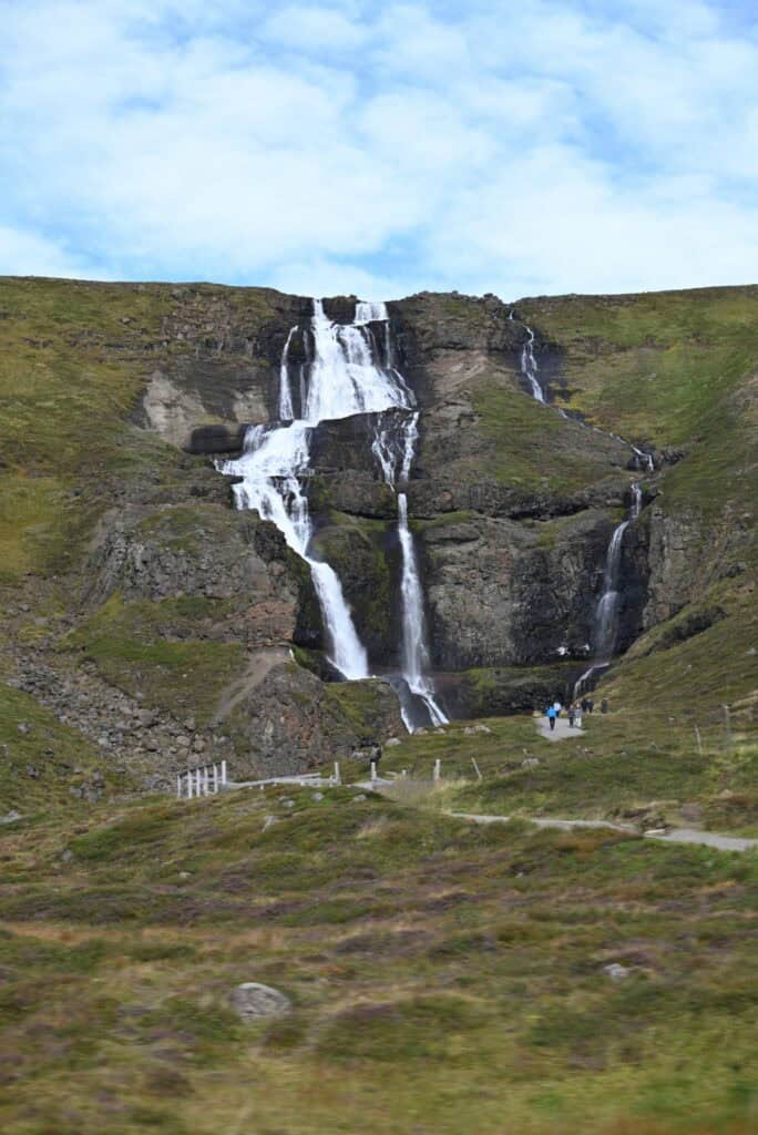
Before heading out, I quickly explored the walking trails behind the campground, racing to the top to grab a few pictures of the northern Icelandic town of Egilsstaðir. Egilsstaðir is found along the Lagarfljót River and is home to approximately 2,500 people. Being the hub of eastern Iceland, however, it offers many amenities of modern life and sees a huge increase in population during the tourist season. The town is unique to Iceland as it is situated away from the coast, at the base of rolling forested hills. Eastern Iceland is also known as the area preferred by the non-native reindeer, and on top of the hill where we got our best views of the town, a large steel reindeer was as close to one as we would get on this trip.
Stuðlagil Canyon
It is an hour’s drive, or 72 kilometers, from Egilsstaðir to Stuðlagil Canyon, our first destination of the day. We had seen a few instances of columnar basalt rocks on the trip so far, but nowhere in Iceland—and perhaps in few other places in the world—is it more prominent and impressive than at Stuðlagil Canyon. The canyon is located in the glacial valley known as Jökuldalur. As the Jökla River flows through the valley, it has carved its way through the canyon, exposing perfectly symmetrical basalt columns rising vertically 30 meters above the river. Columnar basalts are formed when basaltic lavas, high in iron and magnesium, cool slowly. As the surface of the lava cools, it begins to shrink, forming a hexagonal shape. The cracks created stretch through the lava flow, leaving behind what appear to be hexagonal-shaped pillars.
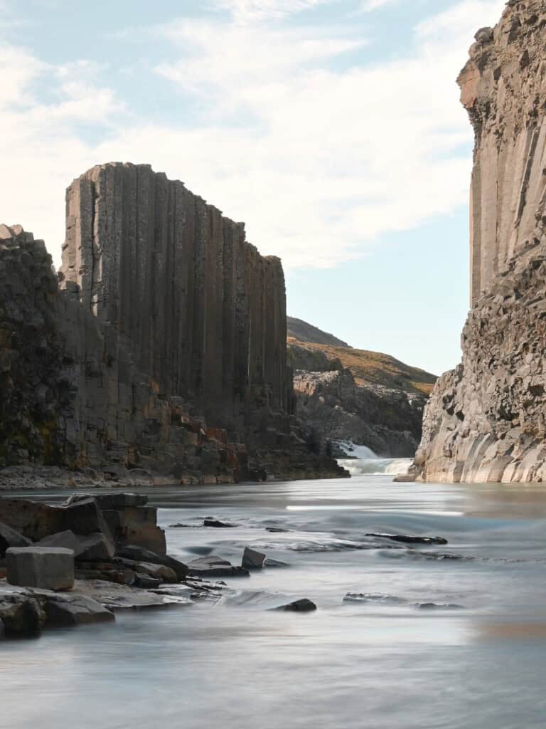
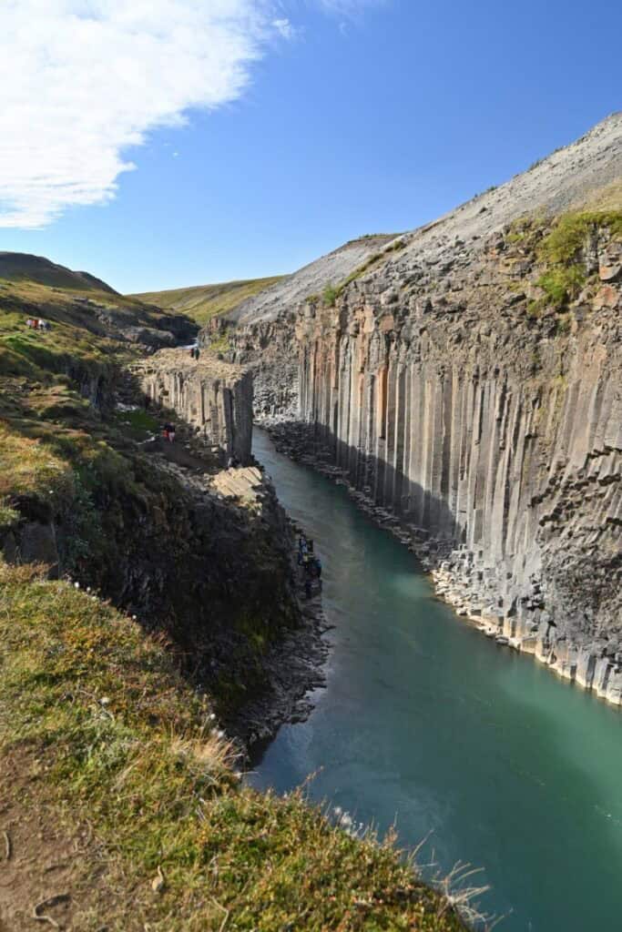
While the story of Stuðlagil Canyon’s formation is interesting, it is perhaps even more notable that the only reason we are able to see it today is because in 2009 water was diverted out of the Jökla River for use in the Kárahnjúkar Hydropower Plant, exposing the canyon which would normally be almost entirely submerged.
The canyon is located at the end of a 2.5-kilometer trail, which brings you up close to waterfalls and grazing sheep. It is certainly worth the hike, and once back at the car, we rewarded ourselves with an Icelandic hot dog and some crêpes from a little food truck in the parking lot.


Crossing the Highland Desert of Möðrudalur
With a big day planned, we began our drive to Mývatn, across the northern interior of Iceland. The drive was desolate and empty in the most beautiful way. In parts, the flat, rocky terrain stretched all the way to the horizon. In other places, the road wound its way through large rolling hills, occasionally intersecting the odd river. As we neared Mývatn, mountains, volcanoes, and glaciers could be seen towards the south, including the volcano Herðubreið.

Herðubreið is an easily distinguishable, flat-topped mountain that has become known as the “Queen of Icelandic mountains.” In 2002, it was even voted Iceland’s national mountain—which is impressive given the spectacular mountains we had already seen. But what makes the mountain even more fascinating is its distinctive, steep-sided, flat-topped shape, a classic example of what happens when a large volcanic eruption occurs beneath a two-kilometer-thick ice sheet. As the volcano erupted, it melted the glacier above it, forming an environment normally only seen in underwater volcanoes. The surrounding ice forced the volcanic eruption to continue within the confines of the melted pool that formed above it, which, over time, created the table mountain shape we see today. Looking at the 1,686-meter peak now, it is eye-opening to think that just over 12,000 years ago a massive ice sheet would have fully covered the mountain.


Mývatn
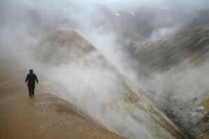
The scenery changes quickly as you leave the interior highlands and head further west. Mývatn is a large volcanic lake, well known as one of the best birdwatching spots in all of Europe. But it was not the wildlife that attracted us to the area, but rather the well-known hikes across a diverse volcanic landscape. The entire area is part of the Krafla Volcanic System, which not only formed the lake itself some 2,500 years ago but also left behind a landscape of craters, jagged lava fields, and caves formed from former lava tubes. The area has suffered many eruptions over the years, but its two most famous occurred in the 1720s and again between 1975 and 1984. Coined the Krafla Fires and Krafla Fires II, the eruptions saw the release of huge quantities of lava through fissure eruptions, each of which greatly altered the topography of the area. While the volcano is currently not active, geothermal generation, baths, and steam vents are clearly visible throughout the area.

Hverfjall
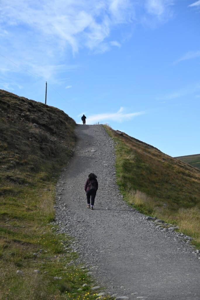
To fuel up ourselves, we first stopped at a gas station and grocery store in the town of Reykjahlíð to pick up some additional items for supper. Leaving here, our next destination was Hverfjall, a large tephra cone crater that explosively formed 2,500 years ago. Parking at the base of the crater, we began the 100-meter trek to the rim. While not a long hike, the mountain is one of the highest in the area, offering a fantastic view of the surrounding geothermal areas, the town of Reykjahlíð, and the craggy terrain left behind from countless lava flows and eruptions. Once at the top, it is possible to hike around the rim of the crater, but we opted to only do a small section, taking in the views before continuing back to the car. On our way down, we stopped at the interpretation center to use the washroom, which had an unusual and slightly unnerving feature: clear glass walls facing the barren landscape.

Grjótagjá Cave
Our next stop was Grjótagjá, a lava cave that gained popularity after it was featured in Game of Thrones, which we dubbed the “Jon Snow Cave.” The cave is a remnant of past eruptions that left behind an underground cavern. After it formed, groundwater accumulated within, heated by the area’s geothermal activity. For a number of years, the underground lagoon was a well-known hot bath, but since the volcanic eruptions of the 1970s, the water temperature has increased to dangerous levels (>50°C), making it prohibited to swim in.

The cave’s popularity was apparent by the line that formed to get inside. The cold wait was worth it though, as once you enter the cave, warm moist air quickly surrounds you. The cave has several openings throughout it, perfectly illuminating the crystal-blue water found inside.


Dimmuborgir Lava Field
With the sun getting low in the sky, we made our way to our last stop of the day, the Dimmuborgir Lava Field. The name Dimmuborgir derives from the words “dimmu,” meaning dark, and “borgir,” meaning cities or forts. The name is a perfect description, as the lava field is an agglomeration of craggy rocks, tall pinnacles, rugged arches, and holes. When the area formed 2,300 years ago, a large pool of lava accumulated in the trough and created a 10-meter-deep lava lake. This lake sat over a large wetland, which caused large quantities of vapour to rise to the surface. Once the lava cooled and subsided, the solidified rock began to collapse, leaving behind towering pinnacles of rock and exposed former lava tubes, now represented in the area’s caves and arches.
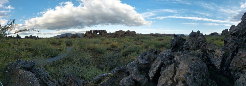
The rocks would be a nightmare to explore if not for the paved trails that have been constructed through the area. Now accessible to everyone, Dimmuborgir offers the best collection of some of Iceland’s most obscure rock formations.
Oddly enough, the area also introduced us to a bit of Icelandic folklore, as Dimmuborgir is said to be the home of the 13 sons of Gryla and Leppaludi, known as the Yule Lads. These brothers include: Stekkjarstaur (Sheepcote Clod), Giljagaur (Gully Gawk), Stúfur (Stubby), Þvörusleikir (Spoon Licker), Pottaskefill (Pot Scraper), Askasleikir (Bowl Licker), Hurðaskellir (Door Slammer), Skyrgámur (Skyr Gobbler), Bjúgnakrækir (Sausage Swiper), Gluggagægir (Window Peeper), Gáttaþefur (Doorway Sniffer), Ketkrókur (Meat Hook), and Kertasníkir (Candle Beggar).


There are many stories and lore around the Yule Lads. In Dimmuborgir, it is said that the 13 Yule Lads make their home for the summer in the area’s caves and arches. Around Christmas, the Yule Lads wake up and leave gifts for good children and a raw potato for the bad ones. Each year the area becomes the centre of celebrations and festivities.
It was dusk by the time we left Dimmuborgir. Circling around the grassy fields, wetlands, and numerous small craters, we gained a sense of why the ecologically sensitive area has been designated a nature reserve.

Ljósavatn Guesthouse
As the temperatures fell, we didn’t feel up to a cold night in the tent, so those of us not driving started searching for accommodations nearby. We thankfully found the Ljósavatn Guesthouse, located in the basement of a large farmhouse with in-floor heating, a small kitchenette, and a few other guests with their own private rooms. Testing our patience and the might of our small Jetboil stoves, we boiled some of our remaining vegetables and fried a few chicken breasts for supper before taking advantage of the house’s geothermal-fed shower and then heading to bed.