We woke up and started dismantling our tents, reconfiguring them into the already overflowing Duster. With everything on charge and some time to spare before our booked timeslot at the Vík Lava Show, we decided to check out the Dyrhólaey Peninsula.
Dyrhólaey Peninsula & Lighthouse
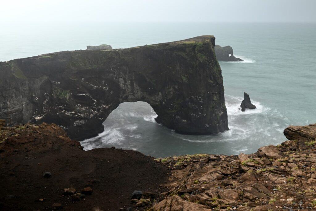
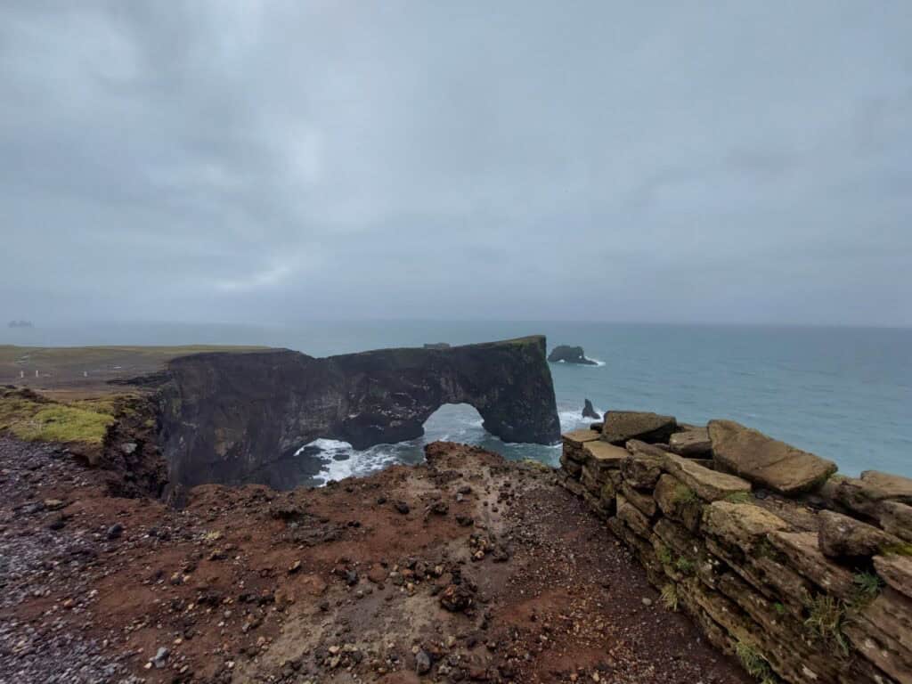
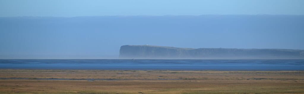
Rising 120 meters above Iceland’s most famous black sand beach, Reynisfjara, is the Dyrhólaey Peninsula. This large headland was formed by underwater volcanic eruptions during the Pleistocene epoch, between 2.6 million and 12,000 years ago. It is composed of basalt and palagonite tuff—a rock formed when lava interacts with seawater, creating steam. The result is a weaker, more brittle material highly susceptible to coastal erosion, which often leaves behind fascinating landforms.
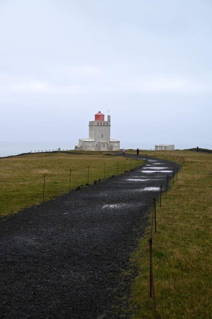
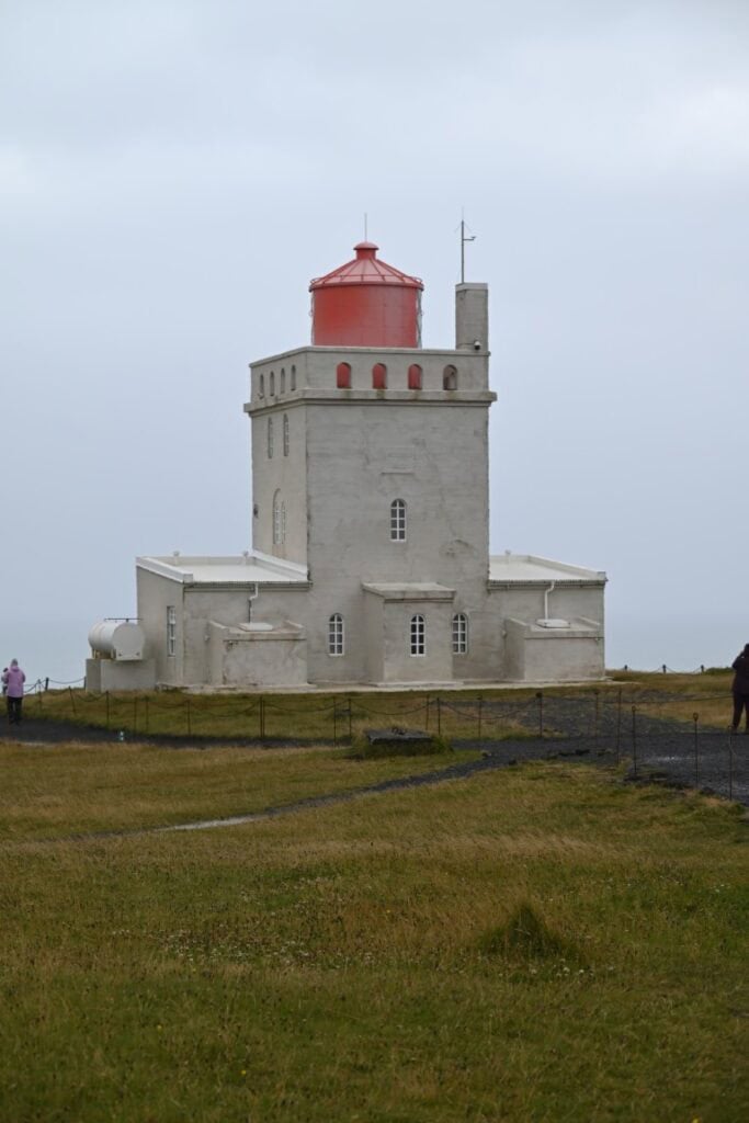
Atop the peninsula stands the Dyrhólaey Lighthouse, a square concrete structure built in 1927. Though only 13 meters high, when combined with the elevation of the headland, its light shines from 118 meters above sea level. Its placement, just meters from mainland Iceland’s southernmost point, made it an ideal site to guide ships along the dangerous coastline.
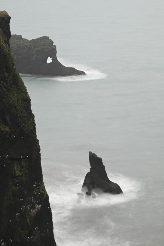
Following a network of trails around the peninsula, we reached viewpoints overlooking sea stacks and arches. The largest of these is a massive sea arch wide enough for boats to pass beneath. In 1993, pilot Arngrímur Jóhannsson and Member of Parliament Árni Johnsen even flew a small plane through it. This feature inspired the name Dyrhólaey, which loosely translates to “the hill island with the door hole.”
Vik Lava Show
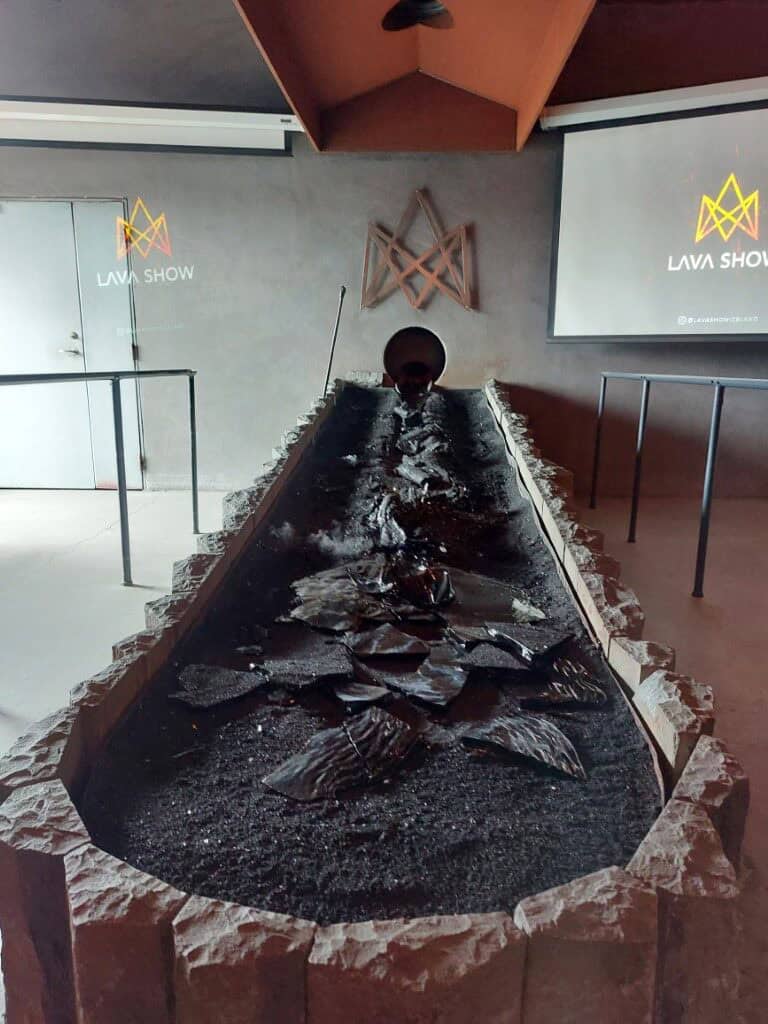
We returned to Vík to attend its famous Lava Show—the only place in the world where you can see real lava indoors. Entering the darkened room, we found our seats, arranged around a rock-lined channel leading from an ominous steel door.
The presentation began with our guide recounting the history of Vík and its relationship with nearby Katla. Hearing a local describe life in the shadow of the volcano would have been worth the ticket alone. After sharing his own harrowing experiences on glaciers and during past eruptions, he opened the steel door, allowing molten lava to flow through the channel toward us.
The lava wasn’t produced by a volcano but rather in a furnace next door, heated to 1,100°C from rocks collected on Katla itself. As it cooled, our guide explained the dangers of fresh lava flows: not just extreme heat, but toxic gases, explosive reactions with water, and unstable, superheated cavities beneath the surface. Needless to say, we had no plans to scramble across any recent lava flows.

Vik’s Evacuation Awareness
Another thing we learned at the Vik Lava Show is the constant threat Katla poses to the town and the country. Vik is located just over 20 kilometers south of Katla’s crater. Katla is a stratovolcano uniquely situated beneath the Mýrdalsjökull ice cap. Erupting roughly every 50 years, it is not lava or ash that is most dangerous about Katla, but a glacial outburst known as a jökulhlaup (“YO-kul-luhp”). When the volcano erupts beneath the glacier, incredible amounts of ice melt quickly. As this pressure builds, it eventually reaches a point where the overlying glacier can no longer contain the water, and it is released, sending a wave of water, sediment, and debris through one of two valleys below. In the last Katla eruption of 1918, the jökulhlaup was estimated to be 25 meters tall and, at its peak, had a flow rate of 300,000 m³/s. For reference, Niagara Falls averages about 2,100 m³/s. In the 1918 eruption, this extended the coastline east of Vik by 5 kilometers. Today, the Icelandic Meteorological Office (IMO) and the Department of Civil Protection and Emergency Management (Almannavarnir) have Katla under 24/7 monitoring. If an eruption is predicted, a Code Red Alert is sent out, prompting the residents to gather at the community church where they wait to learn which valley the jökulhlaup is expected to flow down, before they can plan an evacuation route. Eighteen out of the last twenty eruptions have produced jökulhlaups that have flowed through the Mýrdalssandur outwash plain, east of the town, while two have flowed to the west.
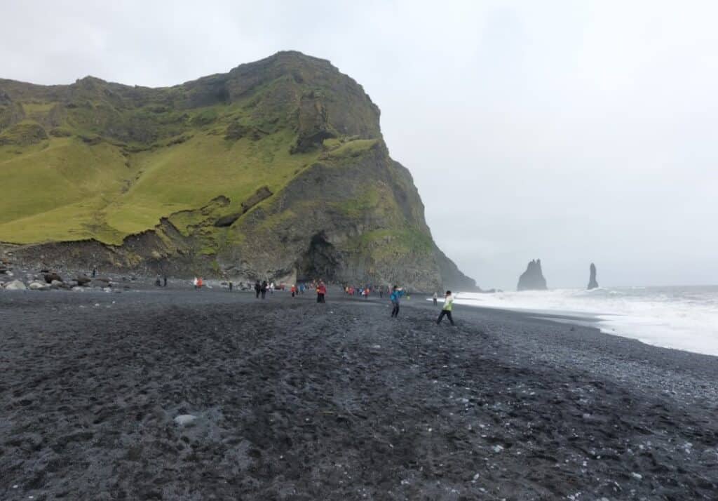
Reynisfjara’s Black Sand Beach
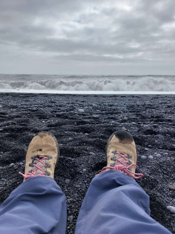
Before leaving the area, we backtracked one more time to the famous Reynisfjara Black Sand Beach. Formed from the gradual erosion of a massive basaltic cliff, the beach has become well known for its black, opaque color, its caves and sea stacks, and its more infamous “sneaker waves.” Approaching the beach, signs, warning lights, and flags quickly alert visitors to surf conditions, noting safe distances to remain from the waterline to avoid being caught by the pounding surf. The area is stunningly beautiful, but an eye must always be kept on the ocean. The beach faces south, exposed to the full force of the North Atlantic Ocean. In addition, a unique bathymetry allows large waves to break directly onto the beach. As the waves break near the waterline, they sometimes group together, allowing a single wave to surge higher up on the shore, washing across the relatively flat beach and catching many off guard. This beach can be incredibly dangerous, as there are numerous emergency calls there every year and several people have perished because of sneaker waves. Having spent our lives around the same ocean and knowing the dangers of turning your back on it, we were determined not to be caught off guard. Still, it was unnerving to see people “tempting fate” for a nice photo or totally ignoring the dangers behind them. As expected, it did not take long to see people tripping and running from the waves, getting soaked in the process. Despite our sea-dwelling confidence, we were also pretty close to having wet boots when the water came quicker and further than it previously had. It was a good reminder that experience is valuable, but Newfoundland is definitely not Iceland.

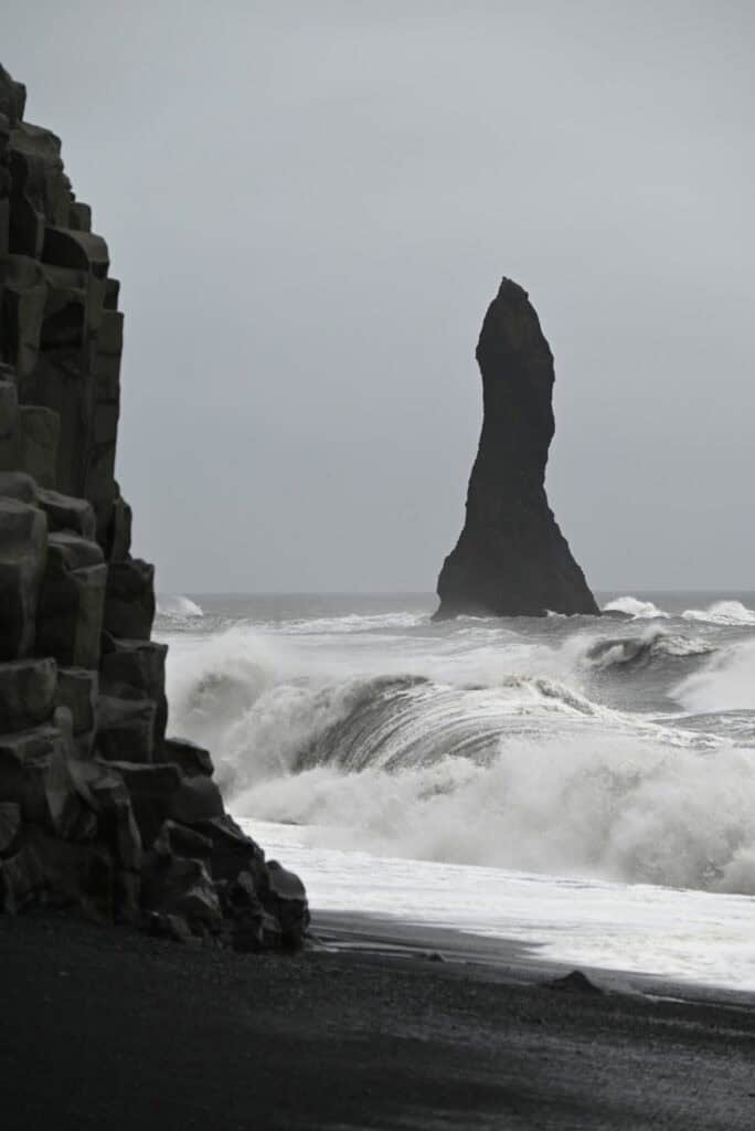
The sea caves and sea stacks located just offshore were incredible, but it was the power of the surf that truly captured your attention. While the nearby cliff face was one of the best examples of columnar basalt we had seen, it was the powerful waves to which it owed its formation that were the real wonder here.
Before we left, we tried our first Icelandic hot dog, which the country has become unofficially famous for. While very delicious, it was the sweet, almost candy-like mustard that really left us craving another.
Gígjagjá (Yoda Cave)
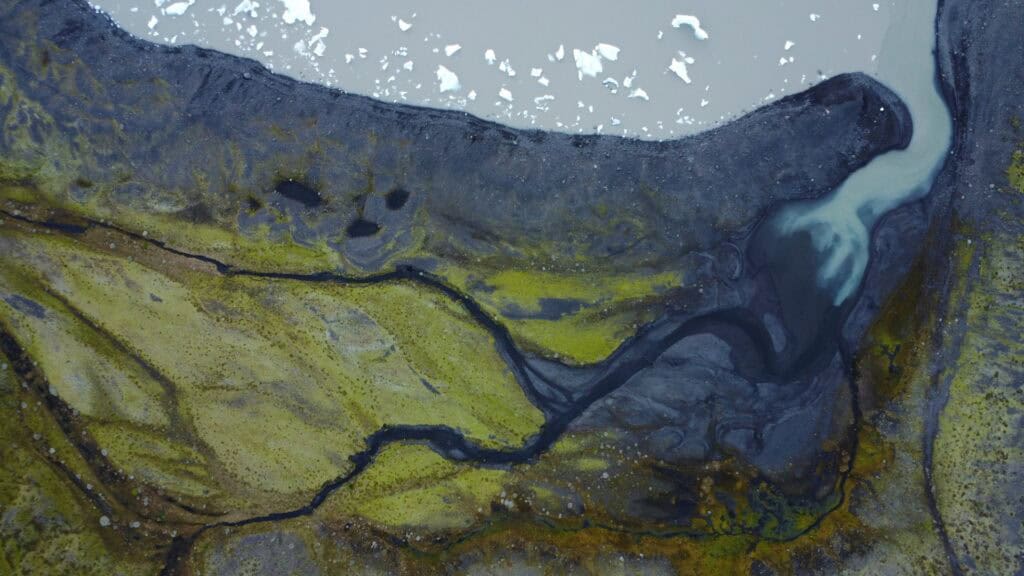
Driving through Vik once more, our weather began to improve and soon the sun was finally peeking through the clouds. Shortly after leaving Vik, you begin the drive across Mýrdalssandur, a glacial outwash plain that was the site of Katla’s famous jökulhlaup, or glacial outburst. This black, flat plain stretches more than 20 kilometers in width, resembling more of a desert plain than something created by disastrous glacial floods.

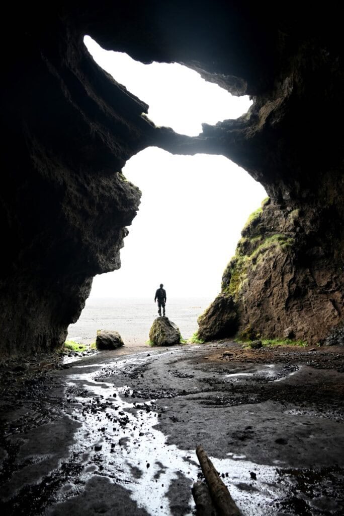
Several kilometers along the plain, a green hill protrudes from the flat terrain. Known as an inselberg, the small mountain was formed as part of a fissure eruption of the Katla volcanic system. On the south side of the hill, a large cave known as Gígjagjá can be found, created by the departure of a past lava flow. While popular among geologists and nature enthusiasts, Gígjagjá has captured the attention of many more because of its resemblance to Star Wars’ Yoda, becoming more colloquially known as the “Yoda Cave.”
While we were visiting, Lindsay and I entered first and found ourselves in the midst of a clothing photoshoot. You can imagine our surprise when one girl took off her shirt and, while facing away from the camera, had her picture taken holding the Icelandic flag with branded pants. But the surprise our friends got when they walked around the corner and came face to face with her was simply priceless.
Drive to Hofn
As the day was already getting away from us, we began our drive to Höfn for the night. After leaving Vik, the amount of traffic and tourists we encountered steadily decreased, proving that Vik tends to be a stopping point for many visiting Iceland. After leaving Gígjagjá, we passed through the famous moss-covered lava fields, including the most well-known, Eldhraun. While we did not have time to stop, it was easy to see the fragile moss from the road.
As we continued traveling, we found ourselves passing through hills once again, taking in the many waterfalls along the way. Getting into the habit of capturing photos from a moving vehicle, we managed a few pictures, including a couple of Foss á Síðu, a beautiful waterfall that picturesquely cascades over a cliff riddled with openings and caves.
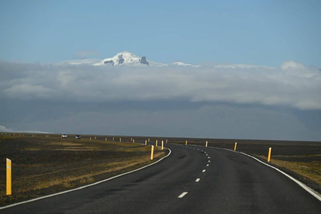
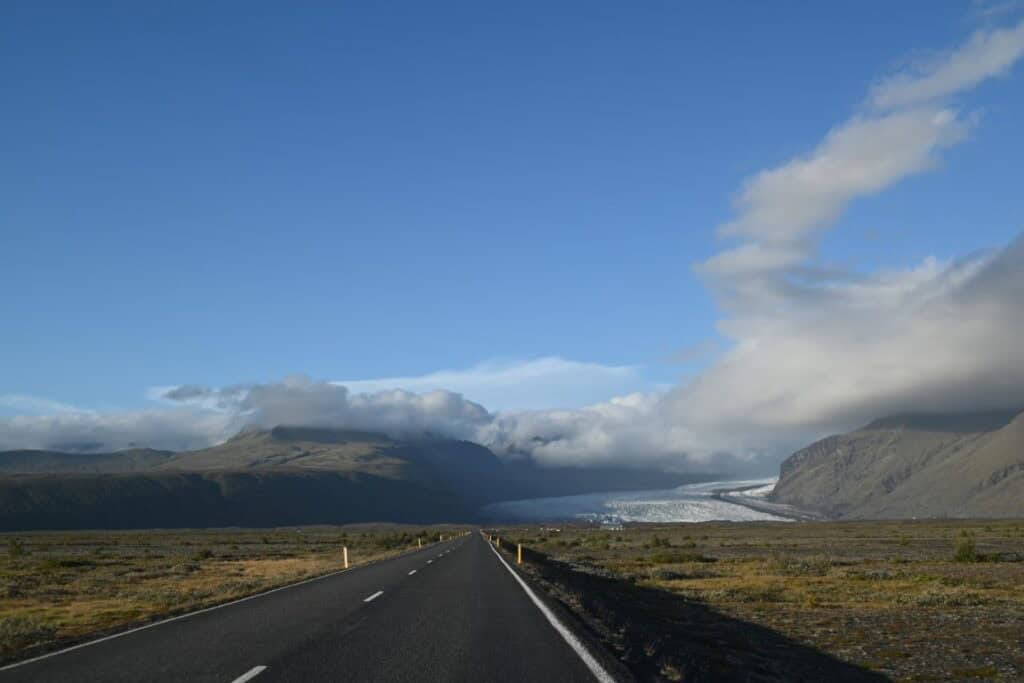
Beyond this, we soon found ourselves entering the mountains once again, as glaciers feeding off Iceland’s largest ice cap, Vatnajökull, came into view. Dozens of glaciers wound through narrow valleys surrounded by several-thousand-meter peaks, including Iceland’s highest mountain, Hvannadalshnjúkur. The mountain’s location near the ocean means these majestic peaks often lie behind a veil of fog, but as we followed the road around the mountains, the low-lying clouds were replaced by a setting sun and oblong-shaped lenticular clouds. This section of the drive around the mountain range seemingly exemplified every concept in glaciology. Massive glaciers fed glacial outwash plains, while nearby pyramid-shaped peaks known as arêtes were perfectly placed between two or more mountain glaciers. Along the southern side, massive walls of rock and dirt known as moraines marked what was once the terminus of the glacier, now receding up the mountain.
Fjallsjökull Glacier Lagoon
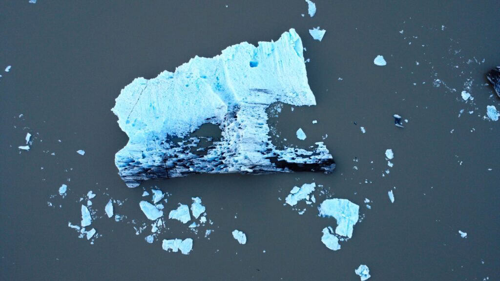
Hoping to get closer to these incredible wonders, we pulled off the main road and traversed a rough gravel road leading to the glacial lagoon of Fjallsárlón. At the far end of the iceberg-filled lake was the glacier Fjallsjökull, joined nearby by Hrútárjökull. While the sun had set behind the mountain, the sky remained bright and colorful, making for a majestic evening. The road to Fjallsárlón is rough, but it is often less populated than the nearby destination of Jökulsárlón and Diamond Beach, making it a perfect place to appreciate the quiet reverence and vastness of Iceland’s glaciers.


Originally, we had planned on stopping at Jökulsárlón and Diamond Beach, but with the sunset and some fatigue from a wet and windy night in Vik, we found a small cabin in Höfn and skipped Jökulsárlón, planning to backtrack to the glacial lagoon in the morning.
We stayed in a small double bunk bed cabin at Höfn Camping Ground, which was snug but provided ample kitchen amenities to cook up a great supper and chat about our trip so far and the plan for tomorrow. For consistency, it may be helpful to note that the shared washroom facilities were free and very clean, but the showers required payment only in ISK coins—a notable difference from most of Iceland, which happily accepts credit cards.