Thingvellir (Þingvellir) National Park
Iceland sits atop the Mid-Atlantic Ridge, a massive underwater mountain chain that runs north to south beneath the Atlantic Ocean. The ridge is formed by the slow separation of two tectonic plates: the North American and Eurasian Plates. When this movement began 180 million years ago, the Atlantic Ocean did not yet exist, but since then the separation has left behind the world’s second-largest ocean.
Many visitors, like us, are drawn to Iceland to experience its geothermal activity in the form of volcanoes, earthquakes, and hot springs. While most of the ridge lies beneath the sea, Iceland is unique in that it rises above a mantle plume—or hot spot—which makes it one of the most dramatic places on Earth to witness the power of plate tectonics. For us land dwellers without submarines, it also happens to be a much nicer place to visit.
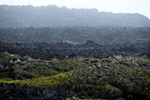
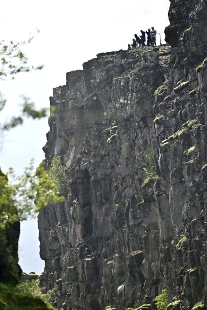
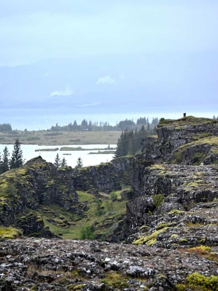
The best place to grasp the size and history of tectonic movements is Þingvellir National Park. Here, a series of incredible fault lines, cracks, and deep canyons mark the location of the divergent plate boundary. The area immediately makes you feel small, as the true power, scale, and force required to separate such massive landmasses becomes apparent.
Silfra
One of the only activities we booked in advance was snorkeling the Silfra Fissure—a narrow but incredibly deep, crystal-blue canyon submerged in Lake Þingvallavatn. September in Iceland is not the first time or place you might think of for a swim, but with thick dry suits and a trusty guide from Troll Expeditions, we were well prepared.
We met in a small cul-de-sac lined with vans from various tour companies. After squeezing into dry suits, gloves, and a questionably tight hood, we grabbed our masks and flippers and waddled across the road to queue for our entry.
The wait was a little long, but thanks to the dry suits, it wasn’t cold, despite temperatures hovering around 5°C. Talking to our guide, Emilio, helped pass the time and proved almost as rewarding as the tour itself. He shared how he ended up guiding snorkelers in the frigid waters of Iceland (though we all agreed snorkeling in the Caribbean is far superior), and he explained the origins of a small crack nearby. Only a meter or two wide but stretching inland as far as the eye could see, the crack was formed suddenly by an earthquake a few years ago. Having studied geology and earth sciences but grown up far from geologically active regions, the thought of such a sudden and dramatic change—even if “just” a small crack—was staggering.
The Silfra Fissure is pulling apart at an estimated two centimeters per year, lying directly along the boundary between the North American and Eurasian Plates. Averaging only four to five meters wide, the underwater canyon reaches depths of more than 50 meters and contains an unknown number of caves and openings. The porous basaltic rocks on either side allow spring water to seep through, creating a gentle current that adds another advantage for snorkelers.
Descending the steel staircase into near-freezing water, we slipped beneath the surface. With masks on and almost no skin exposed, we began an effortless float down the fissure, carried by the current. The water was crystal clear and a vibrant blue but too cold for most life, except for hardy algae and grasses. After about 250 meters, our guide redirected us to the exit, warning how easy it would be to drift into the larger lake. Lindsay, true to her habit of “securing the rear,” missed the message, bypassed the left-hand turn, and set out into the gusty waters of Lake Þingvallavatn. Thankfully, our guide swiftly swam after her and redirected her back to shore.
After a float in the shallower exit pool, we climbed the ladder, changed into dry clothes, and refueled with hot chocolate and Icelandic chocolate bars.
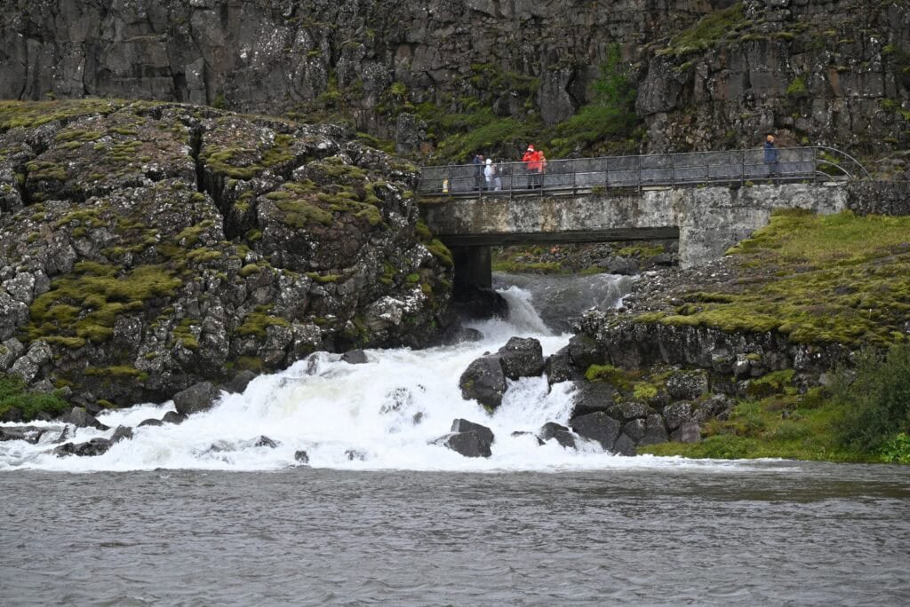
Almannagjá fault
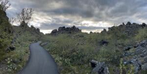
While snorkeling Silfra is the main draw for many visitors, the surrounding area offers remarkable geology, history, and culture. The most prominent above-ground feature of the Mid-Atlantic Ridge is the Almannagjá fault. Towering cliffs enclose a rugged floor covered in vibrant green vegetation, which would have dropped as the two adjacent sides separated.
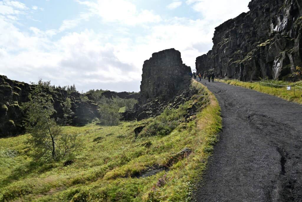
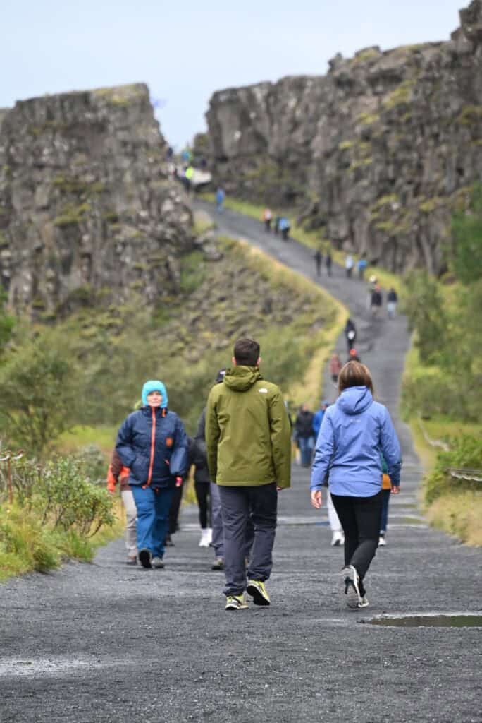
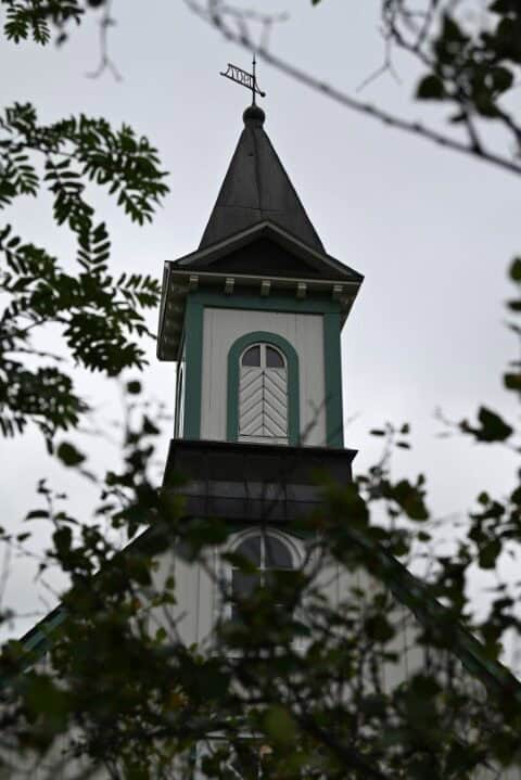
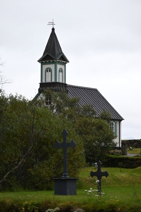
Starting at the Þingvellir National Park Visitor Centre, an accessible trail follows the fault through dramatic landscapes, past the waterfall Öxarárfoss and the river Öxará, and on to Þingvallakirkja (Þingvellir church).
Some may recognize the Almannagjá fault from Game of Thrones, where it was used as the filming location for the “Bloody Gate,” the entrance to the Vale of Arryn. Standing there, it was easy to see why this landscape lends itself to fantasy worlds of dragons and magic.
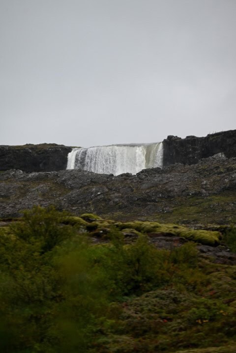
Öxarárfoss
As the river Öxará flows from the west, it meets the edge of the Almannagjá fault, dropping 13 meters to the base of the rift. From there it briefly cascades over dark, jagged rocks before tumbling once more over the eastern edge into a small valley, eventually emptying into Lake Þingvallavatn.

Cultural Significance
In addition to its geological importance—which earned it a UNESCO World Heritage designation—Þingvellir holds deep cultural meaning for Icelanders. Alþingi, Iceland’s national parliament, was founded here in 930 AD. For centuries it represented unity and independence, culminating in June 1944 when Icelanders gathered at Þingvellir to declare independence from Denmark and establish the Republic of Iceland.
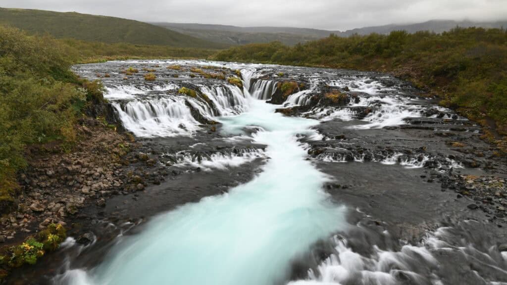
Brúarfoss
Driving from Þingvellir National Park to the Geysir geothermal area, we stopped at Brúarfoss. Though not the tallest or most powerful waterfall in Iceland, it is remarkable for its beauty and accessibility. The Brúará (“Bridge River”) flows south out of the mountains before plunging over a ledge that cuts upstream at the river’s center, creating the illusion of water folding in on itself. The crystal-clear blue water, framed by colorful vegetation along the banks, made it a perfect spot to stretch our legs.
Geysir Geothermal Area
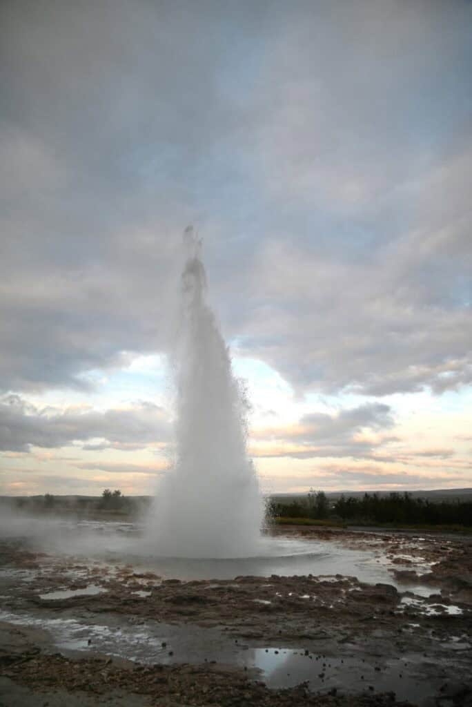
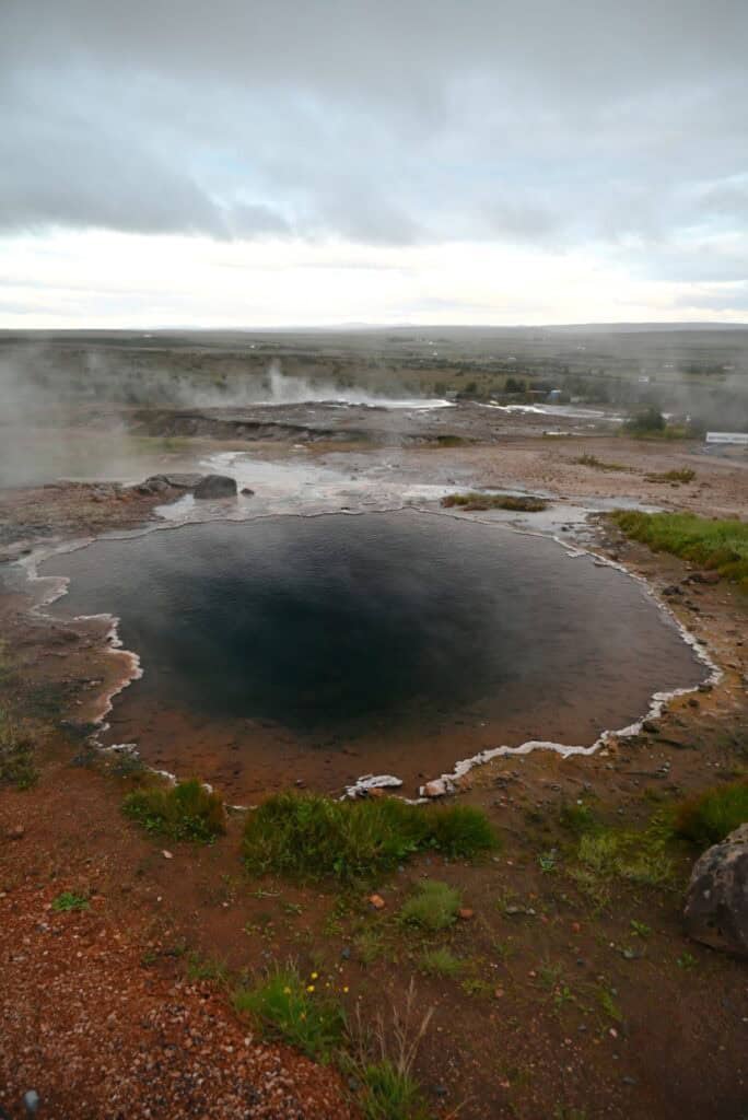
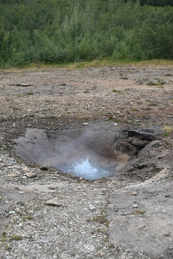
Our final stop of the day—and our campsite for the night—was the Geysir Geothermal Area in the Haukadalur Valley. The landscape is alive with steam vents, boiling mud pots, and geysers. The very word “geyser” comes from this place, named after the now dormant Geysir (“to gush” in Icelandic). Once capable of shooting water 70 meters into the air, Geysir has not erupted in over a decade, due to both natural and human influences.
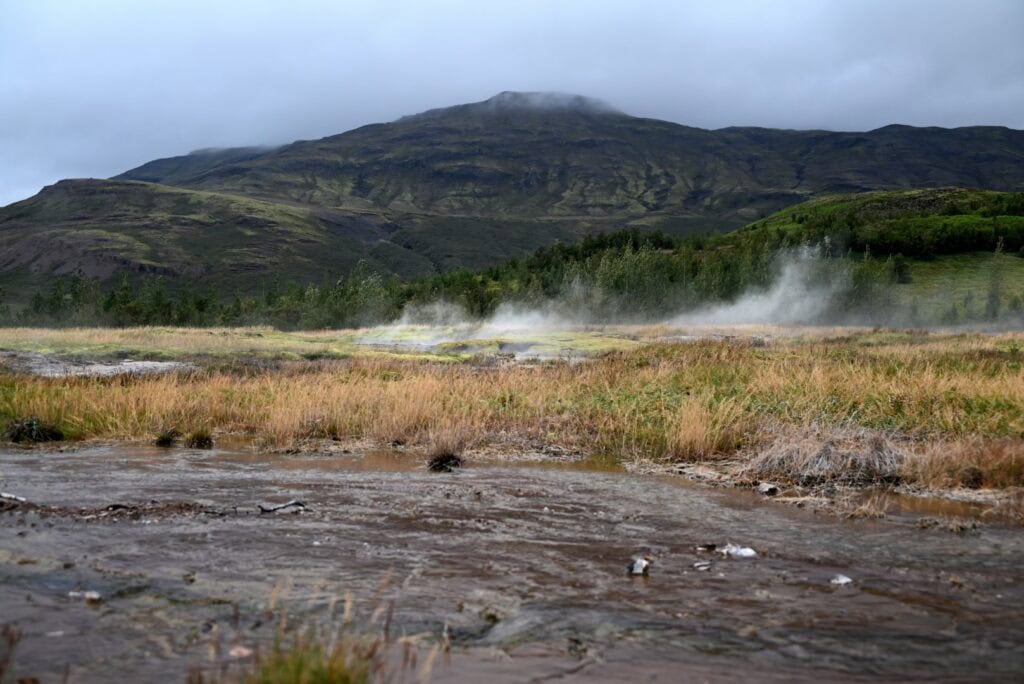
Fortunately, nearby Strokkur still erupts reliably every five to ten minutes, launching water up to 30 meters high. Though only a short walk from the parking lot, we lingered, distracted by steaming fields, bubbling mud pools, and smaller geysers.
An accessible trail system winds through the geothermal area, with ropes and rocks marking safe paths. The following morning, a quick hike to the top of the trail system rewarded us with sweeping views of farmland, valleys, and the 724-meter-high mountain, Bjarnarfell.
After dinner at the Geysir Centre, we set up our tents at the Camping Geysir campground across the road and settled in for our first night in a tent.